
Download
3D Flyover
Add to list
More
2.2 km
~28 min
12 m
Loop
“A gentle riverside stroll to Day’s Dam, where spray-sparkled falls reward careful footing.”
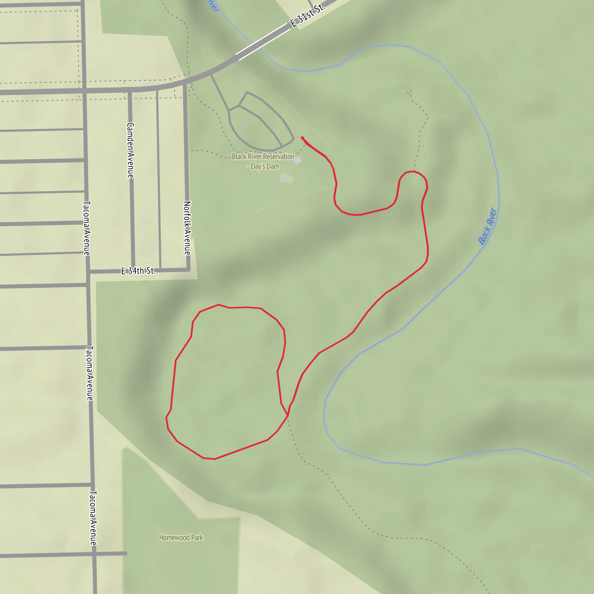
This is a short, low-effort out-and-back walk (about 2 km / 1.2 mi total) on generally level ground (~0 m / ~0 ft elevation gain), ideal for a quick waterfall-and-dam viewpoint with minimal climbing. Expect a mix of compacted path and short boardwalk/bridge approaches, with the main “effort” coming from keeping your footing on damp surfaces near the water.
Getting to the trailhead (car + public transport)
Because the hike start is listed only as “near” (with no coordinates or town/park name), I can’t reliably convert the start location to a nearest address or landmark yet. If you share the lon/lat (or a HiiKER link), I’ll translate it to the closest known road access point/parking area and the nearest transit stop.
In the meantime, here’s how this trailhead is typically approached for short dam/waterfall walks like this: - By car: Look for the closest signed access to the dam/bridge crossing (often a small pull-off or a short access road ending at a gate). Arrive early if it’s a popular local spot—parking is usually limited and informal. - By public transport: The most workable option is usually bus/train to the nearest town center, then a rideshare/taxi for the last few miles/km to the dam access. If you provide the location, I can identify the most realistic stop-to-trailhead connection.
What the walk is like (surface, pacing, and navigation)
With only ~2 km / 1.2 mi to cover and essentially no elevation change, most hikers will be moving at a relaxed pace. Plan on 30–60 minutes depending on how long you spend at the falls and dam.
Use HiiKER to confirm: - the exact start point (some dam walks have multiple informal entry points), - whether the Bridgeway Trail is a single obvious corridor or a short connector to a bridge/overlook, - and whether any short spurs lead to better viewpoints.
Even on easy, flat routes, the most common “wrong turn” is following a maintenance track or riverside footpath that looks inviting but doesn’t reconnect cleanly—HiiKER helps you stay on the intended line.
Key landmarks you’ll encounter
- Bridgeway crossing / bridge approach: This is usually the defining feature early on—expect a short approach to a bridge or causeway that provides the first open views of the watercourse and the dam structure.
- Day’s Dam: Dams often create a noticeable change in the river’s character—calmer pooled water upstream and faster, aerated flow downstream. The dam itself may be fenced in places; respect barriers and signage.
- Day’s Dam Falls: The “falls” here are commonly a spillway drop or a natural cascade enhanced by dam outflow. The best views are often from slightly downstream where you can see the full sheet of water and hear the roar without standing on slick rock.
Nature and wildlife to look for
Water-adjacent trails pack a lot into a short distance. Depending on region and season, keep an eye out for: - Riparian plants: willows, alders, cottonwoods, and dense understory near the banks; in warmer months, expect lush growth that can narrow the path. - Birdlife: swallows and other insect-eaters over the water; herons/egrets in calmer pools; songbirds in the shrubs. - Aquatic signs: fish activity in the tailwater below the dam, especially where oxygenated water attracts feeding. - Mammals: tracks and scat are often more common than sightings—look for prints in soft mud near the waterline.
If you’re hiking at dawn/dusk, be extra alert for wildlife moving along the river corridor and for reduced visibility on the path.
What to watch out for (the real hazards on an “easy” dam walk)
Even with negligible elevation gain, dam-and-falls walks have a few consistent risks: - Slippery surfaces: mist from the falls and shaded, damp ground can make boardwalks, bridge decking, rocks, and roots slick. Shoes with reliable tread matter more than you’d think for a flat 2 km. - Fast water and undercut banks: the water below spillways can be deceptively powerful. Avoid stepping onto wet rocks at the edge, and keep children close near the river. - Sudden noise + spray near the spillway: wind can push spray onto the trail, and the sound can make it harder to hear cyclists/other hikers approaching from behind. - Seasonal bugs: mosquitoes and black flies can be intense near still water or shaded banks—bring repellent in warm months.
Planning notes (what to bring for a 2 km / 1.2 mi easy walk)
- Footwear: trail runners or light hikers with good grip.
- Layers: water-adjacent areas can feel cooler; a light shell helps if spray reaches the viewpoint.
- Water/snack: minimal needs for distance, but useful if you linger at the falls.
- Safety: keep a respectful distance from the dam infrastructure; don’t cross fences or gates.
Historical context (what dams usually represent)
Without the exact location, I can’t cite the specific history of “Day’s Dam,” but dams in many regions were built for one or more of the following: - water supply and flow control (stabilizing seasonal floods/droughts), - industrial power (historic mills and early hydro sites often cluster around falls), - local infrastructure development (bridges, access roads, and settlement patterns frequently grew around reliable crossings and controlled waterways).
If you share the **lon/lat
Surfaces
Unknown
Unpaved
Comments and Reviews
User comments, reviews and discussions about the Day's Dam Fall via Bridgeway Trail, Ohio.
average rating out of 5
0 rating(s)
