
Download
3D Flyover
Add to list
More
788 m
~11 min
23 m
Loop
“A brief, blue-blazed woodland wander to Cedar Falls—cool spray, mossy stone, and potentially slick crowds.”
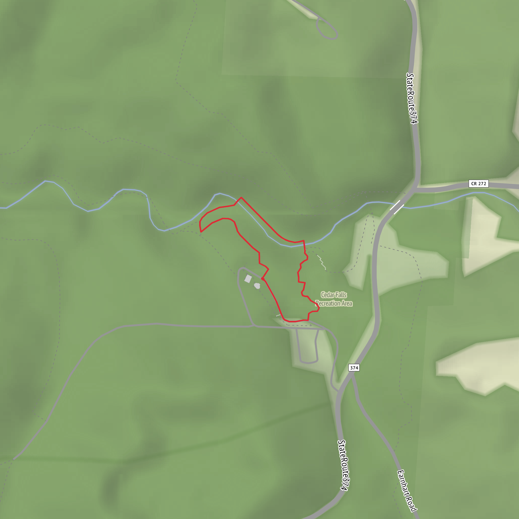
This is a short, mostly level out-and-back-style walk (about 1 km / 0.6 mi total with ~0 m / 0 ft of climbing) that focuses on reaching Cedar Falls quickly via a segment of the Buckeye Trail. Even though the stats look easy, the “Medium” feel usually comes from wet footing, slick rock/boardwalk surfaces, steps, and crowding near the falls—especially after rain or during freeze–thaw conditions.
Getting to the trailhead (car + public transport)
Because the start location is listed only as “near” (no coordinates provided), the most reliable way to pinpoint the correct access is to search “Cedar Falls Buckeye Trail trailhead” in HiiKER, then navigate to the nearest marked parking/entry point shown there.
- By car: Expect a small trailhead pull-off or a designated lot close to the Buckeye Trail corridor. Arrive early on weekends—popular waterfall walks can fill up quickly, and roadside parking is often restricted.
- By public transport: In most parts of Ohio where the Buckeye Trail runs near natural areas, public transit is limited. If you’re coming from a nearby town, the practical approach is usually a rideshare/taxi to the closest park entrance/lot shown on HiiKER, then walk in from there. If you tell me the nearest town/city you’re starting from (or share coordinates), I can translate that into the nearest recognizable address/landmark and a realistic transit plan.
What to look for at the start: Buckeye Trail routes are commonly marked with blue blazes. Confirm you’re on the correct spur/connector in HiiKER before leaving the parking area, since short waterfall paths sometimes intersect with multiple footpaths.
On the trail: what the 1 km actually feels like
With only about 0 m / 0 ft of net elevation gain, the route typically rolls gently through mixed woodland and a shaded ravine environment as you approach the falls. The sound of moving water often becomes your main cue that you’re close.
Underfoot, plan for a mix of: - Packed dirt and leaf litter (can hide roots and small rocks) - Mud patches in low spots - Rocky or stepped sections near the falls where the terrain tightens into a gorge-like setting
Even on a short walk, bring footwear with reliable tread. The most common “gotcha” here is slick footing on damp stone, algae-darkened rock, or polished surfaces where many boots have passed.
Cedar Falls area: landmarks, nature, and wildlife
As you near Cedar Falls, the corridor often narrows and the microclimate shifts—cooler air, higher humidity, and denser moss/fern growth are typical around waterfall spray zones. The falls themselves are the obvious landmark, but also pay attention to:
- Rock overhangs and layered stone around the cascade (great for photos, but also where drips keep surfaces slick)
- Pool edges and stream crossings (banks can be undercut; keep a buffer from the lip)
- Side paths created by visitors—these can cause erosion and may lead to unstable footing. Stick to the main tread shown on HiiKER.
Wildlife you may encounter in this kind of Ohio ravine/forest setting commonly includes songbirds, woodpeckers, squirrels, chipmunks, and white-tailed deer. Near water, you may also see frogs/salamanders and aquatic insects. Ticks can be present anywhere with brushy edges—long socks and a quick post-hike check help.
Safety and planning notes (why it can rate “Medium”)
- Wet-weather hazard: After rain, the last approach to the falls is often the slickest part. Move slowly, keep hands free, and avoid stepping on dark green/black rock.
- Cold-season hazard: If temperatures hover around freezing, expect ice glazing in shaded sections near the water even when nearby roads are clear.
- Crowds: Short waterfall walks can feel more technical when you’re passing people on narrow tread. Be patient and yield on tight spots.
- Navigation: The route is short, but intersections can be confusing. Keep HiiKER open and confirm you’re following the Buckeye Trail segment that leads directly to Cedar Falls rather than a longer loop.
Historical significance (regional context)
The Buckeye Trail is a long-distance footpath that threads through many of Ohio’s natural and cultural landscapes, and waterfall ravines like Cedar Falls are often protected because they preserve older forest pockets, stream corridors, and geologic exposures that are less common in heavily developed areas. In many parts of the state, these ravines also reflect a longer human story—lands shaped by Indigenous presence and later settlement, with conservation areas established to protect scenic water features and sensitive habitats.
If you share either (1) the longitude/latitude for “near …” or (2) the nearest town/park name, I can convert the coordinates to the nearest recognizable address/landmark, confirm the exact trailhead used for this 1 km route, and tailor the directions and on-trail landmarks to the correct Cedar Falls (there are multiple “Cedar Falls” locations in the U.S.).
Surfaces
Dirt
Unknown
Asphalt
Comments and Reviews
User comments, reviews and discussions about the Cedar Falls via Buckeye Trail, Ohio.
average rating out of 5
0 rating(s)


