Download
3D Flyover
Add to list
More
1.6 km
~18 min
0 m
Out and Back
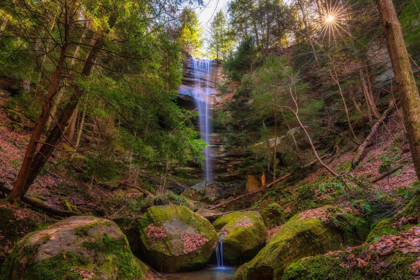
“Slip into a cool, fern-lit hollow for a gentle out-and-back to a mossy waterfall.”
A short, mostly level out-and-back to a waterfall in a shaded hollow, this walk is well-suited to families and anyone looking for an easy nature break. Expect roughly 2 km (1.2 mi) total with ~0 m (0 ft) of climbing overall, though you may notice small ups and downs where the path rolls through the creek-bottom terrain.
Getting to the trailhead (car + public transport)
Because the hike details you provided don’t include a town/state, a longitude/latitude, or a clearly identified “near ___” location, I can’t reliably convert the start point to the nearest address or landmark yet. If you share either:
- a pin / lon-lat, or
- the park/forest name, nearest town, or trailhead name as shown on HiiKER,
…I’ll translate it into the closest known address/landmark and give precise driving/public-transport options.
In the meantime, here’s what to plan for in a typical “hollow falls” access scenario: - By car: trailheads for short waterfall hollows are often on a narrow park road or forest road with a small pull-off. Arrive early on weekends—parking can fill quickly even for short trails. - By public transport: these trailheads are frequently not directly served by transit. The most common approach is bus/train to the nearest town, then a rideshare/taxi to the trailhead. If you tell me the nearest town, I can outline the most realistic transit chain.
What the walk is like underfoot
With an easy rating and near-zero net elevation gain, the route usually follows a creek corridor or a bench above the stream, staying in the cool, damp microclimate of the hollow. Underfoot, plan for: - Packed dirt and leaf litter with occasional roots. - Short muddy patches after rain—hollows hold moisture. - Slippery rock near the falls and along any streamside sections. - Possible informal side paths created by visitors; if you’re using a navigation app, stick to the main line on HiiKER and avoid “shortcut” braids that increase erosion.
Even on a short 2 km (1.2 mi) hike, footwear matters: light hikers or trail runners with decent tread are ideal; casual sneakers can feel sketchy on wet rock near the waterfall.
Landmarks and natural features to watch for
The hollow and creek: The defining feature is the sheltered drainage—cooler, darker, and more humid than surrounding ridges. You’ll often notice: - Mossy boulders and rock ledges where spray and shade keep surfaces damp. - Ferns and moisture-loving wildflowers (seasonal), especially in spring. - Overhanging hardwood canopy typical of eastern hollows (if you’re in the Appalachians/Interior Highlands) or mixed riparian woodland in other regions.
The waterfall: “Hollow Falls” routes commonly end at a small-to-moderate cascade or pour-off. The best viewing is usually from: - A natural rock apron at the base (often slick), or - A slightly elevated side angle where you can see the full drop without standing in the spray zone.
If there’s a pool at the base, treat edges cautiously—undercut banks and algae-coated stone can be surprisingly slippery.
Wildlife and seasonal considerations
In a shaded creek hollow, wildlife encounters are usually subtle rather than dramatic: - Songbirds and woodpeckers are common; listen for calls echoing in the hollow. - Amphibians (salamanders, frogs) often appear near seeps and wet leaf litter—watch your step. - Snakes may sun on rocks near openings; give them space and step onto logs/rocks rather than over them when visibility is limited. - Ticks can be present even on short hikes—long socks or a quick post-hike check is smart.
Seasonally: - After heavy rain: the falls are more impressive, but footing is worse and stream crossings (if any) can be higher. - Late summer/early fall: water flow may be reduced; the hollow can still be pleasantly cool. - Winter/shoulder seasons: shaded hollows can hold ice longer than nearby roads—microspikes can be helpful if temperatures hover around freezing.
Navigation and safety notes (short hike, real hazards)
Even easy 2 km (1.2 mi) waterfall walks can have the same “gotchas” as longer hikes: - Cliff/ledge edges near the falls: keep a buffer, especially with kids. - Phone signal: hollows can be spotty; download the route on HiiKER before you arrive. - Turnaround awareness: many falls trails end in a cluster of social paths—confirm your return line on HiiKER so you don’t wander onto a parallel user trail.
Historical context (what’s typical for “Big Spring / Hollow” areas)
Place names like “Big Spring” often reflect a reliable water source that historically mattered for: - Indigenous travel corridors and seasonal use (springs and sheltered hollows were natural stopping points). - Early settlement and homesteads, where springs supported cabins, small farms, and later mills in some regions. - In many U.S. forested hollows, you may also be walking through landscapes shaped by 19th–20th century logging—second-growth hardwoods, old grades, or subtle bench cuts can be remnants of that era.
If you share the exact location (park/forest or coordinates), I can tie this to the specific local history—Indigenous
Comments and Reviews
User comments, reviews and discussions about the Big Spring Hollow Falls, Ohio.
average rating out of 5
0 rating(s)
