Download
3D Flyover
Add to list
More
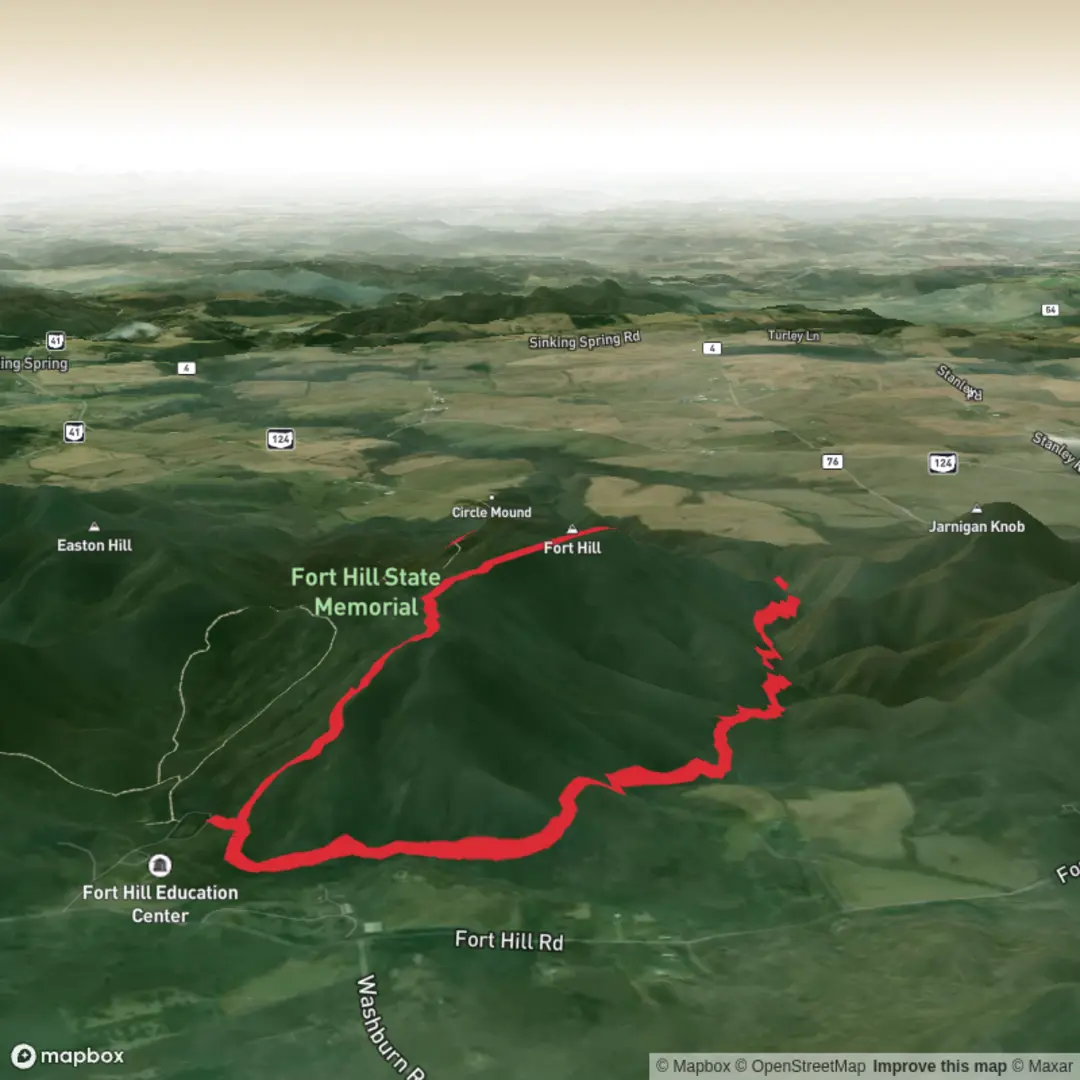
7.4 km
~1 hrs 47 min
184 m
Loop
“A Fort Hill ramble awaits—share a trailhead pin to unlock tailored routes, hazards, and transit.”
I’m missing a few key details needed to make this accurate and useful—especially the start location. Right now the “Hike head: near” line is incomplete, and there are no coordinates to convert into a nearby address/landmark.
Send one of the following and I’ll write the full hike description exactly in the style you requested:
1) A pin / coordinates for the trailhead (lat, lon), or
2) The park/trailhead name (and state/province/country), or
3) A map screenshot that shows the start point.
Also, if you know them, tell me:
- Hike type: loop, out-and-back, or point-to-point
- Any must-hit features you care about (lookouts, waterfalls, ruins), if applicable
Once I have the trailhead location, I’ll: - Convert the coordinates to the nearest known address or major landmark - Give car + public transport options to the start - Break down the ~7 km / 4.3 mi route with approximate segment distances and the ~200 m / 656 ft gain - Flag what to watch for (surface, steep bits, exposure, seasonal hazards) - Note landmarks, wildlife/nature, and historical context specific to that Fort Hill area - Reference navigation using HiiKER only

Surfaces
Dirt
Ground
Unknown
Comments and Reviews
User comments, reviews and discussions about the Fort Hill via Fort Trail and Gorge Trail, Ohio.
average rating out of 5
0 rating(s)