
Download
3D Flyover
Add to list
More
4.0 km
~54 min
62 m
Loop
“Wander a mellow woods-and-meadow loop with birdsong, wildflowers, and a few slick, rooty surprises.”
A gentle, family-friendly loop of roughly 4 km (2.5 mi) with about 100 m (330 ft) of total climbing, this walk is mostly about easy woodland and edge-of-meadow scenery, short rises and dips, and a few spots where you’ll want to slow down for footing—especially after rain. Expect a relaxed pace for most hikers, with plenty of time to stop for birds, wildflowers, and any interpretive signage the preserve may have.
Getting to the trailhead (car + public transport)
Because the start location is listed only as “near” (with no coordinates, town, or state), I can’t reliably convert the trailhead to a nearest address or landmark yet. If you share a lon/lat pair (or even a Google Maps pin), I’ll translate it into the closest known address or prominent landmark and tailor the directions precisely.
In the meantime, here’s the practical approach most preserves in the U.S. follow:
- By car: Look for the preserve’s main parking area (often signed as “Preserve Parking,” “Trailhead Parking,” or “Nature Preserve Lot”). Arrive earlier on weekends—small lots fill quickly. If the preserve is adjacent to neighborhoods, avoid blocking driveways; many towns ticket aggressively near trail access points.
- By public transport: If the preserve is near a town center, the most common pattern is bus to the nearest main road stop, then a 0.5–2.0 km (0.3–1.2 mi) walk along sidewalks/shoulders to the entrance. If you tell me the nearest city or provide coordinates, I can map the most sensible transit stop and walking approach.
What the route feels like underfoot
You’ll typically start on a wide, easy path—often packed dirt, fine gravel, or mown grass—then transition into narrower singletrack as the loop bends into denser trees. With only ~100 m (330 ft) of gain spread across the loop, the climbing usually comes in two or three short rises rather than one sustained hill.
Common surface and conditions to plan for: - Hard-packed dirt with roots: Watch for shallow roots crossing the tread, especially where the trail threads through mature trees. - Short muddy patches: Low points and shaded sections can stay wet longer. After rain, the “easy” rating can feel more like “easy-moderate” for anyone sensitive to slick footing. - Leaf litter: In fall, leaves can hide rocks and roots—step a little more deliberately.
If you’re using a navigation app, download the route in HiiKER before you arrive so you’re not relying on spotty cell service under tree cover.
Landmarks and points of interest you’re likely to notice
On a preserve loop of this length, the highlights tend to be subtle and close together rather than big “destination” features:
- Edge habitat (woods-meet-field): These transition zones are often the most active for wildlife. You may see songbirds flitting between shrubs and taller trees, and you’ll often find more wildflowers here than deep in the woods.
- Seasonal wet areas: Many preserves protect small drainages, seeps, or low swales. Even if there’s no dramatic creek crossing, you may pass through a slightly sunken corridor where the vegetation changes (more ferns, sedges, or moisture-loving plants).
- Old boundary lines: In older preserves, straight lines of mature trees, stone piles, or subtle berms can hint at former property edges, farm lanes, or historic land use before conservation.
If you share the preserve’s state/county (or coordinates), I can be much more specific about what’s on this particular loop—boardwalks, overlooks, interpretive panels, or any named features.
Nature and wildlife to look out for
Even on an easy 4 km (2.5 mi) loop, preserves can be surprisingly rich:
- Birdlife: Expect common woodland and edge species—listen for repeated calls from the canopy and quick movement in the understory. Early morning is usually best.
- Deer and small mammals: White-tailed deer are common in many U.S. preserves; you’ll often spot them at the edges of clearings. Squirrels and chipmunks are frequent along quieter stretches.
- Reptiles/amphibians (seasonal): In warmer months, sunny openings can attract basking turtles or snakes (often non-venomous, but always give space). Damp pockets can hold frogs or salamanders.
- Insects and ticks: In spring through fall, plan for ticks in brushy edges and tall grass. Long socks and a quick post-hike check make a big difference.
Elevation, pacing, and who it suits
With ~4 km (2.5 mi) and ~100 m (330 ft) of gain, most hikers will finish in 1–1.5 hours at an easy pace, longer if you’re stopping for photos or birding. It’s well-suited to:
- beginners building confidence on natural surfaces
- families (assuming no steep drop-offs or technical sections)
- anyone wanting a short nature reset without committing to a long day
A few things can still trip people up on “easy” preserve loops:
- Short, punchy rises that feel steeper than expected because they come after flat walking
- Rooty descents where traction matters more than fitness
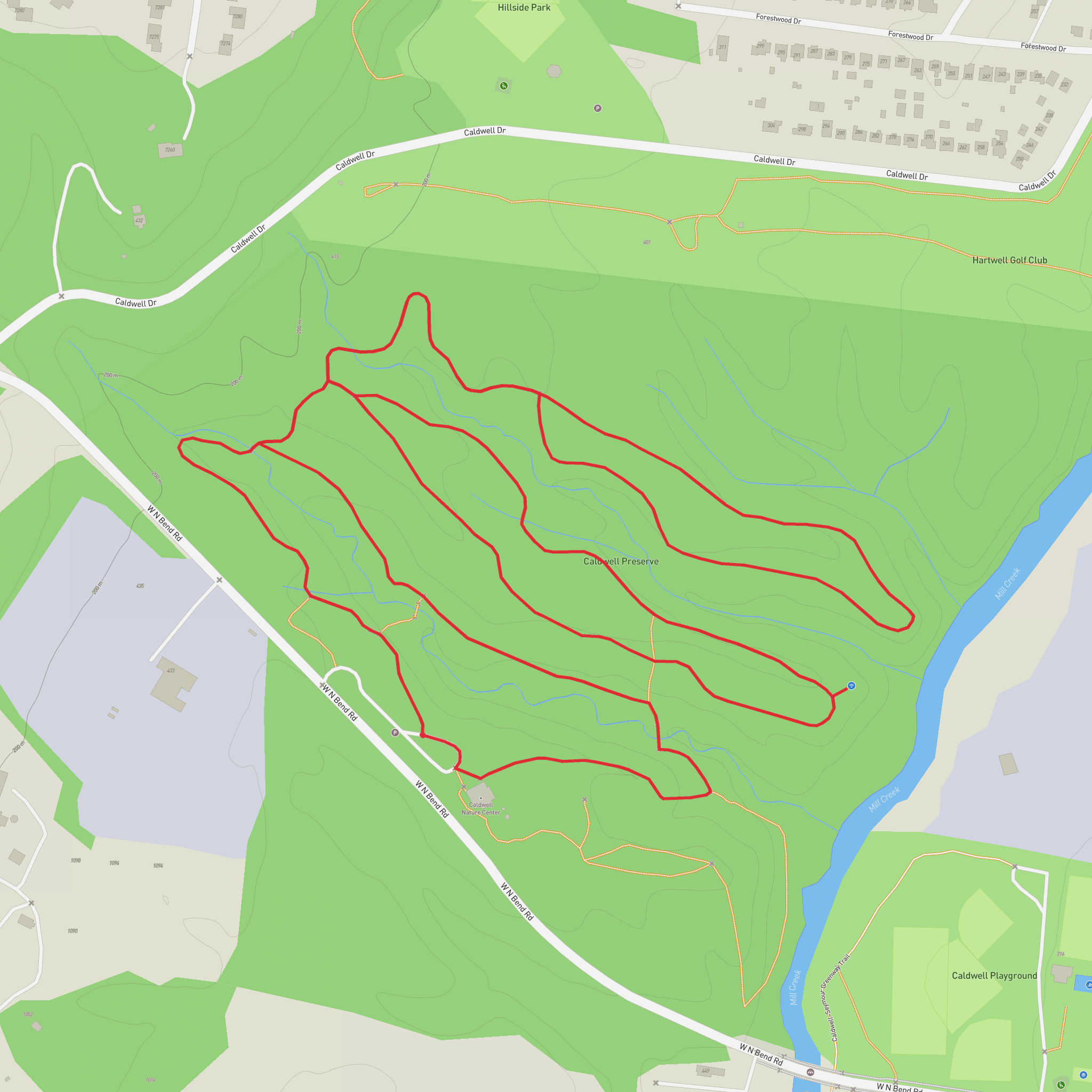
- Trail junctions where multiple short connectors can make the loop confusing without HiiKER
What to bring (light but prepared)
- Footwear: Trail runners or light hikers with decent tread; after rain, prioritize grip.
- Water: For most people
Surfaces
Unknown
Paved
Comments and Reviews
User comments, reviews and discussions about the Caldwell Preserve Loop, Ohio.
average rating out of 5
0 rating(s)
