Download
3D Flyover
Add to list
More
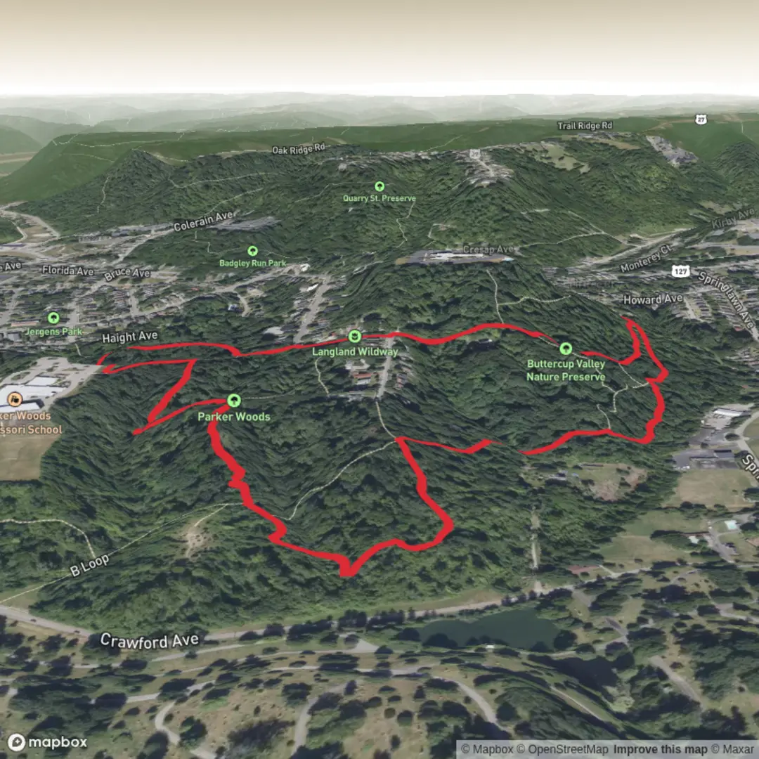
2.8 km
~41 min
79 m
Loop
“Share your trailhead and loop plans, and I’ll paint a vivid, safe hike story with standout sights.”
I’m missing a few key details needed to make this accurate and useful (especially the trailhead location and loop direction). Share any of the following and I’ll turn it into a complete, ready-to-hike description with distances/elevation in km+mi and m+ft, plus landmarks, wildlife, hazards, and transit/driving directions.
1) Trailhead location (any one works)
- A lon/lat pair (I’ll convert it to the nearest known address/landmark), or
- A Google Maps link, or
- The town/state + where you park (e.g., “parking lot at ___ preserve off ___ Rd”).
2) Hike type
- Loop / out-and-back / lollipop (you wrote “Hike type:” but it’s blank). If you’re not sure, tell me whether you want it to be a true loop.
3) Optional but helpful - Any must-see spots you want included (overlooks, boardwalks, big trees, creek crossings). - Whether you’re hiking with kids/dogs, and the season (mud/ticks/ice can change the “look out for” list a lot).
Once I have the trailhead location, I’ll also include: - The best place to park and any fees/permits (if applicable) - The simplest HiiKER-based navigation plan (key turns + where people commonly miss junctions) - A realistic breakdown of the ~3 km / ~1.9 mi and ~100 m / ~328 ft gain into short segments with what to expect underfoot.

Surfaces
Unknown
Dirt
Paved
Concrete
Comments and Reviews
User comments, reviews and discussions about the Buttercup Valley Nature Preserve and Parker Woods Loop, Ohio.
average rating out of 5
0 rating(s)