
Download
3D Flyover
Add to list
More
1.7 km
~19 min
0 m
Loop
“Follow Sugarcreek’s color blazes through prairie, woods, and history for a gentle, choose-your-own loop.”
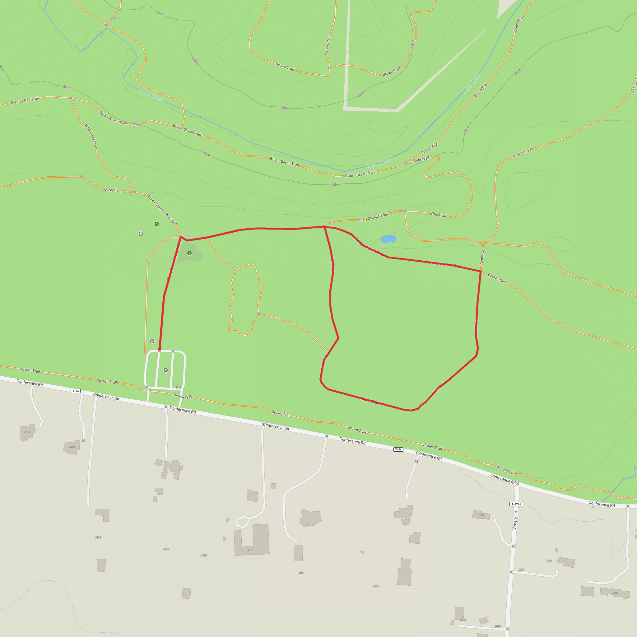
Getting to the start is straightforward: Sugarcreek MetroPark’s main entrance and primary parking area are at 4178 Conference Rd, Bellbrook, OH 45305. (metroparks.org) If you’re driving, aim for the park office/central lots shown on the official park map; from there you can pick up the color-blazed hiking network and stitch together a short, nearly level loop close to 2 km (1.2 mi). (metroparks.org)
For public transport, service in this part of Greene County is limited compared with downtown Dayton; the most reliable approach is usually a rideshare/taxi to the Conference Rd entrance, then walk in from the main lot. If you do use transit, plan on a short last-mile walk from the nearest stop and confirm timing before you go (weekend frequency can be sparse). Build your route in HiiKER ahead of time so you can see exactly which trail junction numbers you’ll be using once you’re on the ground.
This is an easy, family-friendly outing with minimal elevation change—about 0 m (0 ft) of gain overall—ideal for a relaxed walk, birding, or a quick nature break. The tread is generally smooth and forgiving, and because you’re staying on the gentler terrain near the park’s interior features, it’s a good choice after rain when you want to avoid steeper, more erosion-prone hills elsewhere in the park. (Even so, expect occasional soft spots in low areas after wet weather.)
What the walk feels like (and how to pace it)
Over ~2 km / 1.2 mi, most hikers will take 30–45 minutes at an easy pace, longer if you stop for photos or wildlife watching. Use the park’s numbered intersections (shown on the official map) to keep your loop tight and simple—this area is designed for mixing short segments without committing to the longer outer loops. (metroparks.org)
Because Sugarcreek’s trail system is color-coded and loop-based, it’s easy to accidentally “upgrade” your hike by following a different blaze at an intersection. If you want to keep it close to 2 km, decide in advance which color segments you’ll follow between junction numbers and save that plan in HiiKER so you’re not making distance decisions on the fly.
Landmarks, habitats, and what to look for
Even on a short loop, Sugarcreek packs in variety. The park is known for a mix of woodlands, open areas, and restored/planted prairie, which creates excellent edge habitat—often the most productive zone for seeing birds and small mammals. (metroparks.org)
A standout feature of the park is its planted tallgrass prairie, where deep-rooted grasses and wildflowers can reach impressive heights and typically peak in mid-to-late summer. (metroparks.org) In warm months, expect butterflies and other pollinators, plus songbirds that favor open fields. In cooler seasons, the same open areas can be good for scanning for hawks cruising the edges.
If your short loop brings you near the park’s interpretive features, keep an eye out for:
- Sycamore Ridge: sycamores are usually associated with floodplains and stream edges, but the park notes an unusual ridge setting here—suggesting subsurface moisture that supports them. (metroparks.org)
- Sugar Creek corridor (nearby): even if your 2 km route doesn’t fully commit to creekside hiking, the broader park landscape is shaped by the creek and its associated wildlife. (metroparks.org)
Natural and historical significance you’ll notice on the ground
Sugarcreek MetroPark preserves a landscape that shifted from farmland into a managed mosaic of habitats. The park notes that much of the area was once farmed, and that land management and natural processes have helped restore habitat diversity across the property. (metroparks.org)
If you decide to add a small “bonus” spur (still keeping the day easy), Sugarcreek’s most famous living landmark is the Osage Orange Tunnel—a corridor formed by arching branches of old osage orange trees. These trees were planted in the late 1800s as a living fence, back before barbed wire was widely available. (metroparks.org) (It’s specifically noted as being about 0.7 miles / 1.1 km out on the Orange Trail from the referenced point on the map, so it may push your total beyond 2 km if you
Surfaces
Ground
Asphalt
Comments and Reviews
User comments, reviews and discussions about the Yellow Loop Trail in Sugarcreek Metro Park, Ohio.
average rating out of 5
0 rating(s)
