
Download
3D Flyover
Add to list
More
5.4 km
~1 hrs 9 min
50 m
Loop
“A gentle Birch Creek wander—cool, ferny shade to misty cascades—best enjoyed with sure footing.”
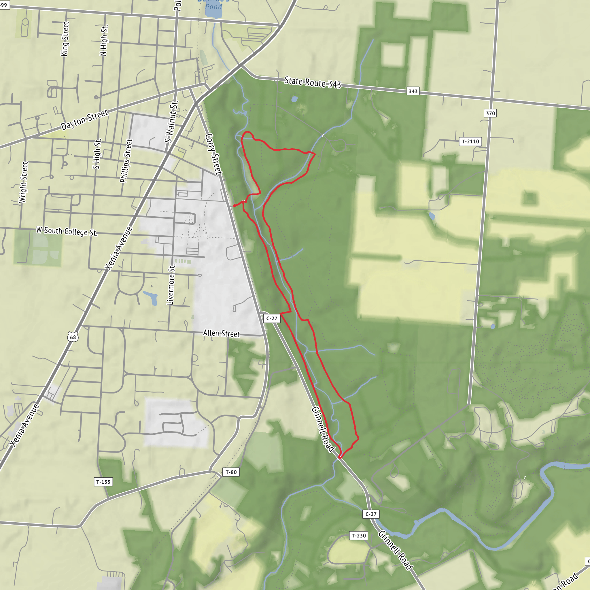
I’m missing a few key pieces needed to write this accurately (especially the trailhead location). Please paste either a lon/lat for the start or a map screenshot, and if you have it, the park/region/state. Once I have that, I’ll convert the coordinates to the nearest known address/landmark and tailor transit + driving directions, landmarks, wildlife, and any local history.
To keep things moving, here’s what I can already tell you based on your stats (about 5 km / 3.1 mi and ~100 m / 330 ft gain) and the trail naming (Lower + Upper Birch Creek typically indicates a creekside approach with a short climb to a cascade viewpoint):
You’ll be looking at a short, low-commitment out-and-back or small loop that follows Birch Creek through shaded riparian forest, then steps up slightly onto higher ground where the creek drops through a series of small falls (“the cascades”). The grade should feel gentle overall, with the steepest moments likely concentrated in short pitches where the trail leaves the creekbank, crosses a side gully, or climbs to a better vantage above the water.
What the terrain usually feels like
- Underfoot: Expect a mix of packed dirt, fine gravel, and rooty sections near the creek. In wetter months, the lowest parts of the Lower Birch Creek Trail can hold mud or slick organic soil.
- Creek crossings: Even on easy trails, “creek trail” often means at least one crossing—either a small footbridge, stepping stones, or a narrow log. After rain or snowmelt, water can rise enough to make stepping stones awkward.
- Microclimate: Creek corridors stay cooler and damper than nearby ridges. Even on warm days, it can feel several degrees cooler in the shade, and the rocks near cascades can be slick from spray.
Landmarks and what to watch for
- Birch Creek corridor: The most consistent landmark is the sound and presence of water—listen for where the creek gets louder; that’s usually where the cascades begin.
- Cascade viewpoints: The best views are often from slightly elevated rock shelves or bends in the trail where the creek narrows. These spots can be slippery—especially if there’s algae on rock.
- Trail junction (Lower → Upper): There’s typically a clear transition point where the route shifts from the lower valley track to a slightly higher bench or hillside alignment. This is the most common place for people to wander onto a side path—have your route loaded in HiiKER and confirm you’re on the correct branch before committing uphill.
Nature and wildlife you may encounter
What you’ll see depends heavily on the region, but creek-and-cascade hikes commonly feature: - Riparian plants: Mosses, ferns, and moisture-loving shrubs close to the water; wildflowers can be concentrated in openings where sunlight reaches the creek. - Birdlife: Songbirds in the understory; near water you may see species that hunt insects along the creek. - Mammals: Deer are common in many areas; smaller mammals (squirrels/chipmunks) are frequent near trail edges. - Biting insects: If this is in a mosquito-prone region, the creek corridor can be the buggiest part of the hike—especially at dawn/dusk or after rain.
Practical planning (for an easy 5 km / 3.1 mi hike)
- Time estimate: Many hikers will take 1.5–2.5 hours including stops at the cascades.
- Footwear: Light hikers or trail runners are fine in dry conditions; choose shoes with decent grip if you expect wet rock near the falls.
- Water: For a short hike, 0.5–1 L is usually enough for most people, more in heat. Don’t assume creek water is safe without treatment.
- Safety near cascades: Keep a buffer from the edge—wet rock + steep banks can turn a simple outing into a rescue quickly.
Navigation and cell coverage
Creek valleys can have patchy reception. Download the route for offline use in HiiKER, and pay attention at: - the Lower/Upper junction, - any unsigned side paths that follow the creek closely (often social trails to fishing spots or viewpoints).
Historical significance (what I need to tailor)
“Birch Creek” and “The Cascades” exist in multiple states and parks, and the history varies a lot—Indigenous land history, logging/mining eras, CCC-era trail building, or watershed protection projects. Once you tell me the exact location (or provide coordinates), I’ll include the relevant, specific historical context for that region.
Send one of the following and I’ll produce the full hike description in the format you requested (no “Trail Description:” label, includes sub-headings mid-way, distances in km/mi, elevation in m/ft, transit + driving directions, and nearest address/landmark from lon/lat):
1) Trailhead coordinates (preferred): lat, lon
2) The nearest town/park name + state
3) A static map image showing the start point and route
Surfaces
Unknown
Dirt
Comments and Reviews
User comments, reviews and discussions about the The Cascades via Lower Birch Creek Trail and Upper Birch Creek Trail, Ohio.
1.0
average rating out of 5
1 rating(s)


