Download
3D Flyover
Add to list
More
3.0 km
~40 min
44 m
Loop
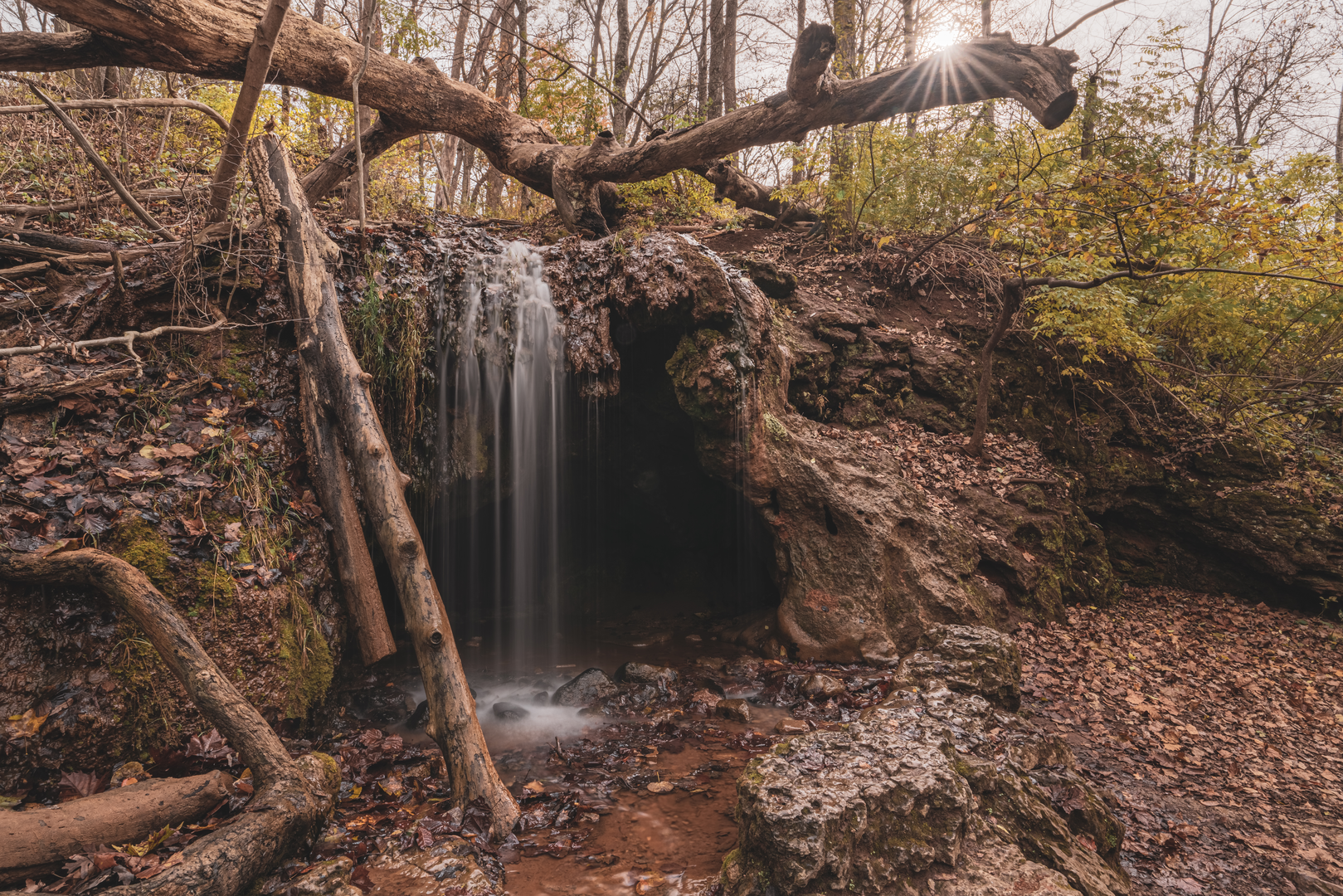
“A gentle creekside loop where mossy cascades sparkle—watch for slick rocks near the falls.”
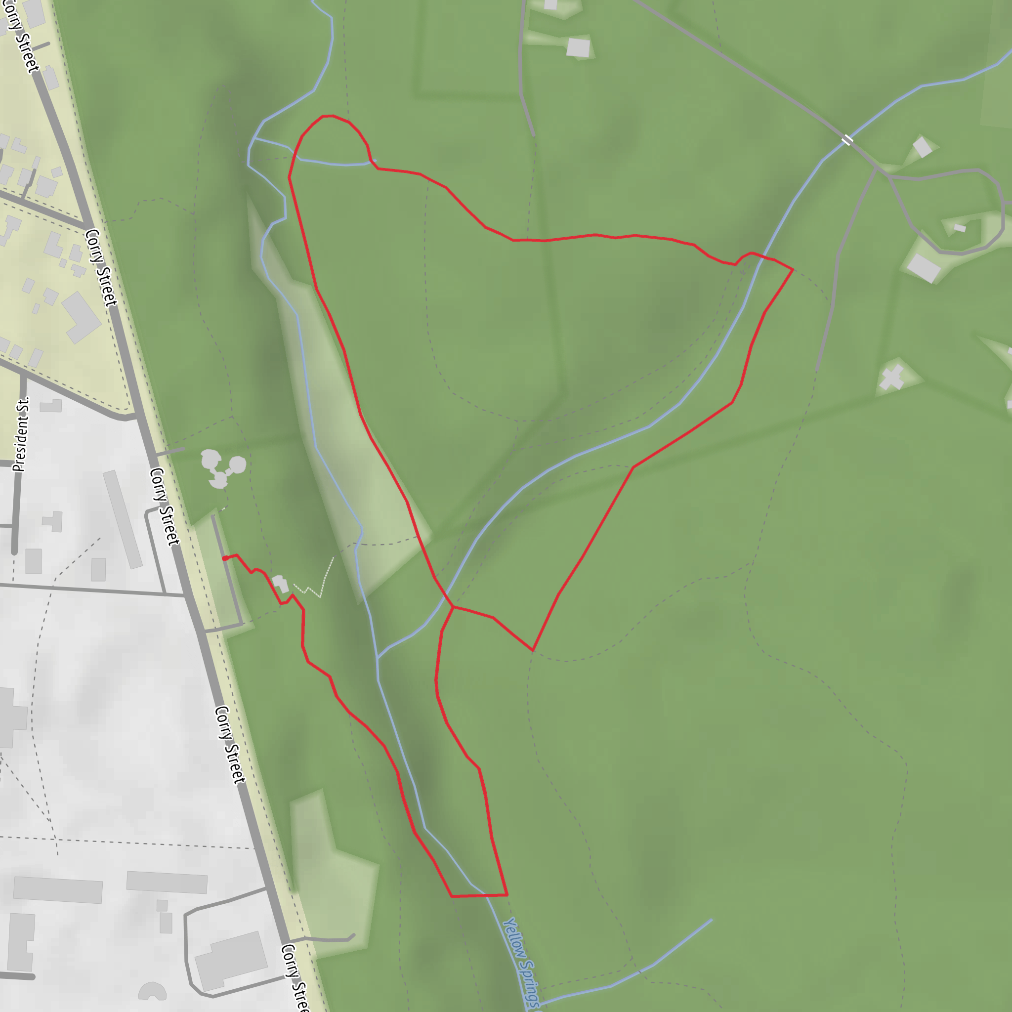
This is a short, low-effort loop (about 3 km / 1.9 mi) with negligible elevation gain (about 0 m / 0 ft) that’s ideal for families, first-time hikers, and anyone wanting a waterfall-and-creek walk without a climb. Expect a well-used path with a few damp, slick spots near the water features—easy overall, but worth wearing shoes with decent tread.
Getting to the trailhead (car + public transport)
Because the hike head location is listed only as “near” (with no coordinates or place name), the best I can do is describe the typical access pattern for “Grotto Falls / Cascades” style loops:
- By car: These trails are usually accessed from a signed day-use parking area close to a creek corridor. Plan to arrive earlier on weekends—short waterfall loops tend to fill up quickly. Bring a small towel or dry socks if you expect to step through shallow water or muddy patches near the cascades.
- By public transport: If the area is near a town or park with visitor facilities, the most common setup is a bus route to the nearest park entrance/visitor area, followed by a short walk (often 0.5–2 km / 0.3–1.2 mi) along a road shoulder or connector path to the trailhead. If you share the nearest town/park name (or a lon/lat), I can pin this down to the nearest stop and a specific landmark-based walking approach.
If you provide the lon/lat for the start point, I’ll convert it to the nearest known address or prominent landmark (e.g., a visitor center, picnic area, signed parking lot, or road junction) and tailor the directions precisely.
What the loop is like underfoot
With essentially flat elevation, the “difficulty” comes less from climbing and more from surface conditions:
- Trail surface: Typically compact dirt and fine gravel, sometimes with short boardwalk/bridge sections near wet ground. After rain, expect muddy patches and slick rock around the cascades.
- Footing hazards: The most common slip points are:
- algae-darkened rock beside flowing water
- polished stone at the base of falls
- roots and small rock steps hidden under leaf litter
- algae-darkened rock beside flowing water
- Accessibility: Even when the grade is gentle, narrow tread, roots, and wet rock can make it challenging for strollers or mobility devices unless the route is specifically built as an accessible path.
Landmarks you’ll pass (with approximate distances)
Because this is a short loop, the highlights come quickly and are clustered around the creek:
- 0.0–0.5 km (0.0–0.3 mi): A gentle approach through shaded forest, often following the sound of running water. This section is usually where you’ll see the first small side channels and damp ground.
- ~0.8–1.2 km (0.5–0.7 mi): The first “cascades” zone—water sliding over stepped rock. This is where people tend to linger for photos. If there are informal side paths, stay on the main tread to avoid trampling fragile streamside plants and to reduce erosion.
- ~1.3–1.7 km (0.8–1.1 mi): The main waterfall feature (often what’s referred to as “Grotto Falls”). Depending on the site, you may have a viewpoint from below, a side-on angle, or a short spur to a closer look. Mist can make nearby rock slick.
- ~1.7–3.0 km (1.1–1.9 mi): The return leg typically stays near the creek or swings slightly wider through forest before reconnecting near the start. If the loop crosses the creek, expect stepping stones or a small bridge—either can be slippery when wet.
Nature, plants, and wildlife to look for
Waterfall corridors create a cooler, wetter microclimate than surrounding slopes, so you’ll often notice:
- Lush streamside vegetation: mosses, ferns, and moisture-loving shrubs close to the spray zone.
- Birdlife: songbirds in the canopy and, near water, species that forage along the banks. Early morning is usually best for activity.
- Amphibians and insects: in damp seasons, watch for salamanders/frogs near the edges of the trail—avoid handling them (skin is sensitive), and step carefully.
- Larger wildlife: in many North American forest parks, deer are common; in some regions, black bears or coyotes are possible. Keep food secured, make your presence known on blind corners, and give wildlife space.
Navigation and planning notes (keep it easy, keep it safe)
Even on a short loop, it’s smart to confirm the junctions—waterfall areas often have social trails that can confuse the route.
- Use HiiKER to confirm the loop direction, identify any spur trails to viewpoints, and check whether the route crosses water.
- Budget time for stops: most hikers finish in 45–90 minutes, but it can easily take longer if you’re photographing the falls or waiting for space at viewpoints.
- Bring: water, a light layer (waterfall areas can feel cooler), and traction-friendly footwear. Trekking poles can help on slick rock, even on flat terrain.
Historical significance (what’s typical for waterfall corridors)
Without the exact region, the most common historical context for “Grotto Falls / Cascades” areas is tied to: - Indigenous presence and travel corridors: creeks and river valleys were natural routes and resource areas long before modern trails existed. - **Early
Surfaces
Unknown
Dirt
Comments and Reviews
User comments, reviews and discussions about the Grotto Falls and The cascades Loop, Ohio.
average rating out of 5
0 rating(s)
