
Download
3D Flyover
Add to list
More
3.0 km
~39 min
36 m
Loop
“Wander Sugarcreek’s shaded creek-and-meadow loop, where wetlands whisper with birdsong after rain.”
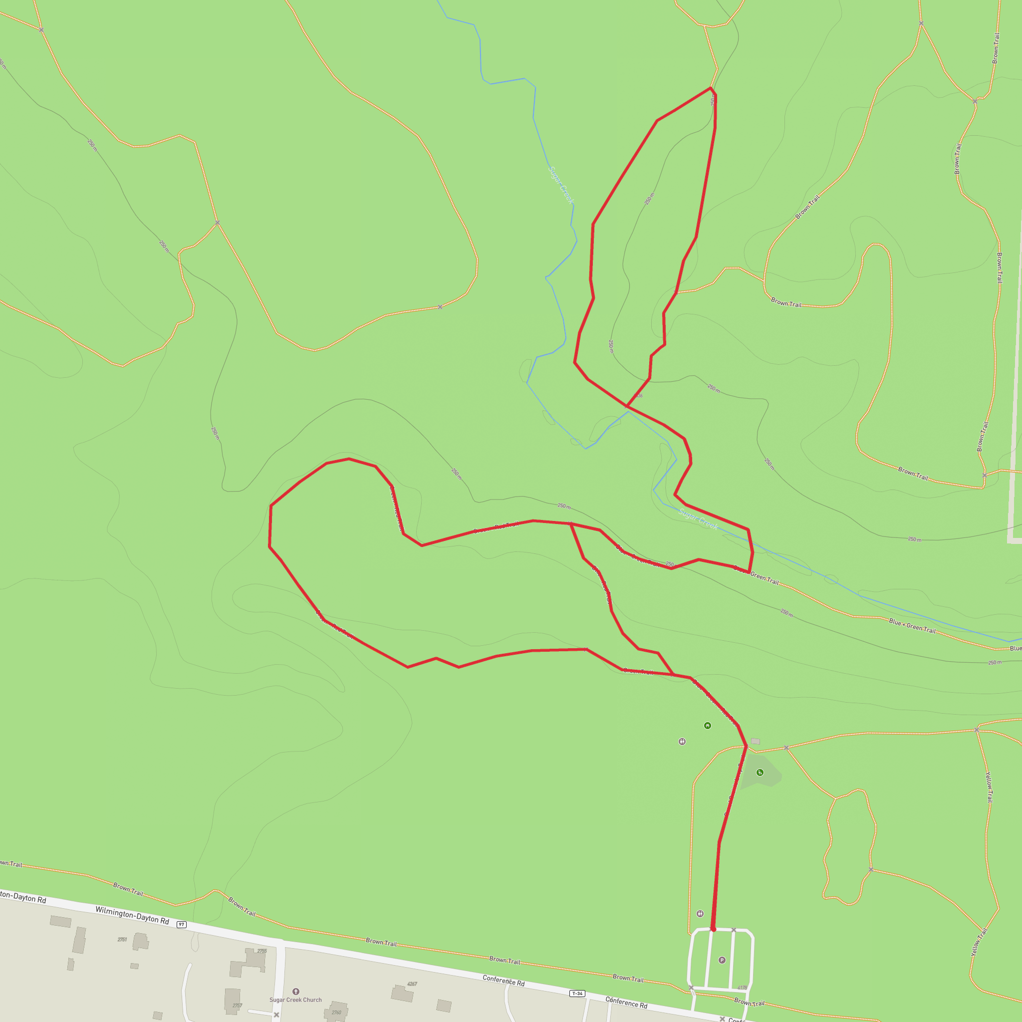
A relaxed, mostly level loop through classic southwest Ohio river-valley scenery, this walk links Sugarcreek MetroPark’s Green and Red Trails for roughly 3 km (1.9 mi) with essentially 0 m (0 ft) of sustained climbing. Expect a mix of packed dirt, mown grass, and short paved connectors, with frequent shade and plenty of spots to pause near the creek and wetland edges.
Getting to the trailhead (car + public transport)
By car:
Sugarcreek MetroPark is in Bellbrook, Ohio, southeast of Dayton. The most reliable “nearest known address” to aim for is the park’s main entrance area around 4178 Conference Rd, Bellbrook, OH 45305 (Sugarcreek MetroPark main parking/visitor area). From there, follow posted trail signs for the Green and Red Trails.
By public transport:
Public transit coverage to Bellbrook parks is limited. The most workable approach is usually:
- Take Greater Dayton RTA service toward Centerville/Kettering corridors, then
- Use a rideshare/taxi for the final few miles to Sugarcreek MetroPark (Conference Rd entrance).
If you want, tell me where you’re starting from (city/neighborhood), and I can outline the most practical RTA-to-rideshare handoff points.
What the route feels like underfoot
Because the elevation change is minimal, the “effort” here is more about surface conditions than hills. After rain, low-lying sections near Sugar Creek can hold water and get slick—especially where the trail skirts wetlands or crosses small drainages. In dry weather, it’s a comfortable stroll suitable for beginners, families, and anyone looking for an easy nature loop.
Plan on 45–75 minutes at a casual pace for 3 km (1.9 mi), longer if you stop for wildlife viewing.
Landmarks and natural highlights along the Green + Red combination
You’ll move through a patchwork of riparian woodland, open meadow, and wetland-edge habitat typical of the Sugar Creek corridor:
- Sugar Creek corridor views: Even when the creek isn’t directly beside you, you’ll notice the vegetation shift—more sycamore and moisture-loving plants closer to the water, with denser understory in shaded pockets.
- Meadow edges and seasonal wildflowers: In late spring and summer, sunny stretches can produce a good variety of blooms and pollinator activity. These open areas are also where you’re most likely to see raptors circling overhead.
- Wooded shade sections: These are the coolest parts of the loop on hot days and can be a good place to spot songbirds moving through the canopy.
If you’re navigating the junctions between the Green and Red Trails, use HiiKER to confirm you’re taking the intended connectors—trail systems in metroparks often have multiple short spurs and cross-links that can add distance if you miss a turn.
Wildlife you’re likely to encounter (and what to watch for)
This is a strong “everyday wildlife” park walk, especially around dawn and dusk:
- White-tailed deer are common along meadow edges.
- Woodpeckers, chickadees, cardinals, and migratory songbirds are frequent in the wooded stretches.
- Near wetter ground you may see frogs, turtles, and waterfowl depending on season and water levels.
Things to look out for: - Ticks: Expect them in warm months, especially where the trail brushes tall grass. Long socks and a quick post-hike check help a lot. - Poison ivy: Common along woodland edges and sunny margins; stay centered on the tread. - Mosquitoes/gnats: Most noticeable near still water and after rain—bring repellent in late spring through early fall.
Practical planning: what to bring for an easy 3 km (1.9 mi)
- Footwear: Light hikers or trail runners are fine; after rain, choose shoes with decent tread.
- Water: For a short loop, 0.5–1 L is usually plenty, more in humid summer weather.
- Layers: The creek corridor can feel cooler in shade; a light layer helps in spring/fall.
- Navigation: HiiKER is ideal for confirming trail color changes and junction choices.
- Accessibility note: While the route is easy in effort, surfaces can vary; if you need fully paved/firm paths, check current park conditions and use HiiKER to identify the most consistent tread.
Historical and regional context
Sugarcreek MetroPark sits within the broader Miami Valley landscape shaped by ancient glacial meltwater and long-term river erosion. The creek-and-floodplain setting you’re walking through is part of what made this region attractive for human settlement over thousands of years—reliable water, fertile soils, and travel corridors along waterways. In the modern era, the Five Rivers MetroParks system has focused on protecting these riparian habitats and keeping the creek corridors connected for wildlife movement and watershed health.
If you share the exact “Hike head: near …” detail (a pin, coordinates, or the parking lot name you plan to use), I can tighten the directions to the nearest landmark and lay out a turn-by-turn description with approximate segment distances (e.g., “0.6 km / 0.4 mi to the first junction,” etc.).
Surfaces
Ground
Unknown
Asphalt
Comments and Reviews
User comments, reviews and discussions about the Green and Red Trail in Sugarcreek Metro Park, Ohio.
average rating out of 5
0 rating(s)
