
Gull Cemetery and Goll Woods via Toadshade Trail, Tuliptree Trail and Cottonwood Trail
Download
3D Flyover
Add to list
More
4.9 km
~59 min
0 m
Loop
“Wander a flat, hushed wet-woods loop from Gull Cemetery to Goll Woods’ towering old-growth—muddy, mosquito-prone, and quietly magical.”
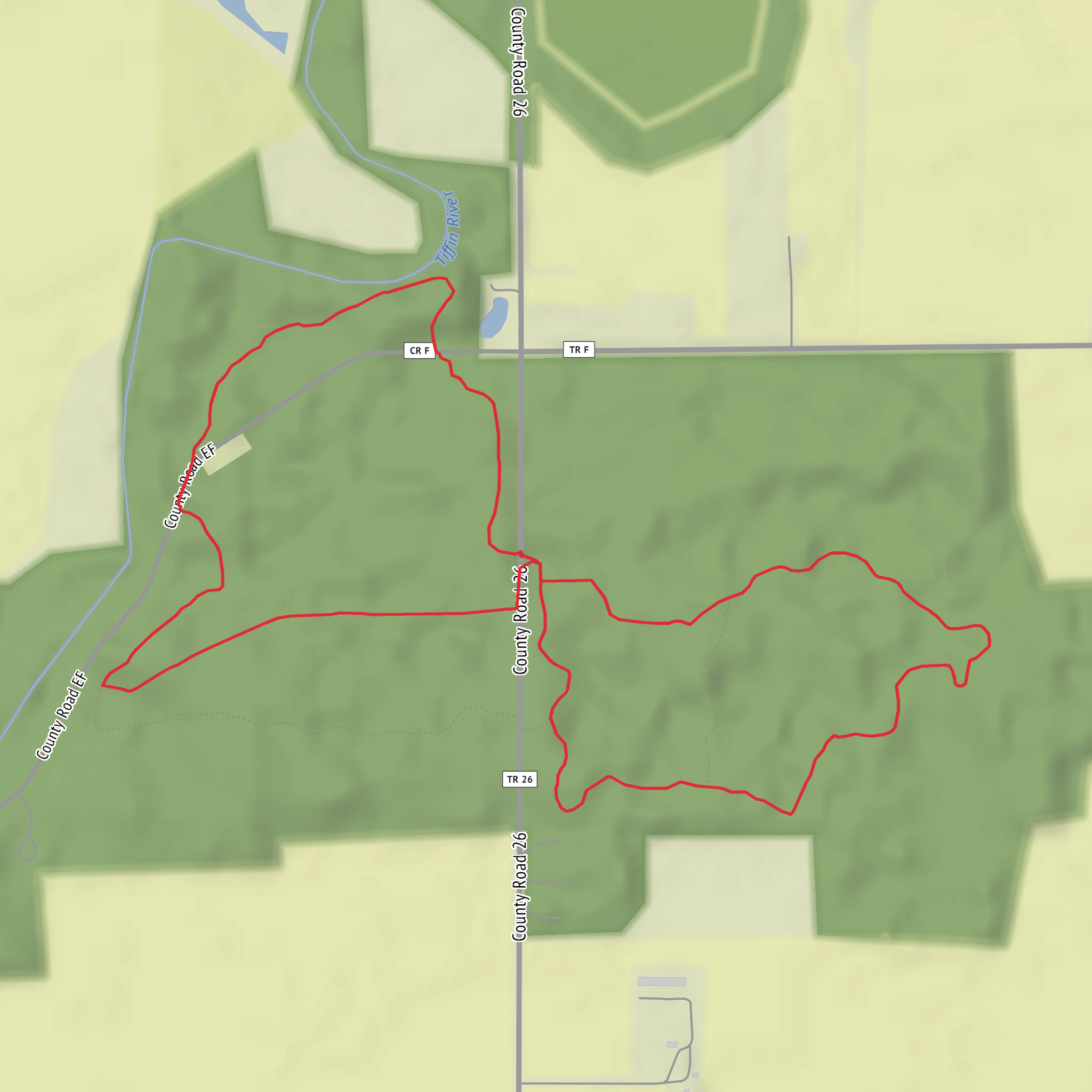
This easy, mostly level loop wanders through a classic Lake Erie lowland forest and wet-woods mosaic, linking the quiet Gull Cemetery area with the old-growth character of Goll Woods. At roughly 5 km (3.1 mi) with about 0 m (0 ft) of climbing, it’s ideal for a relaxed half-day walk where the main challenges are mud, standing water, and mosquitoes rather than hills.
Getting to the trailhead (car + public transport)
Because your “Hike head” field is incomplete (“near …”) and no coordinates were provided, I can’t reliably convert a lon/lat to a nearest address or landmark yet. If you share either (a) the start coordinates, (b) a HiiKER link, or (c) the nearest town/park entrance you’re using, I can pin the closest practical parking pull-off or signed trail access and suggest the best approach roads.
In the meantime, here’s how to plan access in a way that works for most trailheads in this part of northwest Ohio / Lake Erie lowlands: - By car: aim for the signed preserve/woods parking area (often a small gravel lot) closest to the Toadshade/Tuliptree/Cottonwood junctions. Arrive early on weekends—lots can be small and roadside parking may be restricted. - By public transport: service is typically limited outside city centers. The most workable approach is usually bus to the nearest town center, then rideshare/taxi the last few miles to the preserve entrance. If you tell me the nearest town you’re coming from, I can outline a realistic transit chain.
What the route feels like (surface, grade, and pacing)
Expect flat terrain with gentle undulations at most—any “gain” you notice is usually from stepping up onto boardwalks, rooty hummocks, or slightly raised trail tread. Underfoot is commonly: - Packed dirt and leaf litter in drier stretches - Soft, dark soil in low spots - Short boardwalk/bridging (where present) over the wettest pockets - Roots and occasional slick patches, especially after rain
Plan on a comfortable pace of 2.5–4 km/h (1.5–2.5 mph) depending on mud and how often you stop for wildlife and big-tree viewing.
Route breakdown with approximate distances
Distances are approximate and may vary slightly depending on the exact trailhead spur you use.
0.0–1.6 km (0.0–1.0 mi): Toadshade Trail — settling into the wet woods
You’ll start on a gentle, shaded corridor where the forest floor often tells you what kind of day you’re having: if it’s been wet recently, you’ll see shallow puddling and muddy hoofprints (often deer) in the softer sections. Early on, look for spring ephemerals in season—toadshade (trillium) is the namesake, and these woods can also host other early wildflowers before the canopy fully leafs out.
1.6–3.2 km (1.0–2.0 mi): Tuliptree Trail — taller canopy, bigger trunks
This middle portion typically feels more “cathedral-like,” with a higher canopy and straighter boles. Tuliptree (tulip poplar) can be a standout here—tall, fast-growing, and associated with rich soils. Even on a flat hike, this section can feel like the “main event” because the forest structure changes: more verticality, more filtered light, and often a slightly firmer tread where drainage is better.
3.2–5.0 km (2.0–3.1 mi): Cottonwood Trail — edges, openings, and damp pockets
Cottonwood is often associated with moist ground and floodplain influence, so don’t be surprised if this segment brings you back into wetter micro-terrain. Where the trail skirts openings or younger growth, you may notice more bird activity and a different mix of understory plants. This is also where you’re most likely to encounter muddy pinch points—spots where everyone steps around the same puddle and the trail widens. If it’s wet, stay on the most durable tread you can to reduce erosion and trail braiding.
Gull Cemetery and Goll Woods: landmarks and local significance
Gull Cemetery is a quiet cultural landmark—small rural cemeteries like this are common in the Great Lakes region and often reflect 19th- and early 20th-century settlement patterns, when farming communities established family and township burial grounds close to homesteads and churches. If you pass through or near it, treat it as a place of respect: keep voices low, stay on paths, and avoid stepping on grave borders.
Goll Woods is widely associated with old-growth forest preservation in northwest Ohio. In a landscape that was heavily logged and converted to agriculture over the last two centuries, pockets of mature forest like this are ecologically and historically important. Even without elevation, the “wow” factor comes from:
- Large-diameter trees and complex canopy layers
- Standing deadwood (snags) and downed logs that support fungi, insects, and cavity-nesting birds
- A more intact woodland feel than surrounding second-growth areas
Nature and wildlife to look for
Because the route is flat and often moist, it’s a strong habitat for amphibians and woodland birds.
Common sightings and signs - White-tailed deer (tracks, scat, browse lines) - Woodpeckers (listen for dr
Comments and Reviews
User comments, reviews and discussions about the Gull Cemetery and Goll Woods via Toadshade Trail, Tuliptree Trail and Cottonwood Trail, Ohio.
average rating out of 5
0 rating(s)
