
Download
3D Flyover
Add to list
More
9.1 km
~1 hrs 51 min
19 m
Point to Point
“A gentle island loop shifts from shady lakeshore woods to tower-top wetlands and a rocky quarry rim.”
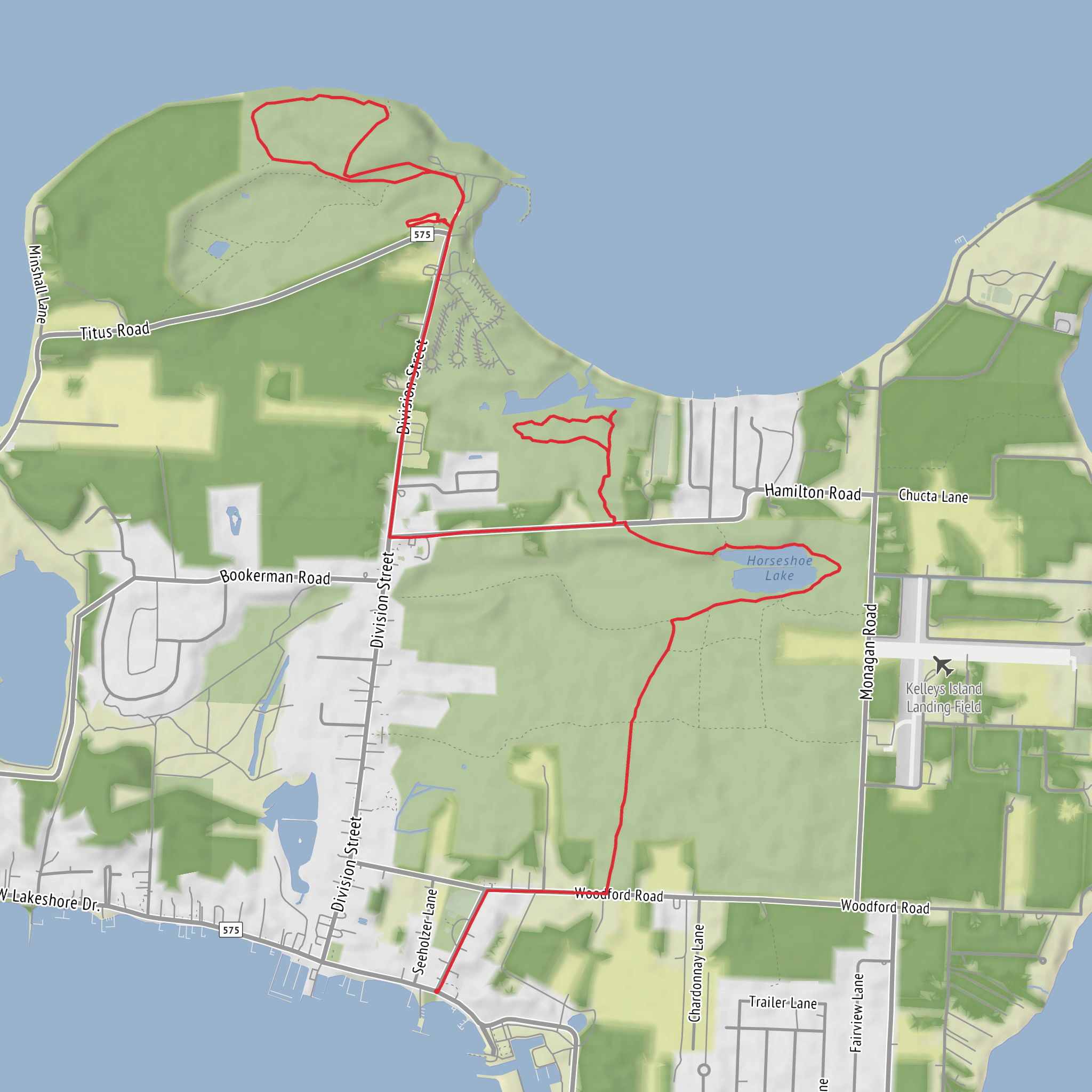
You’ll be walking a low-effort, high-variety loop through three distinct landscapes on Kelleys Island: shady lakeshore woods, a wetland boardwalk with an observation tower, and the open, rocky rim of a flooded limestone quarry (Horseshoe Lake). At roughly 9 km (5.6 mi) with essentially flat elevation (about 0 m / 0 ft of gain), it’s an easy outing that still delivers big scenery changes and plenty of places to pause.
Getting to the start (car + public transport)
By car + ferry (most common): - Drive to the Lake Erie ferry docks on the Ohio mainland (the Kelleys Island ferry runs seasonally), then take the ferry over to Kelleys Island. The island is small and easy to navigate once you arrive. The island’s main roads funnel you toward the state park area and Division Street.
On-island start landmark (nearest known place):
- A practical starting point for linking these three segments is near Kelleys Island State Park’s boat/launch ramp area at the north end of Division Street, close to Titus Road and the state park facilities. The North Shore Loop entrance is described as being just west of the state park boat-and-trailer parking lot. (kelleysislandnature.org)
- If you’re also including the boardwalk and quarry rim in one continuous hike, you’ll likely transition via the island’s signed trail network rather than a single “one trailhead” start. The main access for the East Quarry trail network is commonly referenced from Ward Road, just east of the North Pond Boardwalk entrance. (kelleysislandchamber.com)
Public transport: - There isn’t typical city-style public transit on the island; plan on walking from the ferry drop-off, renting a bike/golf cart, or arranging a ride. If you’re coming without a vehicle, build extra time into your day for the on-island road walking between segments.
What the route feels like underfoot
Expect mostly packed dirt and leaf litter in the woods, boardwalk planks through wetland sections, and wider doubletrack around the quarry rim (shared-use is common here, so stay alert for bikes). The “easy” rating is accurate for fitness and elevation, but footing can still be uneven in places—especially where the North Shore option drops to rocky shoreline depending on Lake Erie water levels. (kelleysislandnature.org)
Segment-by-segment: landmarks, nature, and what to watch for
1) North Shore Loop: shoreline woods + alvar character (about 2–3 km / 1.2–1.9 mi)
From the state park/boat ramp area, the North Shore Loop quickly settles into a quiet, wooded feel with frequent openings toward Lake Erie. This part of the island is known for alvar habitat—thin soils over limestone that create a distinctive, sparse ground layer in spots and a different plant community than you’ll see in deeper forest. (wanderlog.com)
Key choices along the North Shore: - Inland path vs. shoreline line: when lake levels are low enough, some hikers try the rocky shoreline for more open views; when water is high, you’ll stay in the woods. The shoreline option can be slow and ankle-twisty—great for views, but not as “easy” as the mileage suggests. (kelleysislandnature.org)
Wildlife you’re likely to notice: - Songbirds in the canopy and edge habitat, plus waterfowl out on Lake Erie. Early morning and late day tend to be best for bird activity, especially near transitions between woods and open shore.
2) North Pond Boardwalk: wetland crossing + observation tower + beach spur (about 1.6 km / 1.0 mi)
The boardwalk portion is a highlight because it puts you directly over a rare wetland feature for the Lake
Surfaces
Unknown
Unpaved
Asphalt
Concrete
Grass
Paved
Comments and Reviews
User comments, reviews and discussions about the North Shore Loop Trail, Boardwalk and Quarry Rim Trail, Ohio.
average rating out of 5
0 rating(s)

