
Download
3D Flyover
Add to list
More
3.6 km
~43 min
0 m
Point to Point
“A gentle Stonelick Lake loop of wooded shade, watery glimpses, and quiet wildlife—sometimes muddy.”
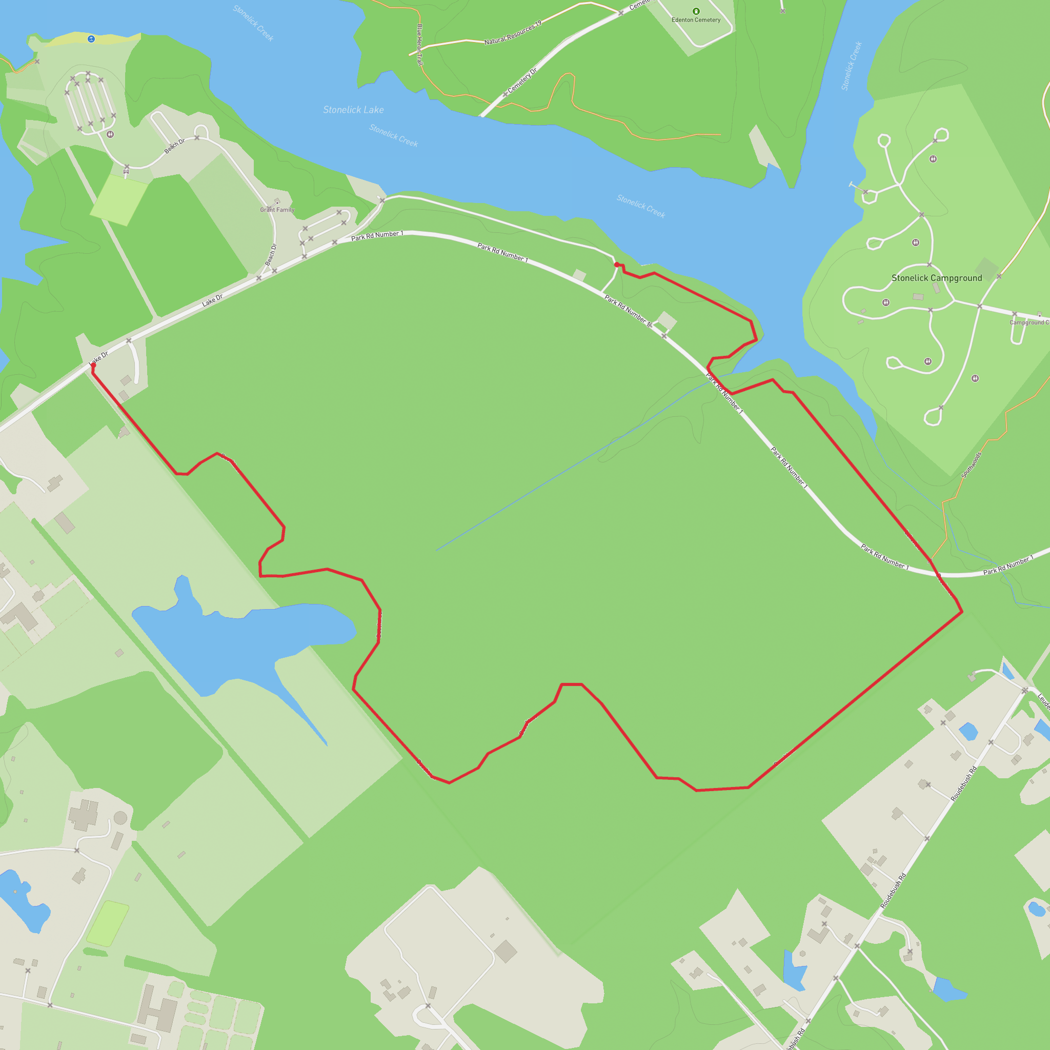
This easy loop stays close to the shoreline and low, wooded ground around Stonelick Lake, making it a good choice when you want a short walk with frequent water views and very little climbing. Expect roughly 4 km (2.5 mi) total with ~0 m (0 ft) of net elevation gain, though you may notice a few gentle rises and dips where the trail rolls over small drainages.
Getting to the start (parking + closest landmark)
- By car: Aim for Stonelick State Park, 2895 Lake Dr, Pleasant Plain, OH 45162. (discoverclermont.com)
From the park roads, you’ll typically choose the nearest lot for either the Lakeview Trail (yellow blazes) or the Beechtree Trail (blue blazes), then stitch them together into a single loop using junctions shown on HiiKER.
- By public transport: There isn’t reliable public transit directly into the park. The most practical option is to get as far as the Cincinnati metro area, then use a rideshare or taxi for the final rural leg to Lake Dr and the park entrance.
What the route feels like underfoot You’ll be on a mix of packed dirt, leaf litter, and short grassy edges near open areas. Because this is lake-country terrain with low-lying pockets, it can hold water after rain—watch for muddy stretches and standing puddles, especially on the more wooded sections. (If it has rained in the last 24–48 hours, plan on shoes you don’t mind getting dirty.)
Lake views, dam scenery, and the “easy miles”
Within the first 0.5–1.0 km (0.3–0.6 mi) you’ll start getting intermittent openings toward the lake—more “glimpses through trees” than continuous shoreline walking. The Lakeview Trail is short overall (about 1.0 km / 0.6 mi in the park system), so you’ll likely use it as a scenic connector rather than the whole hike. (dam.assets.ohio.gov)
As you arc around the lake, keep an eye out for: - Waterfowl activity in calmer coves (ducks, geese, and seasonal migrants) - Turtles sunning on logs and rocks on warm days - Beaver sign (chewed sticks, gnawed trunks) in quieter backwaters
If your loop brings you near the west side of the lake, you may be able to pick out the general area of the dam that created Stonelick Lake—an important landmark in the park’s layout and history.
Beechtree Trail: deeper woods and wetter pockets
The Beechtree Trail is longer (about 2.6 km / 1.6 mi) and tends to feel more enclosed and “forest-forward,” with more shade and a higher chance of damp ground. (dam.assets.ohio.gov)
This is where you’ll most notice:
- Mosquitoes and ticks in warm months—use repellent and do a tick check afterward
- Fallen branches after storms (easy step-overs, but watch footing)
- Soft edges near wet spots—stay on the tread to avoid widening the trail
Wildlife is usually most active here early and late in the day. White-tailed deer are common in this part of Ohio, and you may hear woodpeckers working dead snags.
Navigation and planning notes (HiiKER) Even though this is an easy, short hike, it’s worth loading the loop on HiiKER before you arrive. The park has multiple short trails and junctions, and it’s easy to accidentally shorten (or lengthen) your walk by taking the wrong connector—especially where the yellow (Lakeview) and blue (Beechtree) segments meet other park routes.
What to bring for a 4 km / 2.5 mi easy loop - Footwear: trail runners or light hikers with decent tread (mud can be slick) - Water: at least **0.5 L
Comments and Reviews
User comments, reviews and discussions about the Stonelick Lake via Lake View Trail and Beechtree Trail, Ohio.
average rating out of 5
0 rating(s)

