Download
3D Flyover
Add to list
More
4.6 km
~55 min
0 m
Point-to-Point
“A gentle lakeside wander with shifting water views, herons, and wildflower pauses—weather permitting.”
This easy lakeside walk stays essentially flat (about 5 km / 3.1 mi with roughly 0 m / 0 ft of climbing), making it a good choice for a relaxed loop or out-and-back with frequent water views and plenty of spots to pause for birds and wildflowers.
Where to start (nearest known address / landmark)
The most reliable “put it in your GPS” start point is the main park access at Stonelick State Park, 2895 Lake Dr, Pleasant Plain, OH 45162 (Clermont County, about 24 miles east of downtown Cincinnati). (discoverclermont.com)
From there, use HiiKER to pinpoint the closest Blue Heron Trail access and the best parking lot for the direction you want to walk (day-use lots near the lake are typically the most convenient).
Getting there
- By car: From the Cincinnati area, you’ll generally head east toward Clermont County and connect to the park via local roads and OH-727 (the park is signed). (en.wikipedia.org)
- By public transport: There isn’t dependable, direct public transit to the park entrance. The practical approach is to take regional transit to the eastern Cincinnati / Clermont County area and use a rideshare/taxi for the final miles to 2895 Lake Dr, Pleasant Plain. Plan for limited cell coverage in pockets near the water/woods and confirm your return ride timing before you start.
Once you’re parked, expect a straightforward trailhead experience: typical state-park rules apply—dogs on leash, pack out trash, and be ready to share the path courteously with other visitors. (dam.assets.ohio.gov)
What the walk is like (surface, pacing, and navigation)
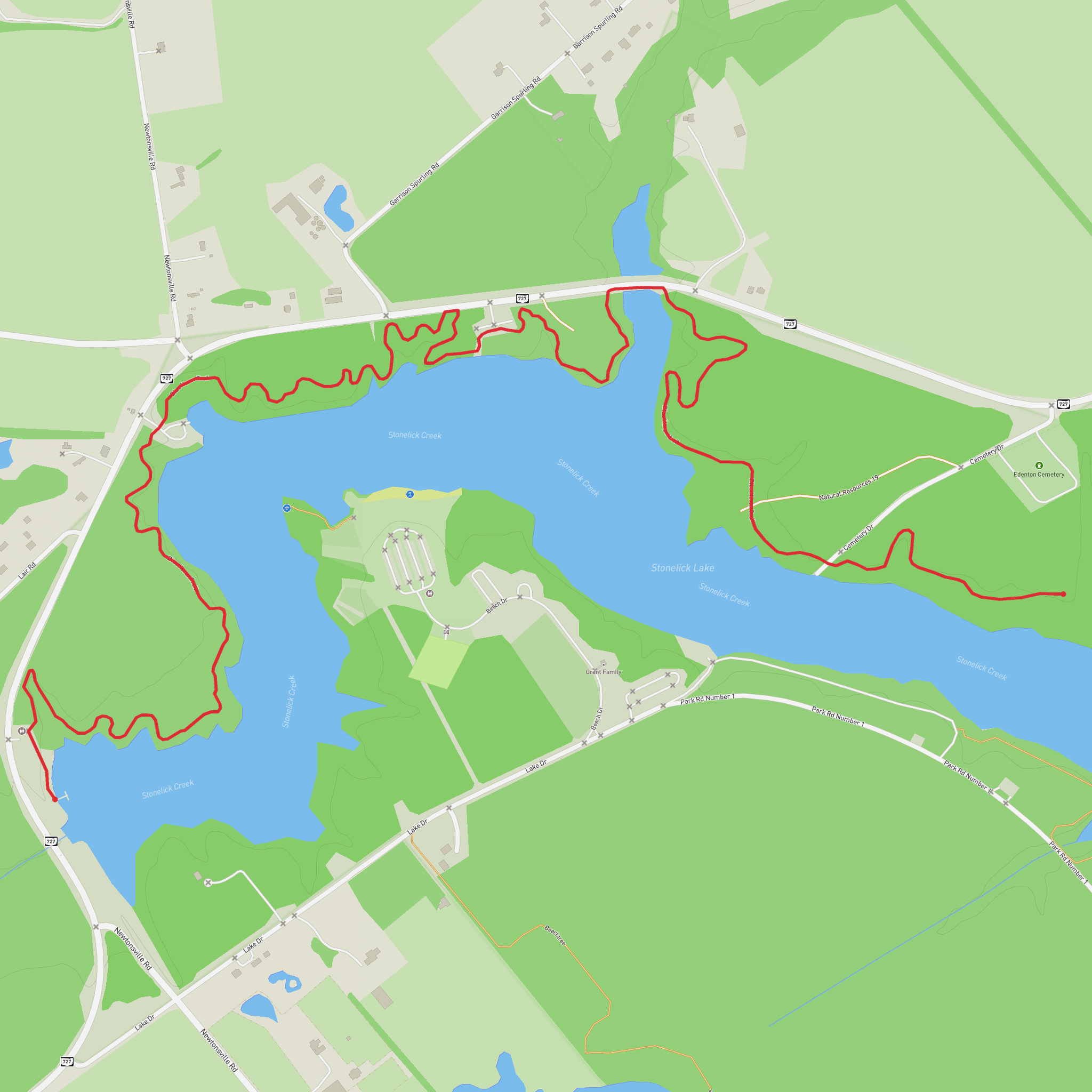
The Blue Heron Trail at Stonelick is designed as a longer lakeside route (the full trail system listing shows it at about 3.4 mi / 5.5 km in the park), so a “~5 km” outing usually means you’ll be doing a shortened out-and-back or a partial loop segment depending on where you hop on. (dam.assets.ohio.gov)
Use HiiKER to:
- choose a segment that totals ~5 km / 3.1 mi from your chosen parking area,
- confirm whether you’re linking short connectors or staying on the main lakeside tread,
- avoid accidentally extending to the full 5.5 km / 3.4 mi if you’re time-limited.
Underfoot, expect typical southwest Ohio state-park trail conditions: packed dirt with occasional roots, a few low spots that can hold water after rain, and short stretches where the trail narrows near the shoreline vegetation. Because the route is essentially flat, the main “effort” variable is mud (after storms) and heat/humidity (mid-summer).
Landmarks and nature to watch for
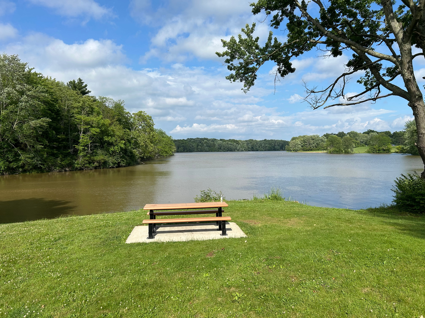
Stonelick Lake is the constant companion here—views open and close as the trail weaves between wooded edges and shoreline clearings. The park includes about 200 acres of water (with over a thousand acres total parkland), so you’ll often feel like you’re walking through a broad, quiet lake basin rather than a small pond loop. (discoverclermont.com)
Wildlife highlights tend to be strongest in the first and last hours of daylight: - Wading birds and waterfowl: Great blue herons are a classic sight along calm coves; you may also see egrets, ducks, and geese depending on season and water levels. - Songbirds at the edges: Brushy margins and meadow-like openings can be active with blackbirds and other edge-habitat species. - Turtles and frogs: Look on sunny logs and near shallow inlets.
Stay alert along the waterline for slick mud, especially where anglers create informal footpaths to the shore. If you’re hiking with kids, the “hazard” on this route isn’t steep terrain—it’s unexpectedly soft banks and slippery algae-coated rocks at the edge.
Practical cautions (easy trail, but not “no-prep”)
- Ticks and poison ivy: Expect both in warm months, especially where the trail brushes against tall grass or viney edges. Long socks and a quick post
Surfaces
Dirt
Unknown
Comments and Reviews
User comments, reviews and discussions about the Stonelick Lake via Blue Heron Trail, Ohio.
average rating out of 5
0 rating(s)
