Download
3D Flyover
Add to list
More
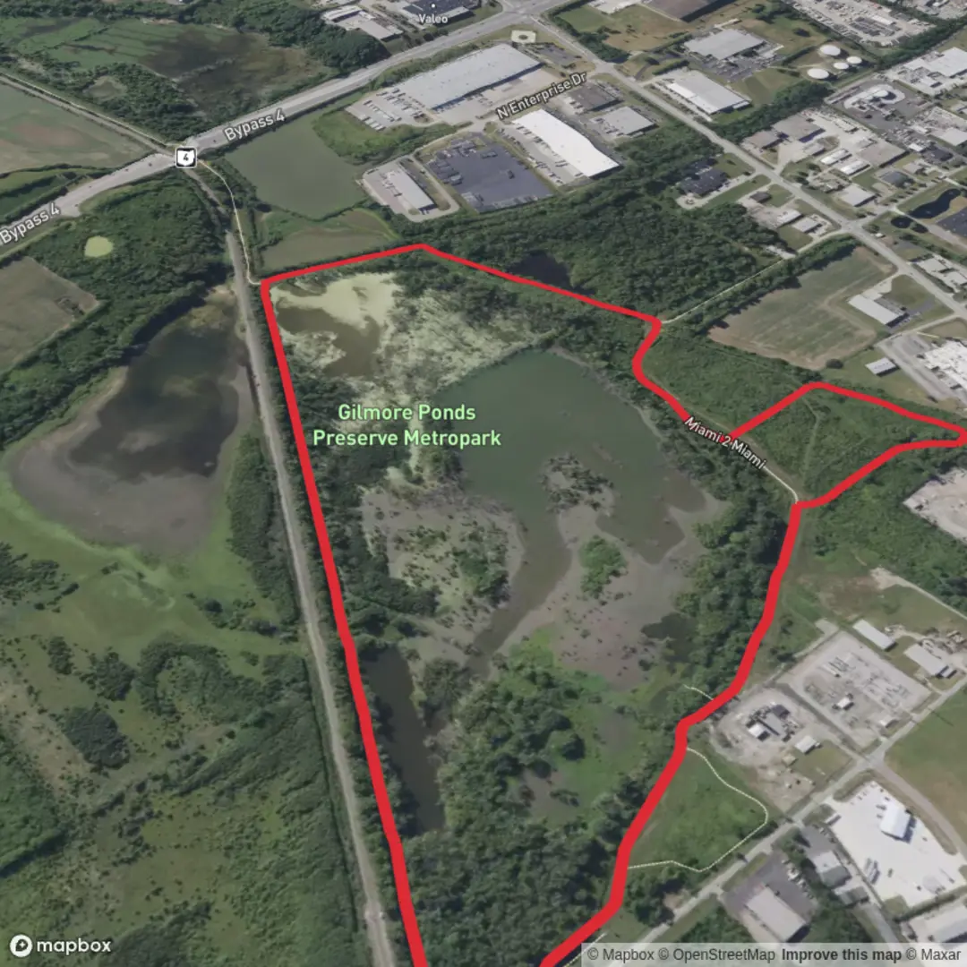
3.7 km
~44 min
0 m
Loop
“A gentle pond-and-wetland loop—flat, reflective, and wildlife-rich—best savoured with steady footing.”
This is a short, low-effort loop of roughly 4 km (2.5 mi) with essentially 0 m (0 ft) of elevation gain—ideal for a relaxed walk where the main “challenge” is staying oriented at junctions and keeping your feet dry if the ground is saturated. The route links the Gilmore Ponds area with the Miami-to-Miami segment, typically following flat, mixed-use paths through wetland-leaning forest and pond edges.
Getting to the trailhead (car + public transport)
Because the hike start is listed only as “near” (no coordinates or town/state provided), the best I can do is describe how to plan access once you confirm the exact Gilmore Ponds/Miami-to-Miami location on HiiKER:
- By car: Use HiiKER to identify the closest signed access point/parking pull-off to the loop’s start. For easy pond loops, parking is often either a small gravel lot, a roadside shoulder near a gate, or a recreation-area lot. Aim to arrive early on weekends if the ponds are popular for fishing or birding.
- By public transport: If the area is near a town, the usual pattern is: bus/train to the nearest town center, then a short rideshare/taxi to the trail access. Use HiiKER to pick the access point closest to a main road (this matters a lot for rideshare pickup reliability).
If you share a lon/lat (or even the nearest town/state), I can convert it to the nearest known address or prominent landmark and give precise, realistic directions.
What the walk is like underfoot
Expect a mostly level stroll on a combination of: - Packed dirt or fine gravel trail - Short boardwalk or puncheon sections if the ponds are bordered by marshy ground - Rooty, damp patches in shaded forest where water lingers
Even with “0 m” gain, you can still get minor ups/downs over old berms, beaver-worked edges, or trail drainage features—nothing sustained, but enough to notice if you’re pushing a stroller or using mobility aids.
Route flow and key landmarks (approximate)
On a 4 km (2.5 mi) loop, it helps to think in quarters:
- 0.0–1.0 km (0.0–0.6 mi): Settling in on flat trail, usually with the first views into wet woodland. This is where you’ll often see the first spur paths—double-check your line on HiiKER so you don’t accidentally take a short-cut that skips the ponds.
- 1.0–2.0 km (0.6–1.2 mi): The most “scenic” portion tends to be here—pond margins, openings in the trees, and the best chance of wildlife sightings. If there are any benches, fishing clearings, or small footbridges, they’re commonly clustered around this middle section.
- 2.0–3.2 km (1.2–2.0 mi): The loop typically transitions back into more enclosed forest. Watch for muddier tread if the trail runs close to outflow channels or low swales.
- 3.2–4.0 km (2.0–2.5 mi): Return leg—often the most straightforward walking, but it’s also where people miss the final turn back to the start if multiple paths converge. Keep HiiKER handy for the last junctions.
Nature, wildlife, and what to look out for
Pond-and-wetland loops are small in distance but rich in detail:
- Birdlife: Expect songbirds in the trees and water-associated species near open edges. Early morning and late afternoon are typically best for activity.
- Amphibians: Frogs and salamanders are common around damp trail margins, especially after rain—watch your step on narrow, wet tread.
- Mammals: Deer sign is common in pond-edge woods. If the ponds are active with beavers, you may notice chewed stumps, small dams, or flooded sections that can change the trail’s wetness from season to season.
- Insects: Mosquitoes and black flies can be intense in warm months near still water. A head net can be the difference between pleasant and miserable on a short loop like this.
Seasonal and safety considerations
- Mud and standing water: Even “easy” flat trails can become messy. Waterproof shoes or light boots are helpful after rain.
- Ice: In colder months, shaded boardwalks and bridge planks can glaze over. Traction devices can be worthwhile even on a 4 km (2.5 mi) walk.
- Ticks: Pond-edge brush and tall grass can be tick habitat. Long pants and a post-hike tick check are smart.
- Navigation: Short loops can still be confusing if there are fishing spurs, maintenance tracks, or intersecting paths. Keep the route loaded on HiiKER and confirm each junction rather than assuming “all paths lead back.”
Historical significance (regional context)
Pond landscapes in many parts of the U.S. are shaped by a mix of glacial geology (where applicable), historic logging, and water management (small dams, culverts, and beaver-influenced hydrology). If this Gilmore Ponds area sits near older settlements, it’s also common for these woods to have been used for timber, charcoal production, or small-scale milling where water flow allowed. If you tell me the state/nearest town (or provide coordinates), I can pin down the specific local history—such as whether the

Surfaces
Unknown
Asphalt
Comments and Reviews
User comments, reviews and discussions about the Gilmore Ponds via Miami to Miami Loop, Ohio.
average rating out of 5
0 rating(s)