Download
3D Flyover
Add to list
More
75.5 km
~3 days
120 m
Multi-Day
“"Discover Ohio's beauty and history on the 47-mile Western Reserve Greenway Trail, an easy, scenic adventure for all."”
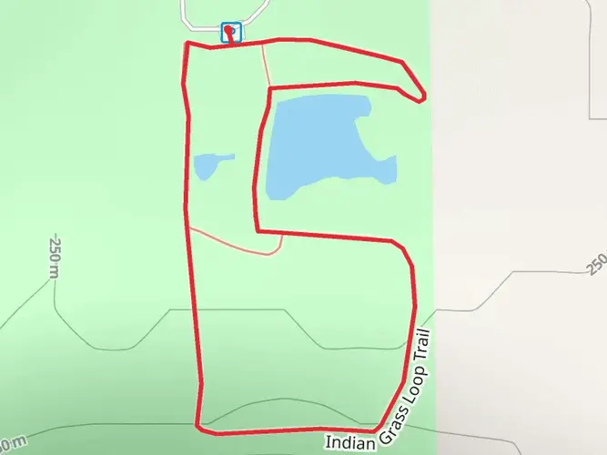
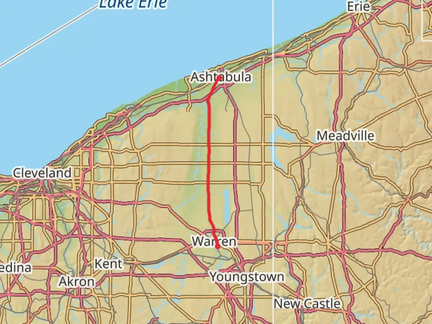
The Western Reserve Greenway Trail stretches approximately 47 miles (around 76 kilometers) through the scenic landscapes of northeastern Ohio, with a minimal elevation gain of roughly 328 feet (about 100 meters), making it an accessible route for hikers of all skill levels. The trailhead is located near Ashtabula County, Ohio, and the trail itself is a point-to-point type, which means it does not loop back to the starting point.
Getting to the Trailhead
To reach the starting point of the Western Reserve Greenway Trail, hikers can drive to the northern terminus near Ashtabula County. If you're using public transportation, you may need to check local transit options to get as close as possible to the trailhead and then arrange for a taxi or rideshare service for the final leg of the journey.
Trail Experience
As you embark on the trail, you'll find yourself surrounded by a mix of woodlands, wetlands, and open fields. The path is well-maintained and primarily consists of crushed limestone and asphalt, making it suitable for both walking and biking. The trail is also part of the Great Ohio Lake-to-River Greenway, which aims to create a continuous corridor from Lake Erie to the Ohio River.
Historical Significance
The Western Reserve Greenway Trail follows the former Penn Central Railroad corridor, offering a glimpse into the region's transportation history. As you hike, you'll encounter remnants of this past, including old railway bridges and historical markers that provide context about the area's development and the role of the railroad in the growth of the United States.
Wildlife and Nature
The trail is a haven for nature enthusiasts, with opportunities to spot a variety of wildlife, including deer, rabbits, and numerous bird species. The surrounding woodlands and wetlands are particularly vibrant in the spring and fall, with wildflowers and changing leaves providing a colorful backdrop for your hike.
Landmarks and Points of Interest
Approximately halfway along the trail, near the town of Austinburg, hikers will find a rest area with picnic tables and restrooms, offering a comfortable spot to take a break. The trail also features several covered bridges, including the picturesque Harpersfield Covered Bridge, which is one of the longest covered bridges in Ohio and is located just off the trail.
Navigation and Planning
For navigation purposes, hikers can utilize the HiiKER app to access detailed maps and waypoints along the Western Reserve Greenway Trail. This tool can be invaluable for planning your hike, as it provides real-time location tracking and information on trail conditions.
Preparation and Safety
Before setting out, ensure you have adequate water and snacks, as there are limited services along the trail. It's also advisable to check the weather forecast and dress appropriately, as conditions can change rapidly. Remember to let someone know your plans and expected return time, especially if you're hiking alone.
The Western Reserve Greenway Trail offers a peaceful and historically rich hiking experience through the heart of Ohio's natural landscapes. Whether you're looking for a leisurely walk or a long-distance hike, this trail provides a unique opportunity to enjoy the outdoors and learn about the region's past.

Frequently asked questions
How long is the Western Reserve Greenway Trail and how many days does it take to hike?
The Western Reserve Greenway Trail is about 75.5 km, or roughly 47 miles, end to end. With only around 120 m of total elevation gain, strong walkers can cover it in a long single day, but most hikers break it into 2 to 3 easier days because it is a point-to-point route rather than a loop.
Is the Western Reserve Greenway Trail easy enough for beginners and families?
Yes. The Western Reserve Greenway Trail is generally rated easy, and its very small elevation gain of about 120 m over 75.5 km means there are no major climbs. The route follows a former railroad corridor, so the grade stays gentle and predictable for beginners, casual walkers, and families covering shorter sections.
What is the surface like on the Western Reserve Greenway Trail in Ohio?
The Western Reserve Greenway Trail is a multi-use rail trail with a mostly smooth tread that includes paved sections and crushed limestone. That old railroad alignment keeps the route wide and relatively flat, which is one reason the trail is popular for walking, running, and longer-distance outings through Ashtabula County and beyond.
Where can you park for the Western Reserve Greenway Trail in Ashtabula County?
There are several signed access points in Ashtabula County, including parking at Rock Creek and other trailheads managed along the corridor. The trail also connects north toward Ashtabula, with additional access tied into the North Shore Trail segment, so section hikers have multiple options for staging a shuttle or shorter out-and-back walk.
Are dogs allowed on the Western Reserve Greenway Trail?
Dogs are generally allowed on the Western Reserve Greenway Trail as long as they are kept under control, and leash use is the standard expectation on this kind of metropark multi-use trail. The easy grade and long straight corridor make it a practical choice for dog walking, especially on shorter sections near established trailheads and parking areas.
Where does the Western Reserve Greenway Trail start and end?
The Western Reserve Greenway Trail runs through northeastern Ohio on a former rail corridor, linking Ashtabula County with Trumbull County. In practical terms, hikers use northern access near Ashtabula and southern access toward the Warren area, making it a classic point-to-point trail with many intermediate entry points for shorter hikes.
What will you see along the Western Reserve Greenway Trail?
The Western Reserve Greenway Trail passes through a mix of woods, wetlands, farmland, and small-town trail communities in northeastern Ohio. Because it follows a historic railroad corridor, the route is known for long straight stretches, old rail infrastructure, and quiet scenery rather than steep overlooks or rugged backcountry terrain.
Comments and Reviews
User comments, reviews and discussions about the Western Reserve Greenway Trail, Ohio.
4.83
average rating out of 5
6 rating(s)