
Download
3D Flyover
Add to list
More
6.9 km
~1 hrs 35 min
130 m
Loop
“A gentle woodland wander ends at Buzzardroost Rock’s dramatic perch above Ohio Brush Creek.”
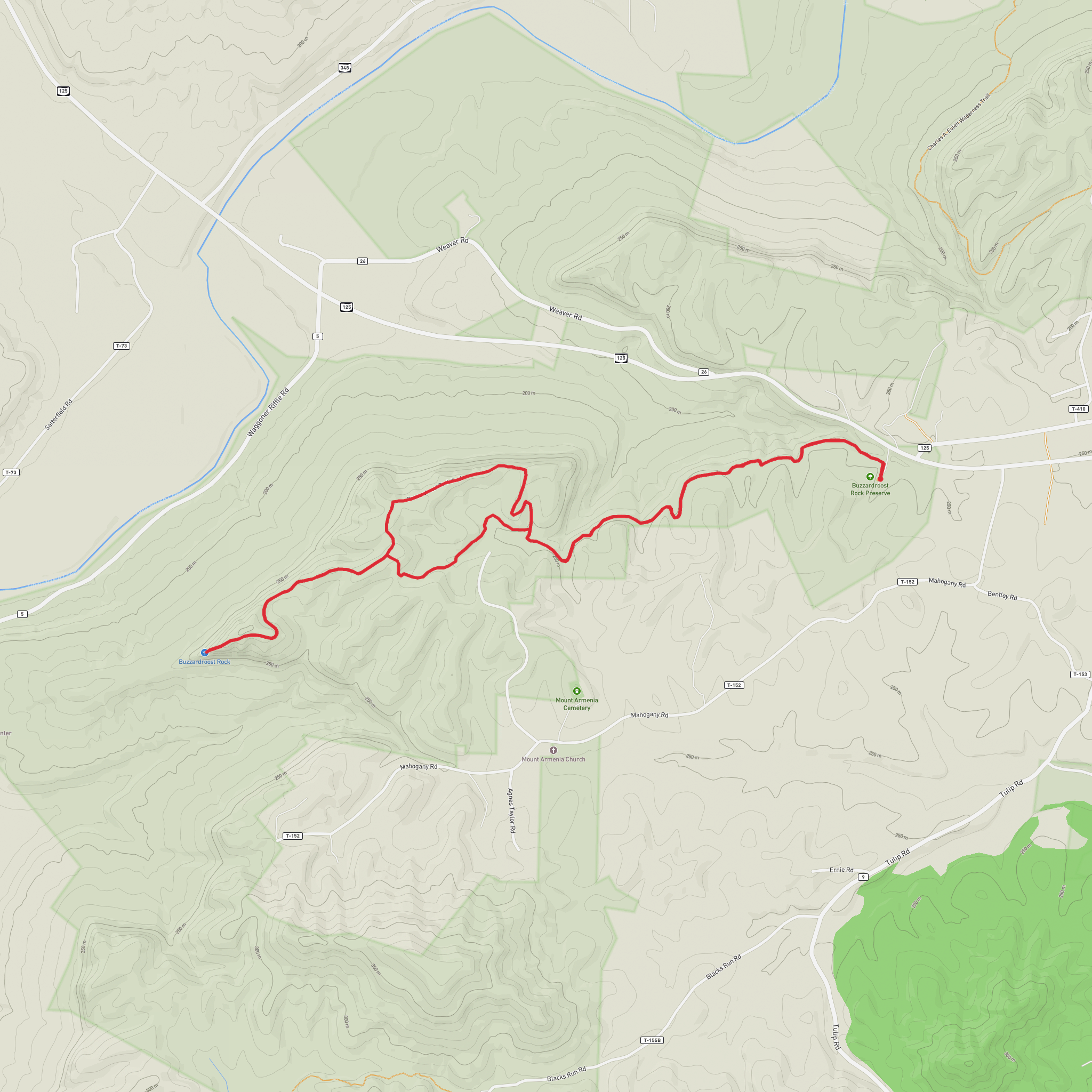
You’ll start from the Edge of Appalachia Preserve System in Adams County, Ohio, in the hills southeast of West Union and near the tiny community of Lynx. The walk to Buzzardroost Rock is a steady, low-stress outing—about 7 km / 4.4 mi round trip with roughly 100 m / 330 ft of total climbing—finishing at one of the most dramatic overlooks in the region, perched high above Ohio Brush Creek. (nature.org)
Getting to the trailhead (car + public transport reality check)
By car: The most reliable “pin” to aim for is the signed Buzzardroost Rock parking access off OH-125 near Lynx. A commonly used navigation address is 16300 OH-125, West Union, OH 45693 (this gets you to the correct stretch of road; look for preserve signage and the gravel parking pull-offs). (trekohio.com)
By public transport: There isn’t practical public transit to the preserve/trailhead. The closest services are in larger towns/cities well outside the preserve area, so plan on a car (or rideshare) for the final leg.
Parking is in gravel lots; expect limited capacity on fair-weather weekends. Cell service can be inconsistent—download your route in HiiKER before you arrive.
What the trail feels like underfoot (and why it’s interesting)
This hike is famous for how quickly it moves through distinct habitats and rock layers. The preserve sits at the “edge” where Midwestern and Appalachian influences overlap, and the trail crosses multiple geologic strata—conditions that help create noticeably different forest types and microclimates over a short distance. (nature.org)
From the parking area, you’ll settle into a woodland path that gently gains elevation overall, with a few short dips and rises that keep it from feeling like a treadmill climb. Even though the net elevation gain is modest, the tread can vary with the season: - After rain: expect slick leaf litter, soft spots, and muddy patches in low areas. - Late summer: some sections can feel warm and still under the canopy; carry water even for an “easy” distance. - Autumn: leaves can hide roots and embedded rocks—watch foot placement.
Approximate mile-by-mile / km-by-km breakdown
0.0–1.5 km (0.0–0.9 mi): Easy walking as the trail eases you into mixed hardwood forest. You’ll notice the terrain subtly changing as you move between slope positions—drier ridges vs. slightly moister hollows.
1.5–2.8 km (0.9–1.7 mi): The path trends upward more consistently. This is where you’ll start to feel the “edge of Appalachia” character—oak-dominated woods in places, with pockets that can look and feel different depending on soil and rock beneath you. (nature.org)
2.8–3.5 km (1.7–2.2 mi): Nearing the destination, the trail approaches the overlook area. The final approach is designed to manage both safety and resource protection: you’ll typically transition onto a boardwalk and stair system near the rock, which helps keep people back from fragile edge habitat and away from hazardous fissures/ledges. (footpathsblog.com)
Turnaround at ~3.5 km / 2.2 mi: Buzzardroost Rock overlook.
Then return the same way for a total of about 7 km / 4.4 mi. (nature.org)
The overlook: Buzzardroost Rock
Buzzardroost Rock stands out as a prominent limestone/dolomite outcrop rising dramatically above Ohio Brush Creek, with a wide, open view over the forested valley. It’s the kind of viewpoint that feels “big” compared to the gentle effort it takes to reach it. (nature.org)
Safety notes at the rock: - Stay on the built surfaces and designated viewing areas—edges can be undercut, and cracks can be hidden by vegetation
Surfaces
Ground
Unknown
Wood
Comments and Reviews
User comments, reviews and discussions about the Buzzardroost Rock via Buzzardroost Rock Trail, Ohio.
average rating out of 5
0 rating(s)
