Download
3D Preview
Add to list
More
364.8 km
~14 days
5435 m
Multi-Day
“Trek the historic Canol Heritage Trail, where wild beauty meets the echoes of World War II engineering.”
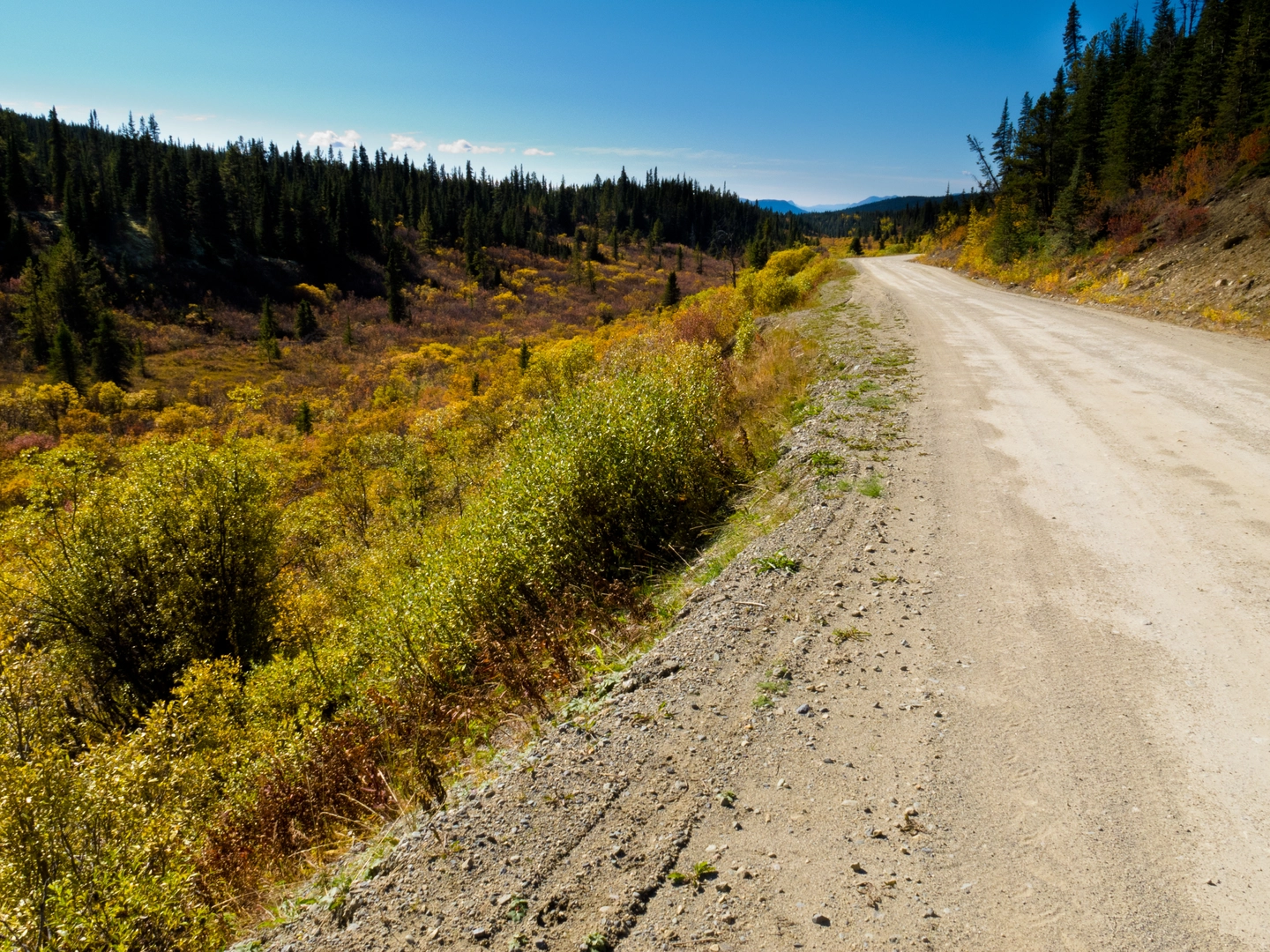
Embarking on the Canol Heritage Trail is a journey through both stunning wilderness and history. This remote and challenging trek spans approximately 365 kilometers (227 miles), with an elevation gain of around 5400 meters (17,716 feet), traversing the rugged landscapes of the Northwest Territories. The trailhead is situated near Norman Wells in the Sahtu Region, accessible by air or by driving the Mackenzie Valley Winter Road when conditions permit.
Getting to the Trailhead
To reach the starting point of the Canol Heritage Trail, most hikers fly into Norman Wells, which has regular flights from Yellowknife. From Norman Wells, you can charter a flight to the trailhead or arrange for a local outfitter to transport you. If you're driving, the trailhead is accessible via the Mackenzie Valley Winter Road, which is only open during the colder months when the ground is frozen.
Historical Significance
The Canol Heritage Trail follows the route of the Canol (Canadian Oil) pipeline, which was constructed during World War II to transport oil from Norman Wells to Whitehorse in Yukon. The pipeline was an extraordinary engineering feat but was only in operation for a short time. Today, hikers can see remnants of the pipeline, old pump stations, and other historical artifacts along the trail, offering a glimpse into the past and the immense effort of the Canol Project.
Navigating the Trail
Hikers should be well-prepared with topographical maps and GPS devices. HiiKER is an excellent tool for planning your route, tracking your progress, and ensuring you stay on the correct path. The trail is not well-marked, and navigation can be challenging, especially in adverse weather conditions.
Terrain and Wildlife
The trail traverses a variety of terrains, including boreal forests, alpine tundra, and river valleys. You'll cross numerous streams and rivers, which can range from small brooks to wide, swift-moving waters, particularly during the spring melt. Be prepared for river crossings and ensure you have the necessary skills and equipment.
Wildlife is abundant in the area, with chances to see caribou, grizzly bears, wolves, and a variety of bird species. It's essential to practice bear safety, including carrying bear spray and knowing how to store food properly.
Landmarks and Points of Interest
- Mile 0: The trail begins near Norman Wells, where you'll find the remnants of the Canol Project's infrastructure.
- Twitya River: Approximately 45 kilometers (28 miles) into the hike, you'll encounter the Twitya River, a significant crossing that may require a raft or good timing to ford safely.
- Godlin Lakes: At around the halfway point, the Godlin Lakes offer a scenic respite, with opportunities for fishing and wildlife viewing.
- The Mackenzie Mountains: As you approach the final third of the trail, the Mackenzie Mountains provide a dramatic backdrop and challenging terrain with steep ascents and descents.
Climate and Best Time to Hike
The best time to hike the Canol Heritage Trail is from June to September when the weather is milder, and the days are long. However, even in summer, the weather can be unpredictable, with the possibility of snow, rain, and cold temperatures. Be prepared for all conditions and pack accordingly.
Preparation and Safety
Due to the trail's remoteness and difficulty, it's crucial to be self-sufficient and well-prepared. This includes bringing enough food and supplies for the entire trek, as there are no resupply points along the way. Emergency evacuation can be difficult and expensive, so consider carrying a satellite phone or emergency beacon.
The Canol Heritage Trail offers an unparalleled adventure for experienced hikers seeking solitude, natural beauty, and a touch of history. With careful planning and respect for the rugged environment, it can be a profoundly rewarding experience.

What to expect?
Activity types
Frequently asked questions
How long does it take to hike the Canol Heritage Trail in the Northwest Territories?
The Canol Heritage Trail is about 364.83 km long, so it is usually treated as a serious multi-day expedition rather than a short backpacking trip. Most hikers plan for several weeks on route because the trail is remote, includes off-trail navigation in washed-out sections, and has major river crossings along the way.
Where does the Canol Heritage Trail start, and how do hikers reach the trailhead from Norman Wells?
The Canol Heritage Trail starts at Norman Wells in the Sahtu Region, with the route beginning across the Mackenzie River from town. Norman Wells is the main access point, and the trail can be approached by hiking in, by river boat or paddling, or by air; there is no road access into the park from the Northwest Territories side.
Are there dangerous river crossings on the Canol Heritage Trail?
Yes. The Canol Heritage Trail has four major river crossings, and NWT Parks advises carrying a pack raft for crossings at about Miles 25, 50, 129/131, and 173. Wildlife encounters are also common, so river safety is only one part of the challenge on this route.
Can you camp on the Canol Heritage Trail, and do you need reservations?
Backcountry camping is allowed on the Canol Heritage Trail, and reservations are not required. This is a remote route with no regular services, so camping is typically fully self-supported, with some hikers arranging food drops to locations such as the airstrips at Miles 108, 170, and 222.
What is the best time of year to hike the Canol Heritage Trail?
The main hiking season for the Canol Heritage Trail runs from May 10 to September 30. Summer and early fall are the practical hiking months, but conditions stay demanding: swampy sections, washouts, and very heavy mosquitoes, black flies, and gnats are all specifically noted along the route.
What makes the Canol Heritage Trail historically significant?
The Canol Heritage Trail follows the route of the World War II Canol pipeline and service road built to move oil from Norman Wells toward Whitehorse. Hikers still pass historic remnants including the former Pump Station No. 1 area near Miles 0 to 1, Camp Canol at Mile 8, and scattered abandoned equipment and buildings farther along the trail.
Is the Canol Heritage Trail difficult, even though it is rated medium?
Yes. Even with a medium rating, the Canol Heritage Trail is widely described as one of North America’s toughest backcountry hikes because it combines roughly 364.83 km of travel with 5,435 m of elevation gain, no cell service, frequent wildlife encounters, river crossings, and sections where the route disappears into overgrowth or washouts.
Comments and Reviews
User comments, reviews and discussions about the Canol Heritage Trail, Northwest Territories.
5.0
average rating out of 5
5 rating(s)