
Download
3D Flyover
Add to list
More
1005.0 km
46 days
14431 m
Multi Day
“Explore Northern Ireland's splendor on the Ulster Way, a tapestry of landscapes and history.”
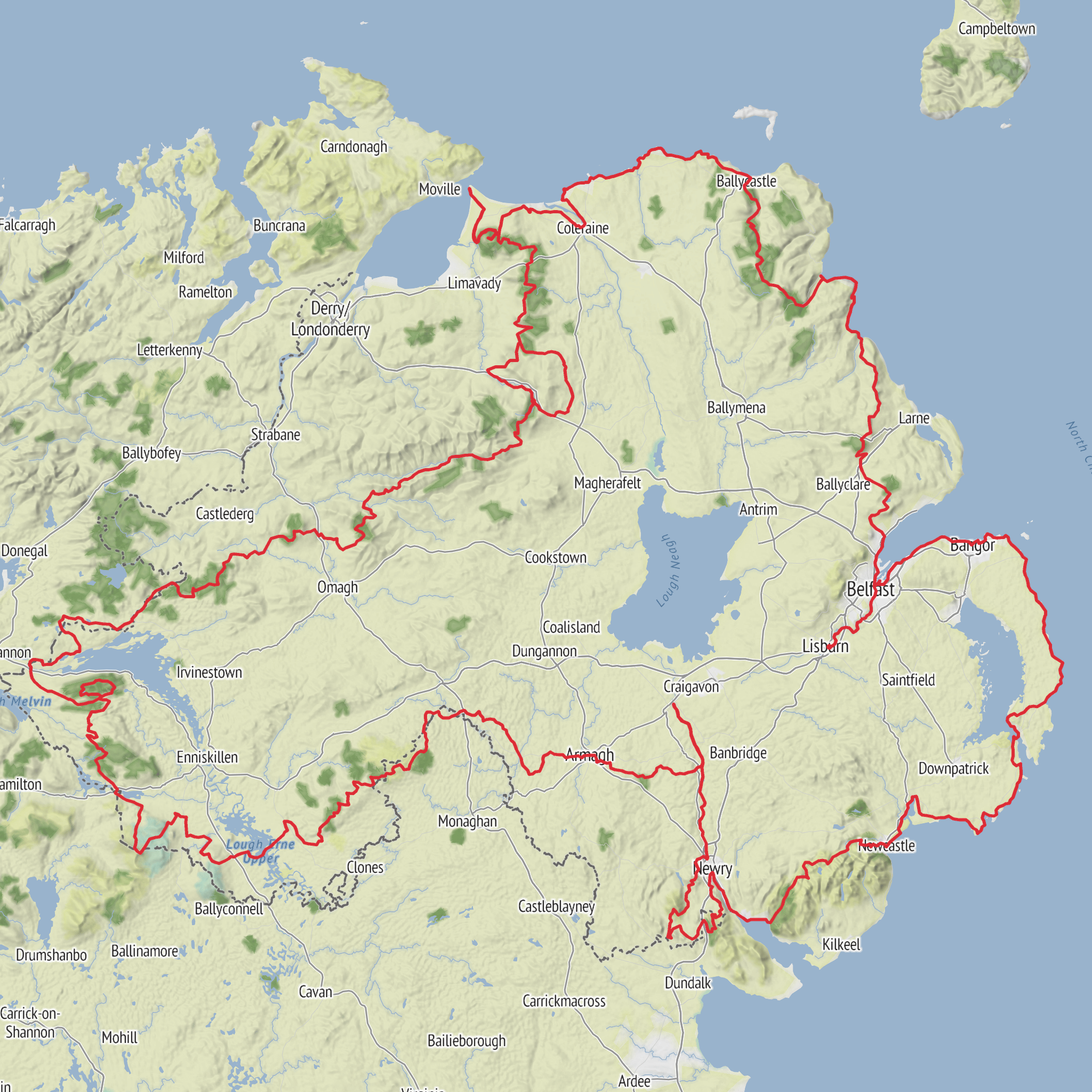
Embarking on the Ulster Way offers an unparalleled journey through the diverse landscapes of Northern Ireland, stretching approximately 1000 kilometers (about 621 miles) with an elevation gain of around 14,500 meters (approximately 47,560 feet). This point-to-point trail begins near County Antrim, a region steeped in history and natural beauty.
Getting There
To reach the trailhead, travelers can make their way to County Antrim, accessible by both public transport and car. If you're using public transport, Belfast serves as a convenient hub. From Belfast, you can take a train or bus to Antrim town, which is well-connected and offers a gateway to the start of the trail. For those driving, the M2 motorway provides a direct route from Belfast to Antrim, with ample parking options available in the town.
Trail Highlights and Landmarks
The Ulster Way meanders through a tapestry of landscapes, from rugged coastlines to serene forests and rolling hills. As you traverse this extensive trail, you'll encounter a variety of significant landmarks and natural wonders.
Giant's Causeway: One of the most iconic sites along the trail, the Giant's Causeway is a UNESCO World Heritage Site renowned for its unique basalt column formations. Located along the northern coast, this geological marvel is steeped in myth and legend, offering a glimpse into the region's volcanic past.
Mourne Mountains: As you venture further, the trail leads you through the Mourne Mountains, a range known for its stunning vistas and diverse wildlife. The highest peak, Slieve Donard, stands at 850 meters (2,789 feet) and provides breathtaking views of the surrounding countryside.
Fermanagh Lakelands: The trail also winds through the Fermanagh Lakelands, a picturesque area dotted with tranquil lakes and lush greenery. This region is perfect for birdwatching, with a variety of species inhabiting the wetlands.
Historical Significance
Northern Ireland's rich history is woven into the fabric of the Ulster Way. As you hike, you'll pass through areas that have witnessed significant historical events and cultural shifts. The trail takes you near ancient castles, such as Dunluce Castle, perched dramatically on a cliff edge, and the historic city of Derry/Londonderry, with its well-preserved 17th-century walls.
Navigation and Safety
Given the trail's extensive length and varied terrain, it's essential to be well-prepared. While the Ulster Way is estimated to be of easy difficulty, hikers should still equip themselves with reliable navigation tools. The HiiKER app is an excellent resource for detailed maps and real-time trail updates, ensuring you stay on course throughout your journey.
Flora and Fauna
The Ulster Way is a haven for nature enthusiasts, offering a chance to observe a wide array of flora and fauna. The trail's diverse ecosystems support everything from ancient oak woodlands to vibrant wildflower meadows. Wildlife sightings may include red deer, badgers, and a variety of bird species, making each step a new opportunity for discovery.
Whether you're drawn by the promise of stunning landscapes, historical intrigue, or the simple joy of walking, the Ulster Way provides an unforgettable hiking experience through one of the most captivating regions of the British Isles.
AI Planner
Days planned around your pace, with somewhere to stay each night.
Surfaces
Unknown
Asphalt
Concrete
Sand
Ground
Gravel
Paved
Unpaved
Cobblestone
Comments and Reviews
User comments, reviews and discussions about the Ulster Way, Northern Ireland.
5.0
average rating out of 5
4 rating(s)



