Download
3D Flyover
Add to list
More
6.6 km
~1 hrs 46 min
266 m
Loop
“Embark on the White Oak Mountain Loop for a 7 km scenic hike rich in natural beauty and history.”
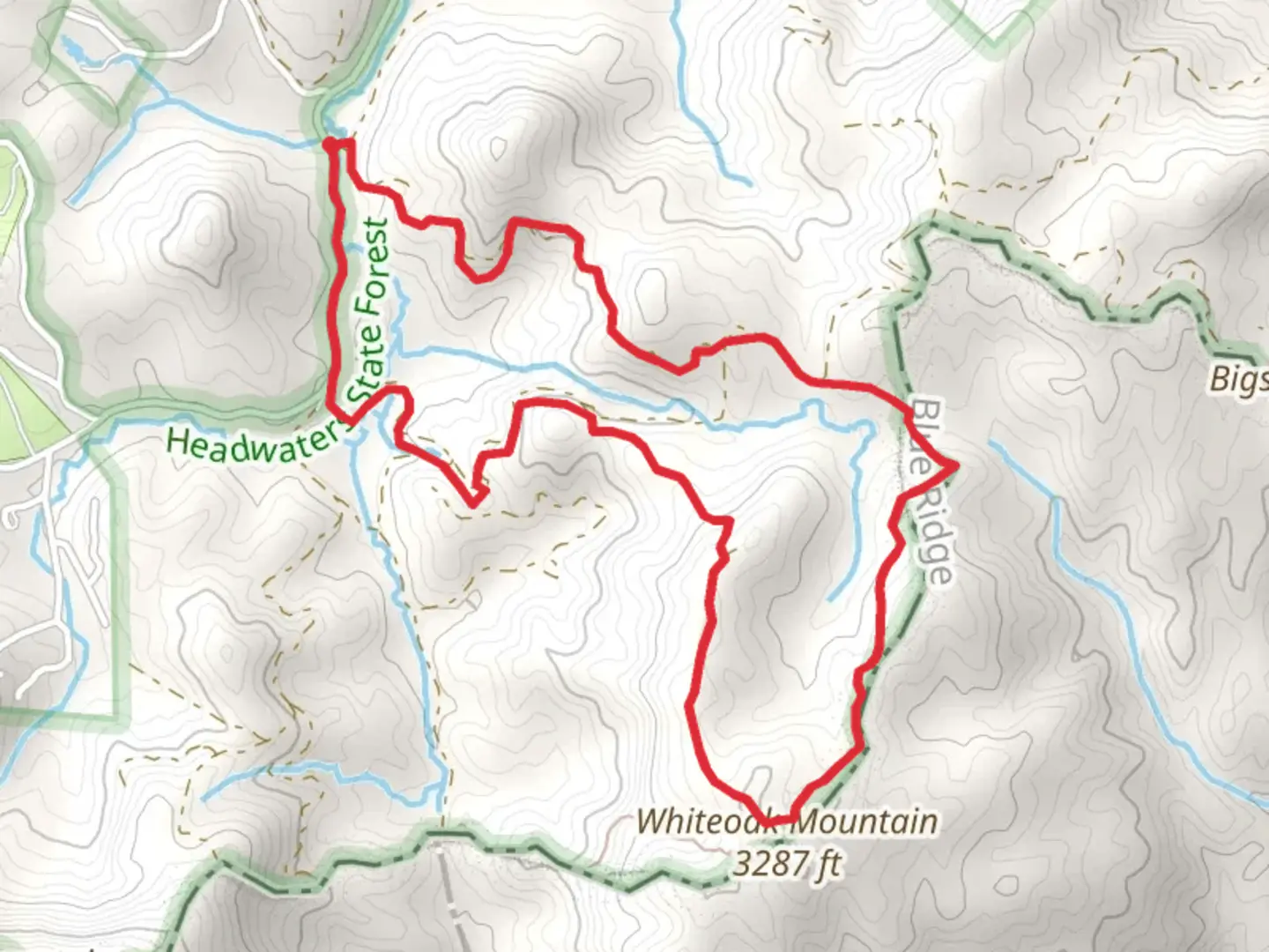
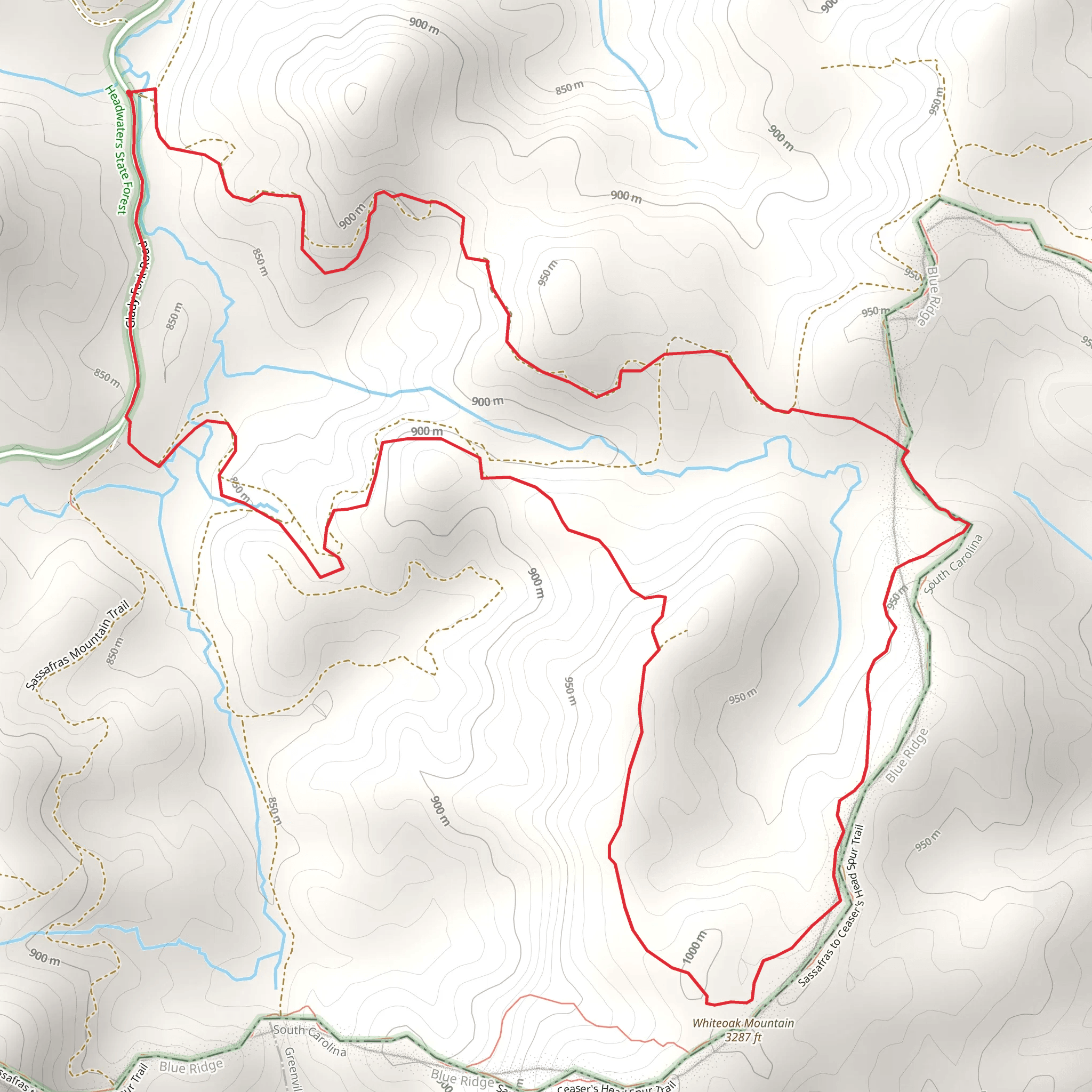
Starting your adventure near Transylvania County, North Carolina, the White Oak Mountain Loop is a captivating 7 km (approximately 4.3 miles) trail with an elevation gain of around 200 meters (656 feet). This loop trail is rated as medium difficulty, making it suitable for moderately experienced hikers.
Getting There
To reach the trailhead, you can drive or use public transport. If driving, head towards the Pisgah National Forest, with the nearest significant landmark being the Pisgah Center for Wildlife Education. For those using public transport, the nearest bus stop is in Brevard, North Carolina. From Brevard, you can take a taxi or rideshare service to the trailhead.
Trail Overview
The trailhead is easily accessible and well-marked. As you begin your hike, you'll find yourself surrounded by lush forests, typical of the Pisgah National Forest. The initial section of the trail is relatively flat, allowing you to ease into the hike.
Flora and Fauna
The White Oak Mountain Loop is rich in biodiversity. Keep an eye out for native plant species such as rhododendrons, mountain laurels, and various types of ferns. Wildlife is abundant, and you may encounter white-tailed deer, wild turkeys, and a variety of bird species. The area is also known for its black bear population, so be sure to follow bear safety guidelines.
Significant Landmarks
At approximately 2 km (1.2 miles) into the hike, you'll come across a small, serene waterfall. This is a great spot to take a break and enjoy the natural beauty. Continuing on, the trail begins to ascend more steeply, gaining about 100 meters (328 feet) in elevation over the next 1.5 km (0.9 miles). This section offers stunning views of the surrounding mountains and valleys.
Historical Significance
The region around White Oak Mountain has a rich history. It was once inhabited by the Cherokee people before European settlers arrived. During the hike, you may notice old stone walls and remnants of early 19th-century homesteads, offering a glimpse into the area's past.
Navigation and Safety
The trail is well-marked, but it's always a good idea to have a reliable navigation tool. HiiKER is an excellent app for this purpose, providing detailed maps and real-time tracking. Make sure to carry enough water, snacks, and a first-aid kit. Weather can change rapidly in the mountains, so pack layers and be prepared for sudden rain.
Final Stretch
As you near the end of the loop, the trail descends gradually, leading you back through dense forest. The final 2 km (1.2 miles) are relatively easy, allowing you to cool down and reflect on the hike. The loop brings you back to the starting point, completing a rewarding and scenic journey through one of North Carolina's beautiful natural areas.
What to expect?
Activity types
Comments and Reviews
User comments, reviews and discussions about the White Oak Mountain Loop, North Carolina.
4.48
average rating out of 5
21 rating(s)
