
Download
3D Flyover
Add to list
More
13.4 km
~4 hrs 1 min
816 m
Out and Back
“The Wildcat Rock Trail to Bearwallow Mountain offers a scenic, moderately challenging 13 km hike with stunning vistas.”
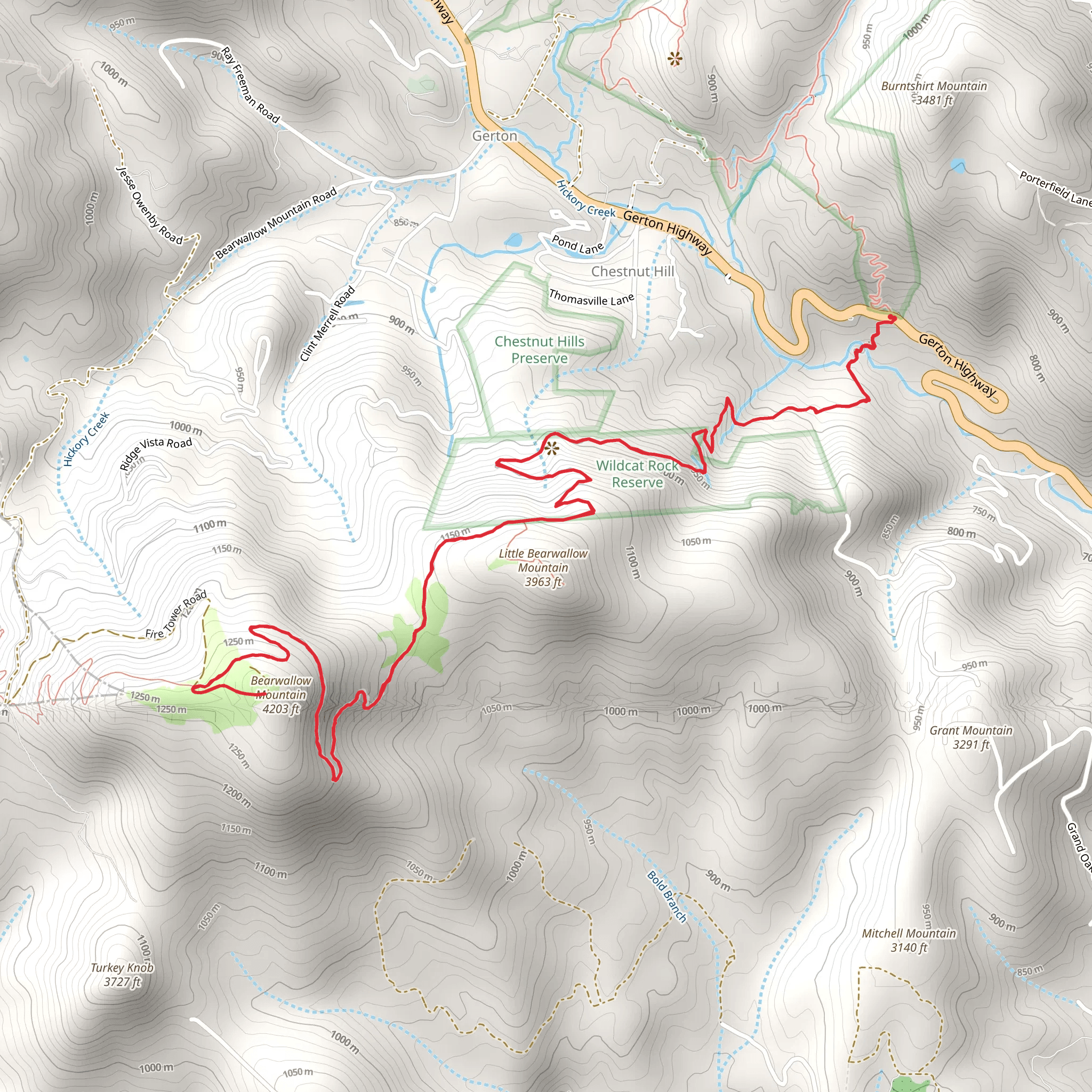
Starting near Henderson County, North Carolina, the Wildcat Rock Trail to Bearwallow Mountain offers a rewarding out-and-back hike that spans approximately 13 kilometers (8 miles) with an elevation gain of around 800 meters (2,625 feet). This trail is rated as medium difficulty, making it suitable for moderately experienced hikers.
Getting There
To reach the trailhead, you can drive or use public transportation. If driving, head towards the Upper Hickory Nut Gorge Trailhead, located near Gerton, NC. For those using public transport, the nearest major city is Asheville, NC. From Asheville, you can take a bus to Gerton and then a short taxi ride to the trailhead.
Trail Overview
The trail begins with a steady ascent through a lush forest, rich with native flora such as rhododendrons and mountain laurels. The first significant landmark you'll encounter is Little Bearwallow Falls, approximately 2 kilometers (1.2 miles) into the hike. This 100-foot waterfall is a great spot for a short break and some photos.
Wildcat Rock
Continuing on, the trail becomes steeper as you approach Wildcat Rock, located about 4 kilometers (2.5 miles) from the start. This rock formation offers panoramic views of the Hickory Nut Gorge and the surrounding Blue Ridge Mountains. The elevation gain to this point is roughly 400 meters (1,312 feet), so be prepared for a bit of a workout.
Flora and Fauna
As you hike, keep an eye out for local wildlife, including white-tailed deer, black bears, and a variety of bird species such as the Carolina chickadee and the red-tailed hawk. The trail is also home to diverse plant life, including ferns, wildflowers, and towering hardwoods.
Bearwallow Mountain
The final stretch to Bearwallow Mountain is another 2.5 kilometers (1.5 miles) from Wildcat Rock, with an additional elevation gain of about 400 meters (1,312 feet). The summit of Bearwallow Mountain is a grassy bald, offering 360-degree views that are particularly stunning at sunrise or sunset. On a clear day, you can see as far as Mount Mitchell, the highest peak east of the Mississippi River.
Historical Significance
The region around Bearwallow Mountain has a rich history, including its use by Native American tribes and early European settlers. The mountain itself was named for the numerous black bears that once roamed the area and the "wallows" they created.
Navigation and Safety
For navigation, it's highly recommended to use the HiiKER app, which provides detailed maps and real-time updates. Always carry enough water, snacks, and a first-aid kit. Weather can change rapidly in the mountains, so bring layers and be prepared for sudden shifts in temperature.
Return Journey
The return journey follows the same path back to the trailhead, offering another chance to enjoy the scenic beauty and perhaps spot some wildlife you missed on the way up.
What to expect?
Activity types
Comments and Reviews
User comments, reviews and discussions about the Wildcat Rock Trail to Bearwallow Mountain, North Carolina.
4.46
average rating out of 5
13 rating(s)
