Download
3D Flyover
Add to list
More
1.2 km
~16 min
21 m
Out and Back
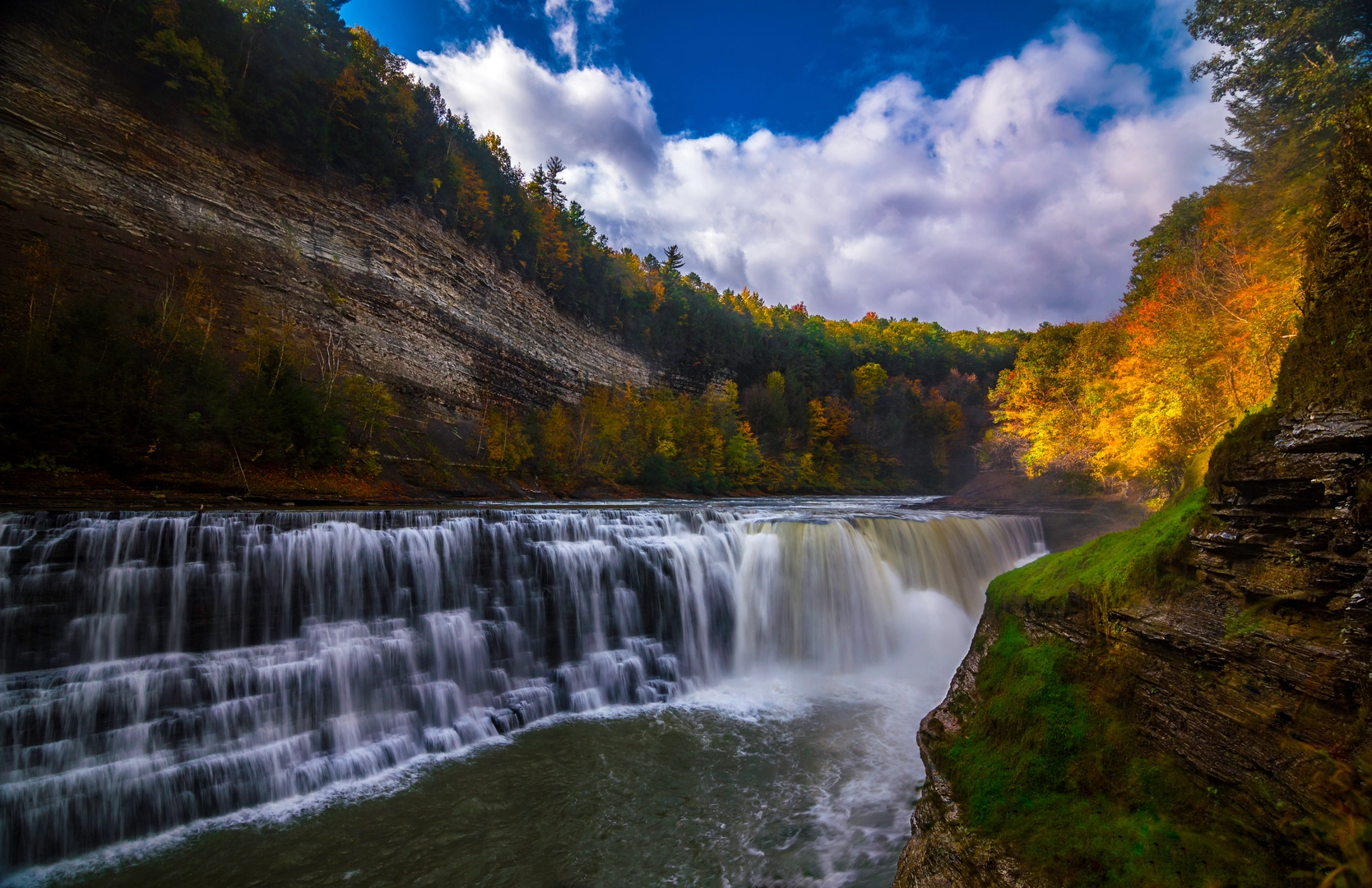
“A gentle, mostly level forest stroll ends at a footbridge, where the waterfall steals the show.”
This is a short, mostly flat out-and-back walk (about 1 km / 0.6 mi total with ~0 m / 0 ft of climbing) that leads to a footbridge viewpoint of a lower waterfall. It’s ideal if you want moving water, forest shade, and an easy stroll that still feels like you “went somewhere.”
Getting to the trailhead (car + public transport)
You didn’t include coordinates or a specific “near …” location, so I can’t convert a lon/lat to the nearest address or landmark yet. If you share the trailhead coordinates (or the park name), I’ll pin it to the closest recognized address/parking area and tailor directions precisely.
By car (general approach): - Most “Lower Falls Footbridge” walks start from a signed day-use parking area near a main park road. Look for posted signs for Lower Falls, Footbridge, or Day Use / Picnic Area. - Arrive early on weekends—short waterfall walks often fill parking quickly, and overflow parking can add extra walking distance.
By public transport (general approach): - If the falls are inside a state/national park, public transit is often limited. The most common workable plan is: transit to the nearest town/visitor hub, then rideshare/taxi to the day-use lot. - If you tell me the region (state + park), I can suggest the most realistic transit stop and last-mile options.
What the hike is like underfoot
Expect a well-defined, family-friendly path with minimal elevation change. Surfaces vary by location, but waterfall footbridge trails are commonly: - Packed dirt or fine gravel with occasional roots - Short boardwalk segments in wetter areas - Slick spots near spray zones and shaded rock
Even with “0 m” listed, you may still have tiny rollers—think a few feet of up/down around drainage dips or bridge approaches.
Landmarks and what to watch for
The main landmark is the footbridge itself—usually positioned to give a safe, centered view of the falls and the plunge pool or cascades below. Along the way, you’ll often notice: - Riverbank vegetation (mosses, ferns, and moisture-loving shrubs) - Erosion control features like edging, steps, or railings near the bridge - Side paths that look tempting but can lead to unstable banks—stick to the maintained tread, especially near water
If there are any spur viewpoints, they’re typically within 0.1–0.2 km (0.06–0.12 mi) of the bridge and may be narrower or closer to drop-offs.
Navigation (keep it simple)
This is usually straightforward, but it’s still worth downloading the route on HiiKER before you go—especially if the area has multiple short connectors (picnic loops, river walks, interpretive spurs) that can make a “1 km” outing accidentally longer.
Nature and wildlife you might encounter
Waterfall corridors concentrate life. Depending on your region, common sightings include: - Songbirds and woodpeckers in the riparian trees - Amphibians (frogs/salamanders) in damp leaf litter near the creek - Insects near still water—bring repellent in warm months - Larger mammals are often present but not seen; you’ll more likely notice tracks or scat near muddy edges
Keep food secured and give wildlife space. If this is bear country, follow local food-storage guidance even on short walks.
Safety and conditions (small hike, real hazards)
Most incidents on easy waterfall walks come from the same few issues: - Slippery rock and wet wood: bridge decking, stone steps, and spray zones can be slick year-round. - High water after rain/snowmelt: the falls may be more dramatic, but banks can undercut and trails can puddle. - Cold-water risk: even in warm weather, plunge pools and fast current can be dangerously cold. - Crowds: narrow bridge approaches can bottleneck—be patient and pass carefully.
Footwear: light hikers or trail runners with decent grip are usually enough; avoid smooth-soled casual shoes if the route is damp.
Historical significance (how to make this accurate)
“Lower Falls” sites are often within protected lands shaped by logging, milling, early tourism, or Indigenous travel corridors, but the specifics vary widely by location. If you share the park/region (or coordinates), I can include the correct local history—such as whether the area was part of a historic timber route, an early scenic railway stop, a CCC-era park project, or a named Indigenous homeland and traditional use area—without guessing.
If you send either:
1) the trailhead coordinates, or
2) the park name + state,
I’ll convert the location to the nearest recognized address/landmark, tighten the distance breakdown (e.g., “0.5 km / 0.3 mi to the bridge”), and tailor wildlife/seasonal notes to that exact place.

Surfaces
Ground
Unknown
Cobblestone
Comments and Reviews
User comments, reviews and discussions about the Lower Falls via Lower Falls Footbridge Trail, New York.
average rating out of 5
0 rating(s)