
Download
3D Flyover
Add to list
More
25.9 km
~5 hrs 22 min
111 m
Loop
“A gentle, water-laced Adirondack wander to High Falls—muddy, rooty, and quietly rewarding.”
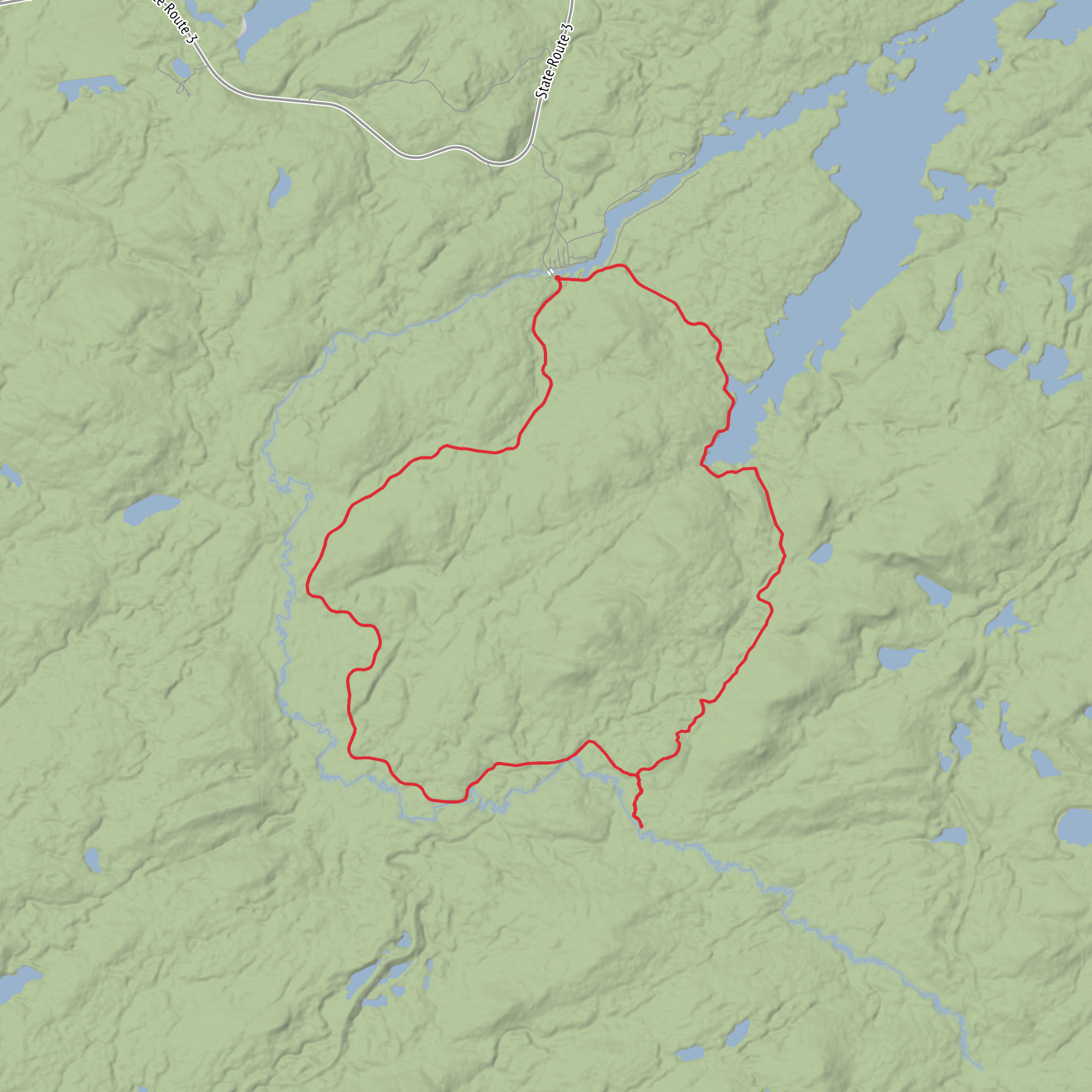
This is a long, low-gradient out-and-back style day hike (or relaxed overnight) through classic Adirondack lowlands: wide, mostly gentle trail grades, lots of water features, and a big payoff at High Falls. At roughly 26 km / 16.2 mi with about 100 m / 330 ft of total climbing, it’s more about steady forward progress than steep effort—expect a few slow sections where wet ground and roots dictate pace.
Getting to the trailhead (car + public transport options)
Because the hike start is listed only as “near” (no coordinates or town provided), I can’t reliably convert the start point to a specific nearest address/landmark yet. If you share a lon/lat (even just one point) or the parking area name shown in HiiKER, I can pin it to the nearest known road/lot and give turn-by-turn style guidance.
In the meantime, here’s how these Adirondack trailheads are typically accessed:
- By car: Most trailheads for routes like Dead Creek Flow / New Plains are reached via a signed DEC trailhead parking area off a two-lane Adirondack highway or well-maintained gravel road. Arrive early on weekends/holidays—parking can fill, and roadside parking is often restricted.
- By public transport: Public transit is limited in the central Adirondacks. The most workable approach is usually:
- Intercity bus/train to a hub town (commonly places like Lake Placid / Saranac Lake / Tupper Lake / Keene Valley depending on the region), then
- Taxi/rideshare (often scarce) or a pre-booked shuttle to the trailhead.
If you tell me the nearest town or provide coordinates, I’ll tailor this to the exact route and the closest realistic transit hub.
What the route feels like underfoot
With only ~100 m / 330 ft of gain over 26 km / 16.2 mi, the trail profile is gentle. The tradeoff is that Adirondack “easy” often means wet, rooty, and muddy rather than steep.
- Trail surface: Expect a mix of packed dirt, roots, and short rocky patches. In low areas you may see bog bridging / puncheon (wooden planks) or stepping stones, but you should still plan for mud.
- Wet footing: “Dead Creek Flow” strongly suggests beaver-influenced wetlands or a broad, slow-water area. These zones can flood trails seasonally, and detours may form.
- Pace planning: Many hikers average 3–4 km/h (1.9–2.5 mph) on smooth ground, but wet sections can drop that. A realistic moving time for most groups is 6.5–9 hours, plus breaks.
Landmarks, scenery, and the “why it’s worth it”
You’ll spend much of the day in mixed northern forest—think spruce/fir pockets in cooler, wetter spots and hardwoods (maple, birch, beech) where the ground rises and drains better. The route’s character is shaped by water:
- Dead Creek Flow area: Look for open water views, drowned timber, and the telltale signs of beaver activity (freshly cut sticks, dam structures, and flooded margins). These flows are often excellent for birdlife.
- New Plains corridor: “Plains” in Adirondack naming often points to flatter terrain—expect long, steady stretches where the trail threads between wetland edges and slightly higher forest.
- High Falls: The destination is typically a dramatic cascade where water drops through a constricted channel. The best viewpoints are often on rock slabs or ledges—beautiful, but they can be slick even in dry weather.
Wildlife you’re likely to notice
This is prime habitat for animals that like water and edge environments: - Beaver (most likely sign), plus river otter in healthier waterways. - Moose are possible in Adirondack wetland complexes—more often you’ll see tracks or browse than the animal itself. - Black bear are present across the region; encounters are uncommon but possible. - Birdlife: loons (on larger waters), herons, kingfishers, and a variety of warblers in season.
Carry binoculars if you like wildlife—wetland edges can be surprisingly active.
Navigation and on-trail decision points
Even on “easy” terrain, Adirondack junctions can be confusing when: - side paths form around mud, - old logging traces resemble trail, - water levels force reroutes.
Use HiiKER to: - confirm you’re on the intended line when the treadway braids, - identify upcoming junctions (especially where Dead Creek Flow Trail meets New Plains Trail), - keep an eye on distance remaining so you don’t underestimate the return leg.
Cell service can be unreliable; download your HiiKER map for offline use before you arrive.
Hazards and what to look out for
- High water & flooding: After heavy rain or spring melt, low sections can become ankle- to calf-deep. Waterproof footwear helps, but quick-drying trail runners can be better than boots if you expect repeated wet crossings.
- Slippery rock near the falls: Mist and algae make rock slabs slick. Keep a buffer from edges, especially if you’re taking photos.
- Biting insects: From late spring through summer, expect black flies and mosquitoes, especially near flowages and slow water. Head net + repellent can be the difference between pleasant and miserable.
- Ticks: Increasingly common in parts of the Northeast—do a full check after the hike.
AI Planner
Days planned around your pace, with somewhere to stay each night.
Surfaces
Unknown
Dirt
Comments and Reviews
User comments, reviews and discussions about the High Falls via Dead Creek Flow Trail and New Plains Trail, New York.
average rating out of 5
0 rating(s)
