Download
3D Flyover
Add to list
More
1.2 km
~21 min
76 m
Out and Back
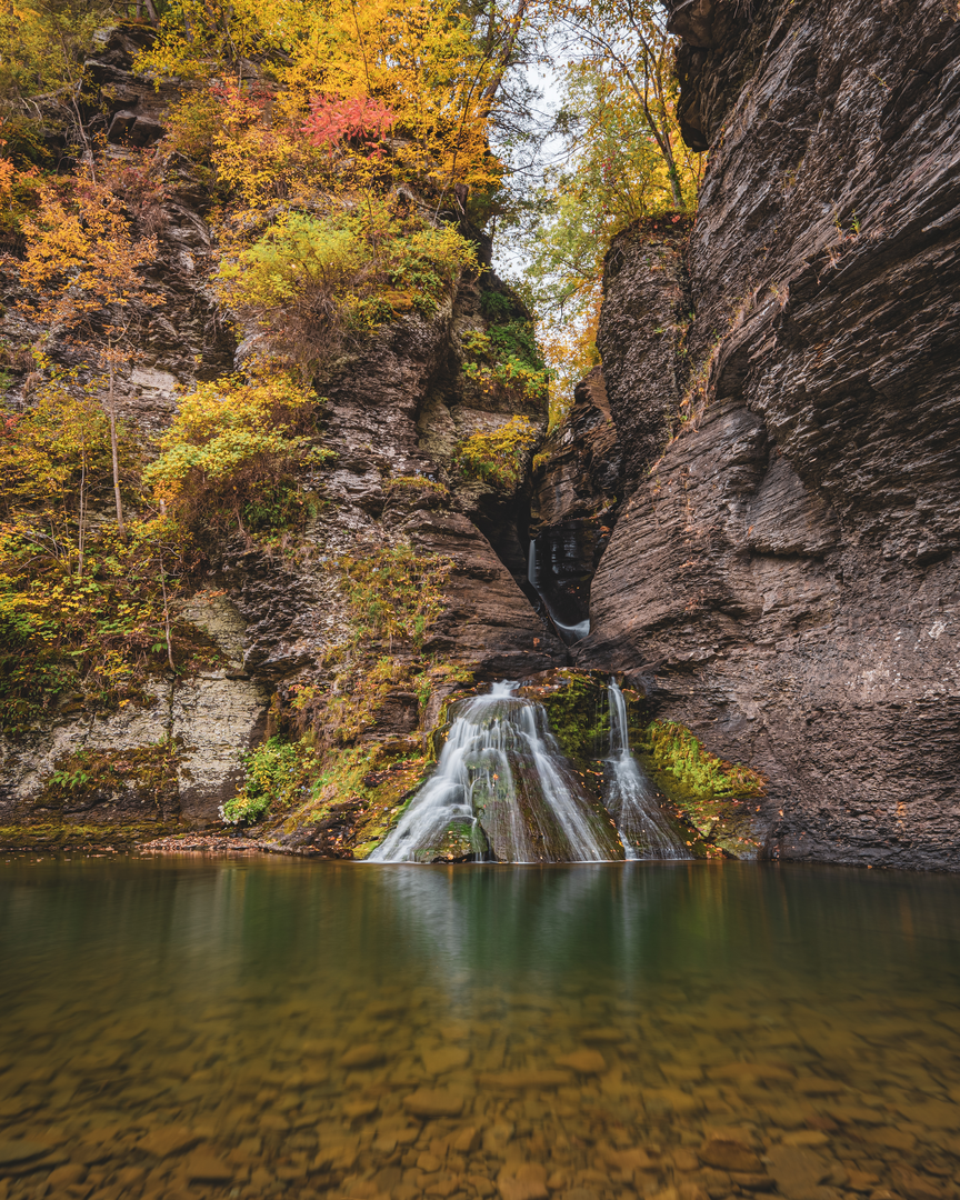
“A short, steep dash to thundering falls—mist-cooled forest, slick steps, and careful footing.”
This is a short, steep waterfall walk that packs a lot into about 1 km (0.6 mi), with roughly 100 m (330 ft) of climbing and descending. Expect a quick transition from easy park paths to slick rock, wet steps, and spray near the falls—conditions that can make a “short” hike feel legitimately difficult, especially after rain, during spring runoff, or when there’s leaf cover on the ground.
Getting to the trailhead (car + public transport)
By car:
Mine Kill State Park is in the northern Catskills region near the Village of North Blenheim / Gilboa, NY. The most reliable “aim point” for navigation is the park’s main entrance area on Mine Kill Road (NY-165), near the Mine Kill State Park parking areas and picnic/day-use facilities. If you’re using HiiKER for routing, look for the park access off NY-165 and choose the closest parking to the falls/Long Path connection.
By public transport:
There isn’t a convenient, frequent public transit stop right at Mine Kill State Park. The closest practical approach is usually:
- Bus or train to the Albany–Schenectady–Rensselaer area, then
- A rental car or rideshare for the final rural leg to the park (service can be limited and expensive in the Catskills).
If you’re committed to car-free, plan on a pre-arranged ride from a nearby town (often Schoharie County communities) and build in extra time—cell coverage can be patchy.
What the route feels like underfoot
Even though the distance is only about 1 km (0.6 mi), the elevation change is concentrated. You’ll likely encounter: - Packed dirt and gravel near the day-use areas - Stone steps / uneven rock as you approach the gorge - Wet, algae-slick surfaces close to the falls and along shaded sections - Short pitches that feel like stair-climbing, especially on the return
Plan for this to be a “hands-ready” walk in places—trekking poles can help, but keep one hand free for railings where provided.
The hike: waterfalls, gorge edges, and the Long Path connection
From the park’s day-use area, you’ll pick up the route toward the falls and the Long Path corridor. The first few minutes are typically straightforward, then the terrain tightens as you near the gorge. Over roughly 0.5 km (0.3 mi) you’ll gain most of the 100 m (330 ft), with the steepest bits often right where the scenery gets best.
As you close in on the waterfall area, you’ll notice the air cool and dampen—spray can drift onto the trail. Footing becomes the main challenge here. If you’re hiking after rain or during snowmelt, assume the rocks and steps will be slippery even if the rest of the park feels dry.
Landmarks to watch for: - Gorge viewpoints: short spur-like openings where you can look into the cut of the creek. Stay well back from edges—crumbly soil and wet leaves can slide. - The main falls area: the sound builds before you see it. Expect the trail to funnel people into a smaller space here; move patiently and pass only where it’s clearly safe. - Long Path markers: the Long Path is a major long-distance route in New York; within the park it functions like a connector that helps you stitch together the best gorge-and-falls scenery in a compact loop/out-and-back.
If your hike type is undecided, this route is commonly done as a short out-and-back to the falls and viewpoints, returning the same way. If you find additional connectors open in the park, HiiKER is the best way to confirm whether a micro-loop is possible without backtracking.
Nature, wildlife, and seasonal conditions
This part of the Catskills/Helderberg fringe landscape is classic mixed northeastern forest—hardwoods like maple and beech, with hemlock in cooler, shaded pockets near water. Close to the creek you’ll often see: - Mosses and ferns thriving in the spray zone - Spring wildflowers (timing varies year to year) - Songbirds in the canopy and along the watercourse
Wildlife is typical for the region: white-tailed deer, squirrels, chipmunks, and a variety of birds. You may also encounter black bears in the broader area (rare on such a short, busy route, but possible). Keep snacks secured and don’t leave food unattended at picnic areas.
Seasonal notes that matter on a steep 1 km: - Spring: highest water, best falls, also the slickest rock and mud. - Summer: more stable footing, but humidity and insects near water; poison ivy can appear along sunny edges. - Fall: beautiful leaf color, but wet leaves on stone steps can be as slippery as ice. - Winter: treat it as a different hike—ice forms near spray zones. If you go, traction devices are often the difference between “difficult” and “unsafe.”
Hazards and what to look out for
- Slips near the falls: algae, spray, and polished rock are the big three. Move slowly and step deliberately.
- Gorge-edge erosion: don’t trust undercut soil or leaf piles near drop-offs.
- Short distance, high effort: the steepness can spike heart rate quickly; pace yourself and take breaks at wider, safer spots.
- **

Surfaces
Ground
Wood
Unknown
Comments and Reviews
User comments, reviews and discussions about the Mine Kill State Park Falls via Long Path, New York.
average rating out of 5
0 rating(s)