Download
3D Flyover
Add to list
More
34.5 km
~2 days
1281 m
Multi-Day
The Suffern Bear Mountain Trail, spanning approximately 34 kilometers (about 21 miles) with an elevation gain of around 1200 meters (nearly 3937 feet), is a challenging point-to-point hike located near Rockland County, New York. This trail is not for the faint of heart, as it is estimated to be difficult due to its length and significant elevation changes.
Getting to the Trailhead
To reach the trailhead, hikers can drive to Suffern, NY, where the trail begins near the intersection of Orange Avenue and Wayne Avenue. For those relying on public transportation, the Suffern train station is a convenient starting point, as it is serviced by NJ Transit and the Metro-North Railroad. From the station, the trailhead is a short walk away.
Trail Overview
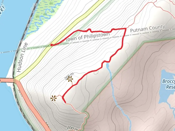
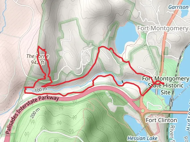
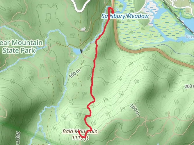
The Suffern Bear Mountain Trail is marked by its red blazes and takes hikers through diverse landscapes, including dense forests, rocky outcrops, and tranquil streams. The trail is rich in both natural beauty and historical significance, as it traverses Harriman State Park, one of the oldest state parks in New York.
Landmarks and Nature
As you embark on your journey, you'll encounter the Ramapo-Dunderberg Trail within the first few miles. This intersection is a good spot to check your progress using HiiKER, ensuring you're on the right path. Further along, the trail offers a view of the impressive New York City skyline on clear days, a sight not to be missed.
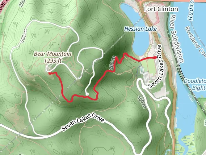
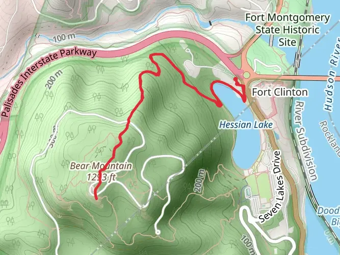
The trail continues to ascend Bear Mountain, one of the most notable peaks in the area, providing panoramic views of the Hudson Highlands. The Perkins Memorial Tower at the summit serves as a significant landmark, offering an opportunity to learn about the history of the region and take in the breathtaking vistas.
Wildlife
The area is home to a variety of wildlife, including white-tailed deer, black bears, and numerous bird species. Hikers should be aware of their surroundings and knowledgeable about how to safely interact with wildlife they may encounter.
Historical Significance
The region holds historical importance, with trails that were used by Native Americans and early settlers. During your hike, you'll come across remnants of the past, such as old mines and stone walls, which are testaments to the area's rich history.
Navigation and Preparation
Given the trail's difficulty, it is crucial to be well-prepared with adequate supplies, including water, food, and appropriate clothing. Hikers should also carry a map and compass or use HiiKER to navigate the trail, as some sections may be less clearly marked than others.
Safety and Regulations
Always remember to check the weather forecast before setting out and be prepared for sudden changes in weather conditions. It's also important to familiarize yourself with the park's regulations regarding camping, fires, and wildlife interaction to ensure a safe and enjoyable experience for all.
By respecting the trail and its natural inhabitants, hikers can enjoy the rugged beauty of the Suffern Bear Mountain Trail while preserving it for future generations.

What to expect?
Activity types
Frequently asked questions
How long is the Suffern Bear Mountain Trail and how hard is it?
The Suffern Bear Mountain Trail is 34.49 km long, or about 21.4 miles, with 1,281 meters of elevation gain. That combination of distance and climbing puts it firmly in the difficult category, and it is usually treated as a demanding point-to-point or overnight route rather than a casual day hike.
Where does the Suffern Bear Mountain Trail start and finish?
The route starts in Suffern in Rockland County and runs north through Harriman State Park to Bear Mountain. The southern end is near Orange Avenue and Wayne Avenue by Suffern, and the northern end reaches the Bear Mountain area, where the trail network connects into Bear Mountain State Park.
Can the Suffern Bear Mountain Trail be reached by train from New York City?
Yes. The southern trailhead is close to Suffern station, which is served by NJ Transit’s Main-Bergen County Line and Metro-North service. NJ Transit lists the station at Ramapo Avenue and Chestnut Street, adjacent to Orange Avenue, making it a practical walk-in start for a point-to-point hike.
Is there parking for the Suffern Bear Mountain Trail in Suffern?
Yes. Parking is available around Suffern station and nearby municipal lots, including parking at Orange Avenue and Wayne Avenue. NJ Transit’s station information shows both paid and permit parking in the area, with some evening and weekend free periods, but overnight restrictions apply in several lots, including no parking from 2 AM to 6 AM without a permit in certain areas.
Are dogs allowed on the Suffern Bear Mountain Trail?
Dogs are generally allowed on park trails in the Harriman and Bear Mountain area, but they must be leashed. In Bear Mountain State Park, dogs are limited to a leash no longer than 6 feet and are not allowed in buildings, picnic areas, bathing areas, on walkways, or in the Trailside Museum and Wildlife Center, so the rules become stricter near the northern end.
How is the Suffern Bear Mountain Trail marked?
The Suffern Bear Mountain Trail is marked with red blazes. Following the red-blazed route is important because the trail crosses a large network of intersecting paths in Harriman and Bear Mountain, including junctions with other named long-distance and park trails.
Are there any closures or reroutes on the Suffern Bear Mountain Trail near Bear Mountain?
There can be. The New York-New Jersey Trail Conference has reported temporary reroutes affecting the Suffern-Bear Mountain Trail in Bear Mountain State Park during construction near the Bear Mountain Inn and nearby trailheads. Conditions in the Bear Mountain area can change seasonally or after storm damage, so the northern end is the section most likely to be affected.
Comments and Reviews
User comments, reviews and discussions about the Suffern Bear Mountain Trail, New York.
4.57
average rating out of 5
14 rating(s)