Download
3D Flyover
Add to list
More
3.6 km
~47 min
49 m
Out and Back
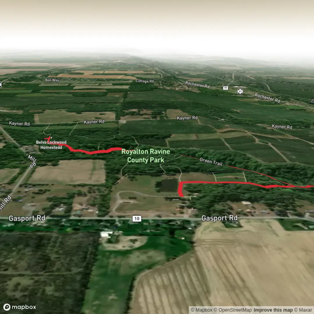
“Slip into a shaded escarpment ravine where creek-song leads to Royalton Falls’ mossy, rock-layered hush.”
This easy ramble drops you into a cool, wooded ravine cut into the Niagara Escarpment, with the sound of Eighteenmile Creek guiding you toward Royalton Falls (often also called Norton Falls). Expect a mostly shaded walk on wide park paths and dirt singletrack, a few short steeper pitches as you descend into (and climb out of) the ravine, and a classic “Western New York creek gorge” feel—mossy banks, layered rock, and damp ground in the low spots.
Distance & elevation: about 4 km (2.5 mi) with roughly 100 m (330 ft) of total climbing spread out in small ups and downs rather than one long ascent.
Getting to the start (car + public transport)
Best start point (car): the main park entrance/parking area for Royalton Ravine County Park at 4662 Gasport Rd, Gasport, NY 14067. (letsgoplayoutside.com)
From the lot you can pick up the main gravel path toward the pond and the ravine trails.
Alternate quick access (limited parking): there’s also a small roadside pull-off/trail access off Kayner Rd just west of the falls area, but space is tight and it’s less “park-like” than starting from the main lot. (nyfalls.com)
Public transport: this is a rural edge-of-town park south of the hamlet of Gasport, so regular transit service is limited; most hikers plan on driving or using a rideshare/taxi from nearby hubs like Lockport. (If you want, tell me where you’re coming from—Buffalo, Niagara Falls, Lockport, etc.—and I can outline the most realistic bus/train-to-rideshare combination.)
What the hike is like, step by step
From the Gasport Rd parking area, you’ll typically begin on a gravel path heading toward the park’s fishing pond and picnic lawns. This opening stretch is gentle and family-friendly—good footing, minimal grade, and a nice warm-up before the ravine terrain begins. (nyfalls.com)
At roughly 0.5 km (0.3 mi) in, you’ll reach the treeline and transition onto the main dirt trail that trends toward the creek. The character changes quickly here: the air cools, the ground can stay damp, and you’ll start to feel the ravine walls closing in.
Around 1.0 km (0.6 mi) from the start (varies by exact route), you’ll reach a creek crossing/bridge area. This is a key decision point: - Staying on the main trail system keeps things straightforward and “easy-rated.” - Dropping closer to the creek for better waterfall views can add slick rocks, mud, and a bit of hands-on balance work. (nyfalls.com)
Continue another 0.5–1.0 km (0.3–0.6 mi) and you’ll reach the top-of-falls viewpoint area. The falls here are a modest but pretty cascade (about 15 ft / 4.5 m), framed by hardwood forest and escarpment rock. (nyfalls.com)
If water levels are low (common in drier periods), the falls can look thin; after rain or during wetter seasons, the creek is livelier—but the trails also get muddier. (nyfalls.com)
Most hikers then return the way they came to complete the ~4 km (2.5 mi) outing. If you want to keep the difficulty easy, resist the temptation to “shortcut” along the creekbed unless conditions are clearly safe and dry.
Landmarks, nature, and wildlife to watch for
- Niagara Escarpment geology: the ravine is carved into the same escarpment system that underpins the region’s famous waterfalls, just on a smaller scale here. (nyfalls.com)
- Eighteenmile Creek ravine corridor: expect a mix of creekside vegetation, shaded slopes, and occasional openings where you can look down into the gorge.
- Wildlife: white-tailed deer are common in this part of Niagara County, and the creek corridor is good for songbirds and woodpeckers. In warmer months, watch for mosquitoes and ticks in the shaded, humid sections.
Footing, hazards, and what to pack
- Mud & slick surfaces: the ravine holds moisture; after rain, the dirt can turn greasy and the rocks near the creek get slick fast. Waterproof trail shoes or light boots help a lot.

Surfaces
Dirt
Grass
Unknown
Wood
Gravel
Ground
Comments and Reviews
User comments, reviews and discussions about the Royalton Falls in Royalton Ravine Country Park, New York.
average rating out of 5
0 rating(s)