Download
3D Flyover
Add to list
More
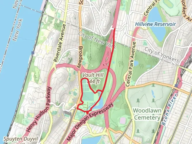
663.7 km
~26 days
14178 m
Multi-Day
The Long Path is an extensive trail stretching approximately 413 miles (664 kilometers) with an elevation gain of around 46,260 feet (14,100 meters). This point-to-point trail begins near New York County, New York, and offers a medium difficulty rating, making it accessible to hikers with a moderate level of experience.
Getting to the Trailhead
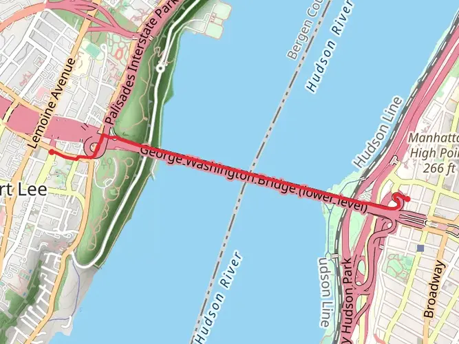
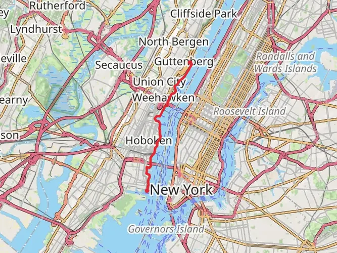
The starting point of the Long Path is accessible from New York City, making it convenient for those using public transportation. Hikers can take the Metro-North Railroad or a bus service to reach the vicinity of the George Washington Bridge in Fort Lee, New Jersey, which is a known landmark near the trailhead. For those driving, parking is available in the area, but it's advisable to check for any parking restrictions or permits required.
Trail Overview
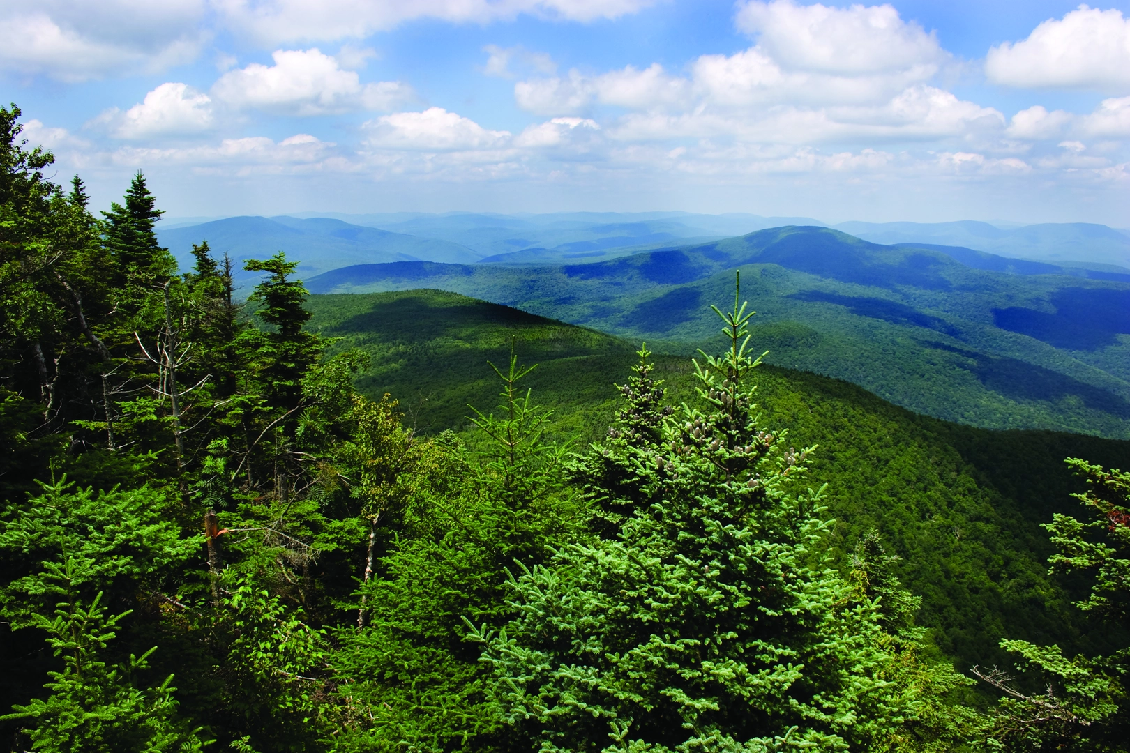
As you embark on the Long Path, you'll traverse through a variety of landscapes including rugged mountains, serene forests, and rolling hills. The trail offers a rich tapestry of the region's natural beauty, with sections running through the Catskill Mountains and the scenic Hudson Valley.
Landmarks and Nature
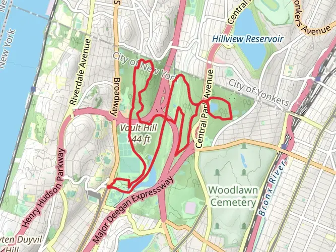
One of the significant landmarks along the trail is the Catskill Mountain Range, where hikers will encounter challenging terrain and breathtaking vistas. The trail also passes through several state parks and forests, including Harriman State Park, which is known for its diverse wildlife and over 200 miles of hiking trails.
The Long Path is home to a variety of flora and fauna. Hikers may spot white-tailed deer, black bears, and a wide array of bird species. The trail also features a number of streams and rivers, providing refreshing water sources and opportunities for fishing.
Historical Significance
The region through which the Long Path runs is steeped in history. The trail often follows old Native American routes and passes near historic sites from the Revolutionary War. Hikers will find educational opportunities to learn about the early settlers and the development of the region.
Navigation and Planning
To navigate the trail, hikers are encouraged to use the HiiKER app, which provides detailed maps and essential information about the Long Path. It's important to plan your hike in sections, as tackling the entire trail in one go requires significant time and preparation. The app can help you identify suitable camping spots, water sources, and resupply points along the route.
Preparation Tips
Given the trail's length and varied terrain, hikers should be well-prepared with appropriate gear, including sturdy hiking boots, weather-appropriate clothing, and a reliable means of water purification. It's also wise to carry a first-aid kit and be prepared for changes in weather, as conditions can shift rapidly in the mountains.
Conclusion
The Long Path offers a unique and immersive hiking experience, rich with natural beauty and historical significance. Whether you're looking for a challenging multi-day adventure or a series of day hikes, this trail provides an opportunity to explore the heart of New York's wilderness. With careful planning and respect for the natural environment, hikers can enjoy all that the Long Path has to offer.

What to expect?
Activity types
Frequently asked questions
How long is the Long Path and how many days does the full Long Path usually take?
The Long Path is about 663.67 km, or roughly 413 miles, with around 14,178 m of climbing. The officially maintained route is commonly described as 358 miles from the George Washington Bridge in New York City to the Adirondacks, and a full end-to-end hike is usually planned as a multi-week trip rather than a weekend outing.
Where does the Long Path start, and can the Long Path trailhead be reached by public transit?
The southern start of the Long Path is at the George Washington Bridge in New York City, with the route beginning near the West 175th Street subway area. That makes the start unusually accessible for a long-distance trail, since hikers can reach the bridge area by New York City transit instead of needing a remote trailhead shuttle.
Is the Long Path difficult, and which parts of the Long Path are the toughest?
The Long Path is an extra-difficult multi-day route with more than 14,000 m of elevation gain, so the challenge comes from both distance and cumulative climbing. The hardest stretches are generally in the Catskills and Shawangunks, where the route includes steeper mountain terrain, rugged footpaths, and longer backpacking sections than the lower Hudson Valley segments.
Can you camp along the Long Path, and are there shelters on the Long Path?
Camping is possible on parts of the Long Path, but the rules change by land manager and section. In the Catskills, backcountry camping is generally allowed on Forest Preserve land below 3,500 feet if camps are at least 150 feet from roads, trails, and water unless a site is officially designated, while Harriman camping is tied to shelter areas and some southern sections have tighter restrictions.
Is the Long Path dog friendly for backpacking and day hikes?
Dogs are allowed on some major Long Path sections, but the policy is not uniform for the entire route. In Harriman State Park, dogs are allowed on a leash up to 6 feet, and Minnewaska also allows leashed dogs on many trails, though not in buildings, bathing areas, or certain groomed ski-trail conditions, so each segment needs to be checked before a thru-hike.
What are the main landmarks and regions on the Long Path?
The Long Path links several of New York’s best-known hiking regions on one continuous route. Major landmarks and landscapes include the George Washington Bridge, the Palisades, Harriman State Park, the Hudson Valley, the Shawangunks, the Catskills, Schoharie Valley, and the route’s northern continuation toward the Adirondack Park.
What is the best time of year to hike the Long Path?
Late spring through fall is the most practical season for most of the Long Path because snow, ice, and short daylight can make the mountain sections much slower in winter. Summer brings longer days for big mileage, while fall is especially popular in the Catskills and Shawangunks for cooler temperatures and clearer views.
Comments and Reviews
User comments, reviews and discussions about the Long Path, New York.
4.4
average rating out of 5
5 rating(s)