
Download
3D Flyover
Add to list
More
428 m
~6 min
14 m
Out and Back
“Steps from town, La Chute’s roaring rapids and storied corridor feel wild—watch your footing.”
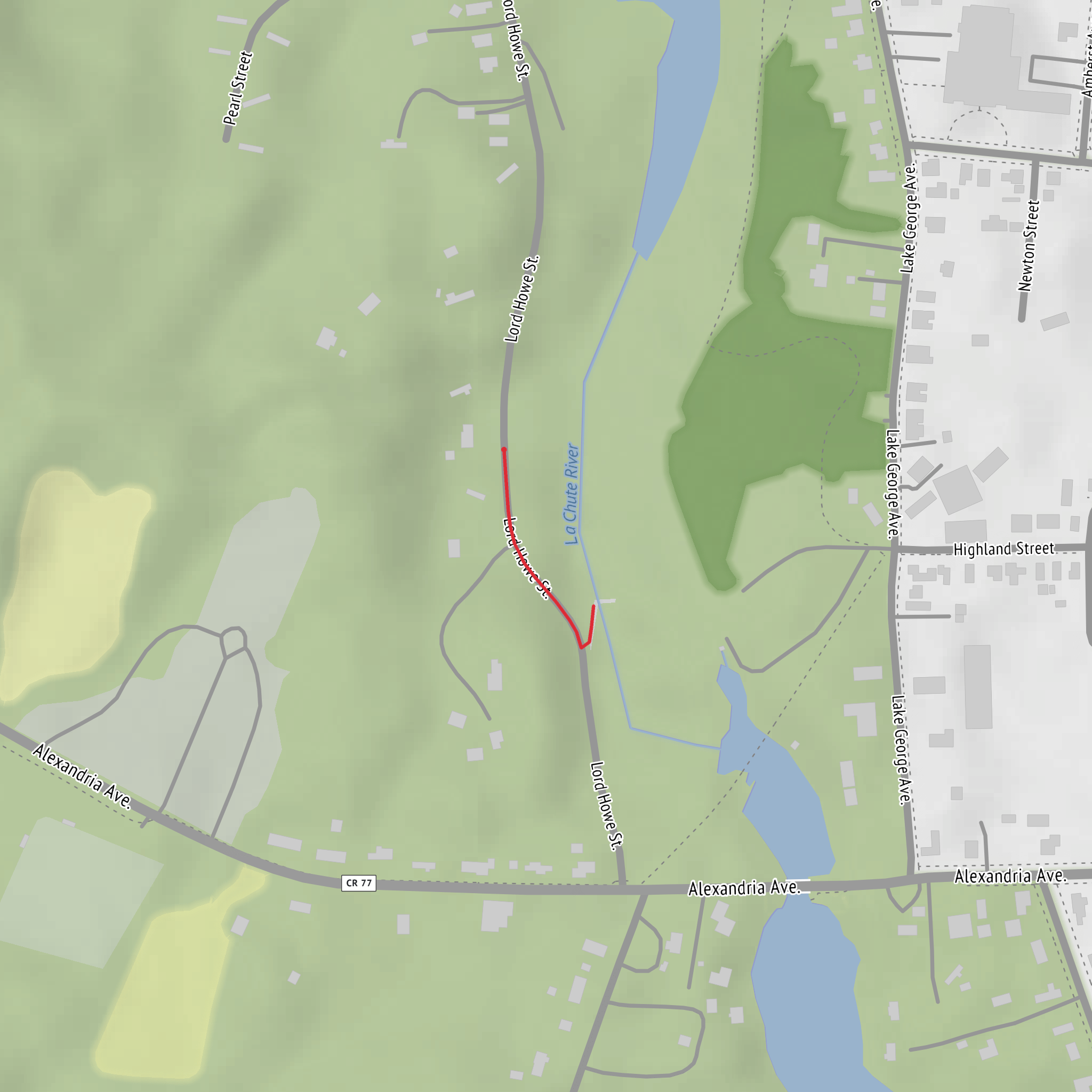
La Chute Falls is essentially a “walk-up viewpoint” rather than a traditional hike: the distance is effectively 0 km (0 mi) with ~0 m (0 ft) of climbing, but the setting can still feel adventurous because you’re near fast-moving water, slick rock, and steep riverbanks. Expect a short approach from nearby parking/paths, a few minutes of standing and exploring at the overlooks, and then the same short return.
Where you’re going (and what it’s like)
“La Chute” (“the fall” in French) is most commonly associated with La Chute River, the outlet that drains Lake George into Lake Champlain in Ticonderoga, New York. The falls/rapids here are part of a historically important corridor between the Hudson–Lake George–Champlain waterways, used for centuries for travel, trade, and military movement.
Because your hike details don’t include coordinates, the most reliable “nearest known landmark” to use for planning is:
- Bicentennial Park / La Chute River waterfront area in Ticonderoga, NY, near the La Chute River and close to the Ticonderoga Heritage Museum and the downtown bridge crossings.
If you share a lon/lat pin (or a map screenshot), I can convert it to the nearest specific address/landmark and tailor the exact access point and safest viewing spots.
Getting to the start (car and public transport)
By car - Aim for downtown Ticonderoga, NY and look for parking associated with Bicentennial Park or nearby municipal lots along the La Chute River corridor. - From there, you’re typically only a few hundred feet to a few hundred meters (0.05–0.3 km / 0.03–0.2 mi) from river viewpoints depending on where you park.
By public transport - Public transit in this part of the Adirondack/Champlain region is limited. The most workable approach is usually: - Intercity bus/train to a larger hub (often Fort Edward / Glens Falls area), then - Taxi/rideshare (availability can be inconsistent) or a pre-arranged local shuttle to Ticonderoga. - If you tell me where you’re coming from (nearest city), I can outline the most realistic connection options and what to expect for last-mile logistics.
What to expect on the ground
Even with near-zero distance, plan for conditions like a short nature walk:
- Footing: Expect wet stone, algae-slick rock, muddy edges, and uneven ground near the river. Traction matters more than endurance here.
- Exposure: Riverbanks can be steep and undercut. Stay back from edges—especially after rain or during spring runoff.
- Noise & spray: The falls/rapids can be loud, and mist can make surfaces slick.
- Time needed: Many hikers spend 15–45 minutes total, depending on how many viewpoints you visit and how long you linger.
Navigation and finding the best viewpoints
Because access points can vary (parks, short spur paths, sidewalks, and informal lookouts), use HiiKER to confirm: - the exact start point you intend to use, - any short spur paths to overlooks, - and whether there are parallel paths that keep you safely back from the river edge.
If you’re traveling in shoulder season, also use HiiKER to sanity-check whether any connectors are marked as closed/seasonal or prone to flooding.
Landmarks, nature, and wildlife
Scenery & natural features - The highlight is the constricted river channel where water accelerates into cascades/rapids and small drops. In higher flow, the water can look dramatically more powerful even though you’re only steps from town. - Look for glacially influenced rock and rounded stone along the river margins—this whole region was shaped by ice and meltwater.
Plants - Expect a mix of riparian vegetation (willows, shrubs, moisture-loving plants) near the water and northern hardwoods/conifers as you step back from the river corridor. - In spring and early summer, the river edge can be lush; later in summer it can be brushier, with ticks more likely in grassy margins.
Wildlife - Common sightings are typically songbirds, waterfowl (depending on the exact stretch), and small mammals. - You may spot fish holding in calmer pockets below faster water. - In warm months, be alert for mosquitoes and ticks; do a tick check afterward if you’ve brushed through vegetation.
Safety: what to look out for (this is why it can feel “Medium”)
Even though the distance and elevation are negligible, the hazard profile can justify a “Medium” rating:
- Fast water: The current near drops/rapids is unforgiving. Avoid stepping onto midstream rocks or “just getting closer for a photo.”
- Slippery rock: Algae and spray create skating-rink conditions. Wear shoes with solid tread; avoid smooth-soled casual footwear.
- Cold-water risk: In spring and late fall, water temperatures can be dangerously cold even on mild days.
- Crowds and distractions: Short waterfall viewpoints often mean people moving unpredictably near edges—give yourself space.
Historical significance of the area
The Lake George–Lake Champlain corridor is one of the most historically strategic routes in the Northeast. Nearby, Fort Ticonderoga (a major 18th-century fortification) reflects how critical this passage was during conflicts such as the **French and Indian War
Comments and Reviews
User comments, reviews and discussions about the La Chute Falls, New York.
average rating out of 5
0 rating(s)

