
Download
3D Flyover
Add to list
More
21.3 km
~5 hrs 48 min
936 m
Out and Back
“From Indian Falls’ shimmering cascade to Marcy’s wind-scoured summit, the Adirondacks demand respect—and reward you with sweeping horizons.”
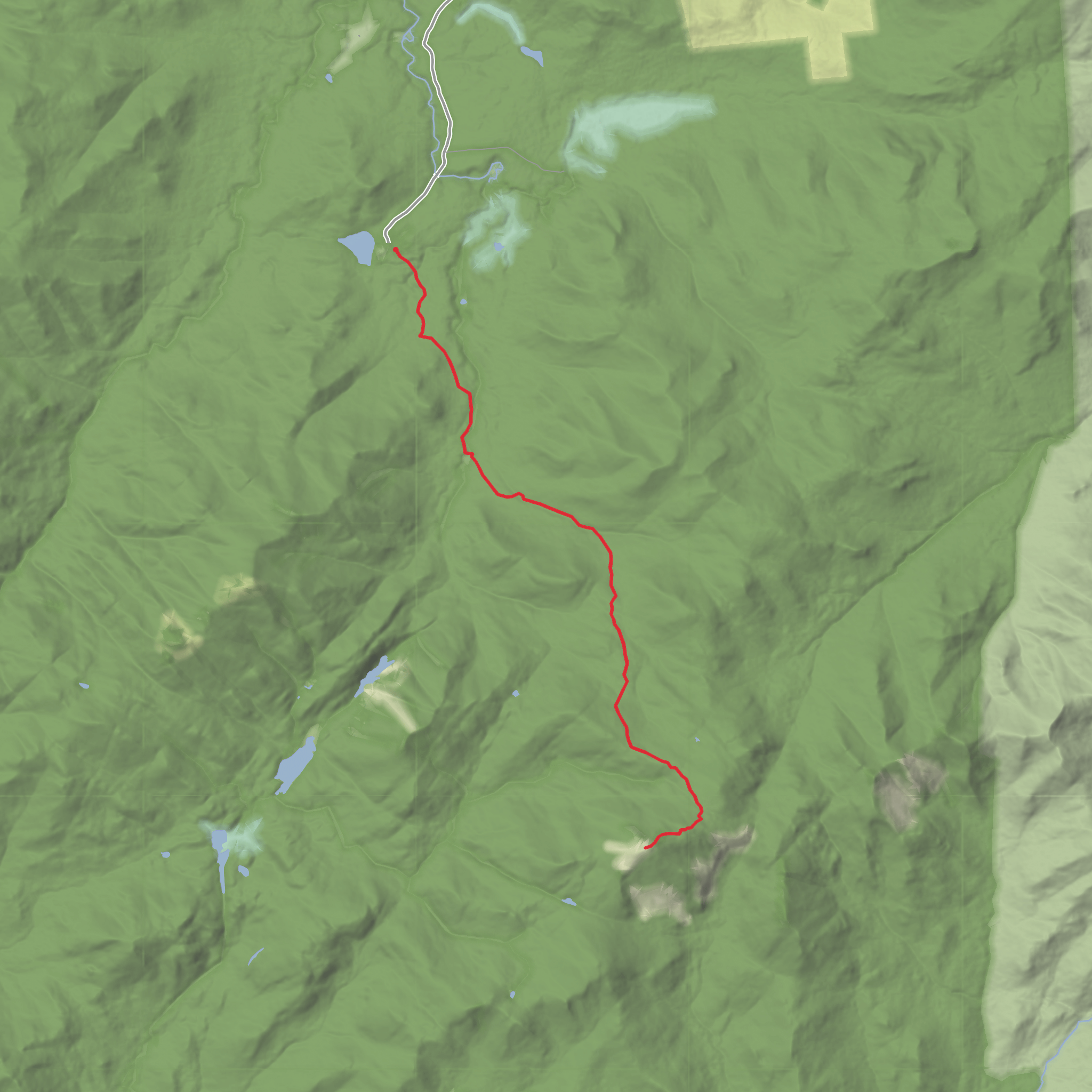
You’ll be hiking in New York’s Adirondack High Peaks Wilderness to the state high point, Mount Marcy (5,344 ft / 1,629 m), with a classic stop at Indian Falls—one of the most memorable cascades-and-viewpoints on the Van Hoevenberg approach. (britannica.com)
Stats to plan around (approx.) - Distance: ~21 km / ~13.0 mi round trip (out-and-back) - Elevation gain: ~1,000 m / ~3,280 ft total - Time: many parties take a full day; start early for daylight and weather margin - Difficulty: “Medium” only if you’re already comfortable with sustained mountain hiking; conditions can push this into strenuous quickly (mud, ice, wind, heat)
Getting to the start (car + public transport)
Trailhead landmark / nearest known address: Adirondack Mountain Club’s High Peaks Information Center (HPIC) at the Adirondak Loj / Heart Lake area, just south of Lake Placid, NY. This is the standard start for the Van Hoevenberg Trail to Marcy. (lakeplacid.com)
By car - Drive to the Adirondak Loj / Heart Lake parking for the HPIC (arrive early—this is one of the busiest trailheads in the Adirondacks). - Expect parking fees/permits to be handled on-site; have a backup plan if lots fill.
By public transport - The closest practical hub is Lake Placid. Intercity bus service (Adirondack Trailways) serves Lake Placid from larger cities (often via Albany/Ticonderoga/Schroon Lake depending on route). From Lake Placid you’ll typically need a taxi/rideshare (limited) to reach the Adirondak Loj/HPIC. (mtvanhoevenberg.com)
Route flow and what to expect underfoot
From the HPIC, you’ll follow the Van Hoevenberg Trail south toward Marcy. The first several kilometers/miles are a steady “Adirondack warm-up”: rolling terrain, roots, rocks, and frequent wet sections. This approach is popular for good reason—it’s direct, well-established, and passes major landmarks on the way to the alpine zone. (lakeplacid.com)
0.0 to ~6.5 km / 0.0 to ~4.0 mi: HPIC to the Indian Falls area - Grade: mostly moderate, with short steeper pitches. - Footing: expect mud in low spots, slick rock after rain, and exposed roots that get treacherous when wet. - Water: you’ll cross/parallel brooks at points; treat all water.
~6.5 to ~7.5 km / ~4.0 to ~4.7 mi: Indian Falls Indian Falls is a highlight because it’s both a cascade and a natural “balcony” with a big, open look toward the High Peaks. The rock here can be extremely slick—especially in shoulder seasons when thin ice forms, or after rain when algae coats the stone. Give the edge space and keep groups spread out so no one is forced onto risky footing.
~7.5 to ~10.5 km / ~4.7 to ~6.5 mi: Climb toward treeline Past Indian Falls the trail commits to the mountain. The grade becomes more sustained, and you’ll feel the elevation gain stack up. This is where pacing matters: keep a steady cadence, eat before you’re hungry, and don’t wait to adjust layers—sweat management is a safety issue in the Adirondacks.
Above treeline: alpine exposure and fast-changing weather
Near the top, Mount Marcy breaks above treeline into open alpine terrain. The payoff is huge—wide, multi-directional views on clear days—but so is the exposure. Wind can be strong enough to affect balance, and temperatures can be dramatically colder than at the trailhead. The highest few hundred feet are notably open compared to the forested approach. (en.wikipedia.org)
Navigation is usually straightforward in good visibility, but fog can erase the “obvious” line across open rock. If you use a digital map, keep HiiKER downloaded offline and don’t rely on cell service.
Nature, wildlife, and seasonal hazards
- Forest zones: Expect classic Adirondack hardwoods transitioning into spruce-fir as you gain elevation, with mossy groundcover and wet drainages.
- Wildlife: Black bears are present in the High Peaks region; practice strict food storage and never feed wildlife. Smaller animals (red squirrels, chipmunks) are bold around popular stops—guard snacks.
- Bugs: Late spring through summer can bring intense black flies and mosquitoes—head net and repellent can be the difference between pleasant and miserable.
- Mud season: Trails can be deeply muddy; waterproof footwear and gait
Comments and Reviews
User comments, reviews and discussions about the Indian Falls and Mount Marcy via Van Hoevenberg Trail to Marcy Trail, New York.
average rating out of 5
0 rating(s)


