Download
Preview
Add to list
More
2.5 km
~31 min
19 m
Out and Back
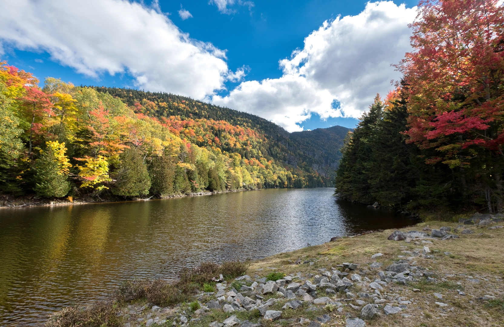
“A gentle, mostly level Hudson riverside stroll with breezy views, birdsong, and occasional rooty bumps.”
This is a short, mostly level riverside walk of about 2 km (1.2 mi) with ~0 m / ~0 ft of climbing, best suited to beginners, families, and anyone looking for an easy leg-stretcher with frequent views of the Hudson and a good chance of spotting waterbirds. Expect a mix of paved or hard-packed path (often stroller-friendly) with occasional short rough patches where tree roots, puddles, or winter frost heave can make the surface uneven.
Before I can convert the start point to the nearest known address/landmark and give truly accurate “what to expect” details (surface, exact landmarks, transit stops, parking, closures), I need one missing piece:
- Where is the trailhead “near”? (You left it blank.)
If you can paste coordinates (lat, lon), a HiiKER link, or even the nearest town/park name, I’ll pin it to the closest recognizable address/landmark and tailor the route description precisely.
In the meantime, here’s what you can generally plan for on a “Hudson River + Upper Work Trail” style 2 km easy loop/out-and-back along the Hudson corridor, and what to watch for.
What the walk feels like (terrain, pacing, and navigation)
- Distance & time: 2 km (1.2 mi) typically takes 25–45 minutes at an easy pace, longer if you stop for river views or birdwatching.
- Elevation: essentially flat (~0 m / ~0 ft), though you may encounter tiny rises over bridge approaches, path undulations, or flood-control berms.
- Footing: commonly paved multi-use path or compacted gravel, with short sections that can be sandy or muddy after rain—especially near low river edges or drainage dips.
- Navigation: simple, but bring HiiKER anyway—short riverside networks can have spur paths to overlooks, docks, picnic areas, or parallel promenades that look “main” but rejoin later.
Landmarks and scenery you’re likely to encounter
- Hudson River viewpoints: frequent open sightlines across the water; on clear days you may see river traffic (tugs, barges) and, depending on the stretch, distant bridges or waterfront towns.
- Riparian vegetation: expect a ribbon of willows, cottonwoods, sycamores, and riverbank shrubs. In spring and early summer, look for dense green growth; in fall, the corridor can be surprisingly colorful.
- Wet spots and floodplain features: the Hudson’s water level and tides (in the lower/mid Hudson) can influence puddling and damp ground near the edge. After storms, some low sections can be soft or briefly flooded.
Wildlife and what to look out for
- Birdlife: common sightings include Canada geese, mallards, gulls, cormorants, and herons/egrets. In some areas you may also spot osprey hunting over the river.
- Small mammals: squirrels are common; near quieter edges you might see muskrat or signs of beaver activity (chewed sticks, gnawed trunks), depending on the exact location.
- Ticks & poison ivy: along the Hudson corridor, ticks can be present in brushy edges and tall grass, and poison ivy is common where vegetation crowds the trail. Stay centered on the path and do a tick check afterward.
- Seasonal insects: expect mosquitoes near still water in warm months; a light repellent can make the walk much more pleasant.
Practical planning: what to bring for a 2 km easy walk
- Footwear: sneakers are usually fine; choose light hikers if it’s wet or if the “Upper Work” segment is more natural-surface.
- Layers: riverfront paths can feel cooler and windier than inland streets.
- Water: a small bottle is enough for most people, but bring more on hot, humid days.
- Sun protection: many river walks have long exposed stretches.
Historical context (Hudson River region)
The Hudson River corridor is one of the most historically significant landscapes in the U.S., shaped by Indigenous presence for thousands of years and later by Dutch and English colonial settlement, shipping, and industry. Many Hudson waterfront paths pass near remnants or interpretive signs tied to: - Maritime commerce and shipbuilding - Rail and industrial-era infrastructure - Revolutionary War-era movement and river strategy (especially in the mid/lower Hudson)
Once you tell me the exact trailhead area, I can call out the specific historic sites (e.g., nearby forts, waterfront districts, rail corridors, or preserved industrial structures) that are actually on or adjacent to your route.
Getting to the start (car and public transport)
Because the trailhead location is missing, I can’t yet name the nearest station/stop or parking lot. Share the coordinates or the nearest park/town and I’ll convert it to the closest known address/landmark and give step-by-step options. Generally, Hudson River walks are often accessible via:
- By car: parking is commonly at a riverfront park lot, marina, or trailhead pull-in. Arrive earlier on weekends—popular waterfronts fill quickly.
- By public transport: many Hudson communities are served by Metro-North Hudson Line (downstate) or Amtrak (select river towns/cities), plus local buses. The last mile is often a short walk or rideshare to the waterfront.
Send any one of the following and I’ll rewrite this as a precise, location-anchored hike description with accurate

Surfaces
Ground
Unknown
Asphalt
Comments and Reviews
User comments, reviews and discussions about the Hudson River and Upper Work Trail, New York.
average rating out of 5
0 rating(s)