
Download
3D Flyover
Add to list
More
20.6 km
~4 hrs 8 min
12 m
Point to Point
“A gentle rail-trail threads wetlands, woods, and old rail history toward the uplifting Walkway Over the Hudson.”
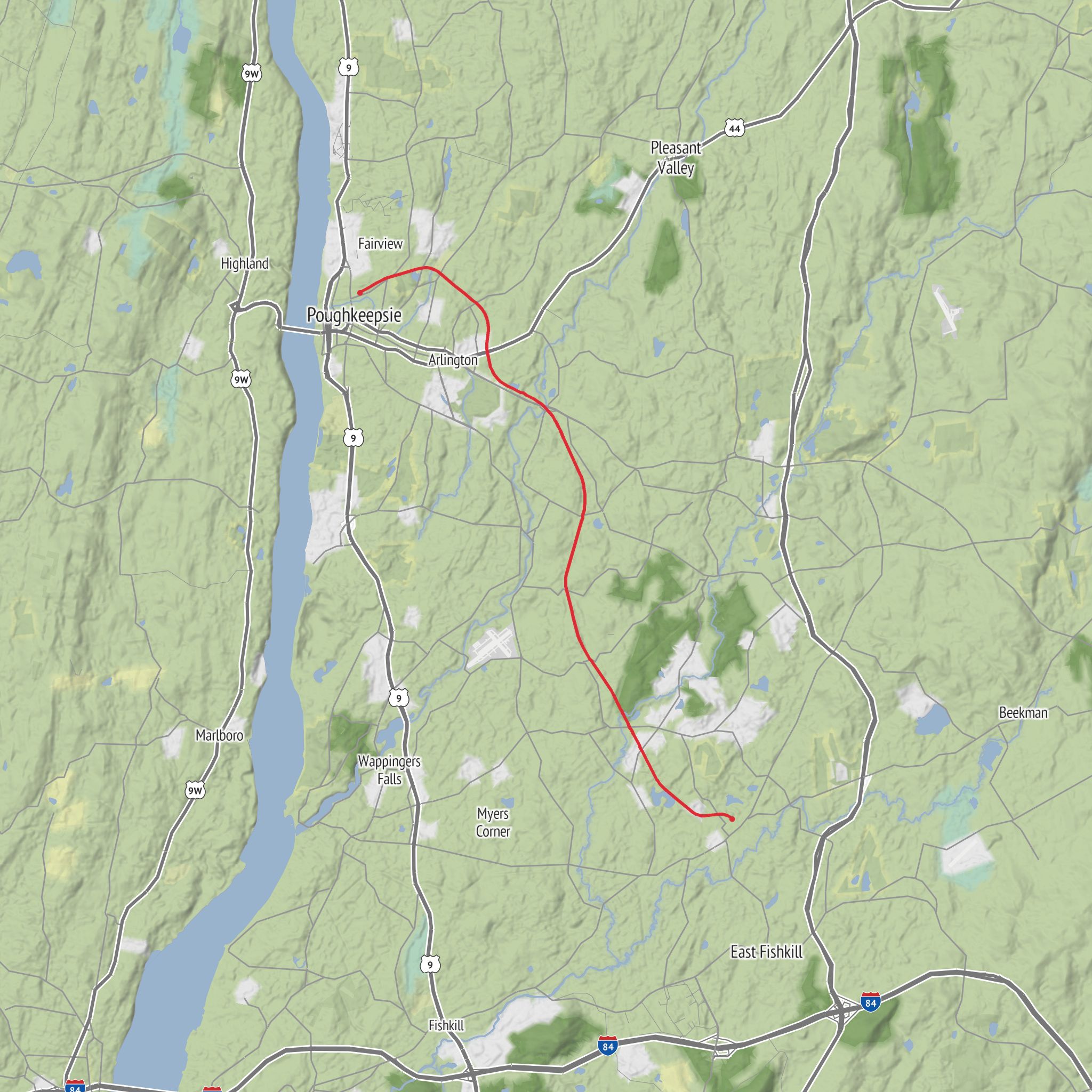
This easy rail-trail outing follows a long, nearly level corridor through central Dutchess County, making it one of the most accessible longer walks in the Hudson Valley. Expect roughly 21 km / 13 miles of paved multi-use trail with essentially no meaningful climbing—about 0 m / 0 ft of elevation gain overall—so the challenge comes more from time on your feet and exposure to weather than from terrain. The route runs between the Hopewell Junction area and the eastern approach to the Walkway Over the Hudson in Poughkeepsie, along the former Maybrook rail corridor. Official sources describe the trail as about 13 to 13.5 miles long, so your planned distance is right in line with a full end-to-end walk. (dutchess.org)
For the southern end, the nearest well-known starting point is the Hopewell Depot Trailhead near 36 Railroad Avenue, Hopewell Junction, New York, just west of NY Route 82. Dutchess County and Empire State Trail information note trailhead parking, restrooms, and the restored depot area here. At the northern end, the trail ties into Walkway Over the Hudson State Historic Park, 61 Parker Avenue, Poughkeepsie, New York 12601, which is the key landmark if you are planning a one-way hike or arranging pickup. (empiretrail.ny.gov)
By car, the simplest approach is to choose either end depending on whether you want a shuttle, out-and-back, or one-way walk. Hopewell Junction is convenient for southern access and usually the most straightforward place to begin if you want a quieter start. Poughkeepsie is better if you want immediate access to services, cafés, and the Walkway area before or after the hike. There are also intermediate access points and parking areas along the corridor through LaGrange, Wappinger, and the Town of Poughkeepsie, which can be useful if you want to shorten the day. (dutchess.org)
Public transport is easiest from the Poughkeepsie side. Metro-North serves Poughkeepsie, and Dutchess County Public Transit operates bus routes in and around Poughkeepsie, Wappingers Falls, Beacon, and Hopewell Junction, though service patterns can be less convenient for a precise trail-to-trail transfer, especially at the Hopewell end. If using transit, it is wise to plan around the Poughkeepsie side first and then use HiiKER alongside current county transit schedules to work out the most practical access point. (dutchessny.gov)
What the walk is like
Because this is a converted rail bed, the grade stays gentle and the tread is predictable. That makes it suitable for newer hikers, families, and anyone wanting a steady-distance day without steep ascents or rough footing. The surface and width also mean you should expect to share the route with cyclists, runners, and casual walkers, especially near Poughkeepsie and the Walkway connection. Even on an easy trail, that shared-use character is something to prepare for: keep right, stay aware of faster users approaching from behind, and be especially attentive at road crossings and trail access points. (dutchess.org)
Scenically, this is less about dramatic mountain views and more about a changing cross-section of Dutchess County. The trail passes through wooded stretches, wetland edges, suburban green corridors, and open pockets where old rail infrastructure gives way to ponds, creeks, and seasonal foliage. Bridges and overpasses break up the walk, including the newer span over Route 55, Wappingers Creek, and Old Manchester Road, which created a longer uninterrupted section of trail and removed one of the more awkward barriers along the route. (dutchess.org)
If you walk north toward Poughkeepsie, the sense of arrival builds as the corridor links into the Walkway Over the Hudson. That connection is one of the route’s biggest highlights: the rail trail feeds directly into one of the region’s best-known linear parks, extending the outing if you want to continue onto the bridge. The Walkway itself is part of a larger trail network and Empire State Trail system, so this route can feel like both a standalone hike and a segment of a much bigger Hudson Valley journey. (dutchess.org)
Landmarks, nature, and what to watch for
The standout landmark is the Old Hopewell Depot area at the southern end, which anchors the trail with a strong sense of railroad heritage. Farther north, the connection to the Walkway Over the Hudson is the signature destination, linking the former freight corridor to the rep
AI Planner
Days planned around your pace, with somewhere to stay each night.
Surfaces
Asphalt
Concrete
Comments and Reviews
User comments, reviews and discussions about the Dutchess Rail Trail, New York.
average rating out of 5
0 rating(s)
