Download
3D Flyover
Add to list
More
80.1 km
~4 days
3597 m
Multi-Day
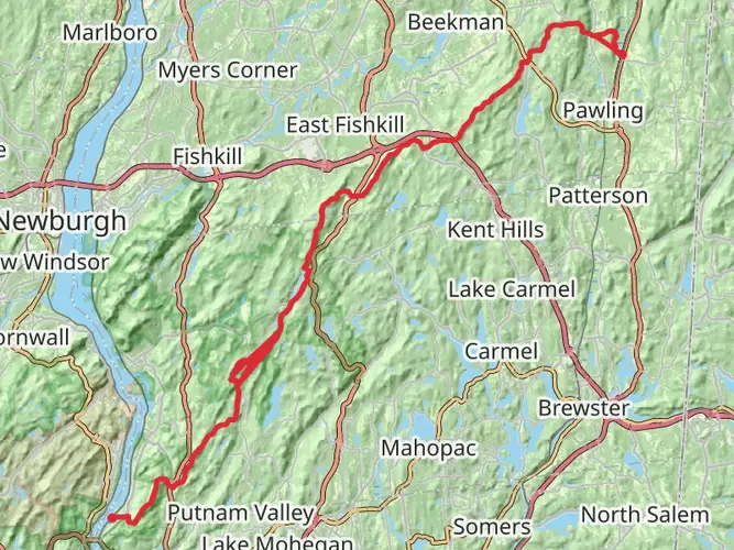
The Appalachian Trail's Connecticut section offers a diverse and challenging experience for hikers, spanning approximately 50 miles (80 kilometers) with an elevation gain of around 8,530 feet (2,600 meters). This point-to-point trail begins near the border of Dutchess County, New York, and winds its way through the scenic landscapes of Connecticut before reaching the Massachusetts state line.
Getting to the Trailhead
To start your journey on the Connecticut section of the Appalachian Trail, you can reach the trailhead by car or public transport. If driving, the southern terminus is accessible via Route 55 near the town of Sherman, Connecticut. For those using public transportation, the nearest significant landmark is the Metro-North Railroad's Harlem Line to the Appalachian Trail station. From there, a short taxi ride or a connecting bus service can bring you to the trailhead.
Trail Overview
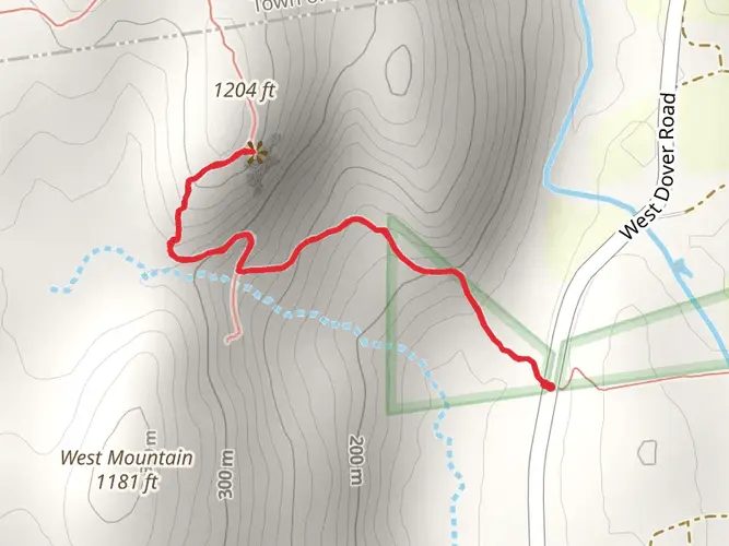
As you embark on the trail, you'll traverse a variety of terrains, including dense forests, open meadows, and rocky ridges. The trail is well-marked with the iconic white blazes, and using the HiiKER app can help you navigate the route and track your progress.
Significant Landmarks and Natural Features
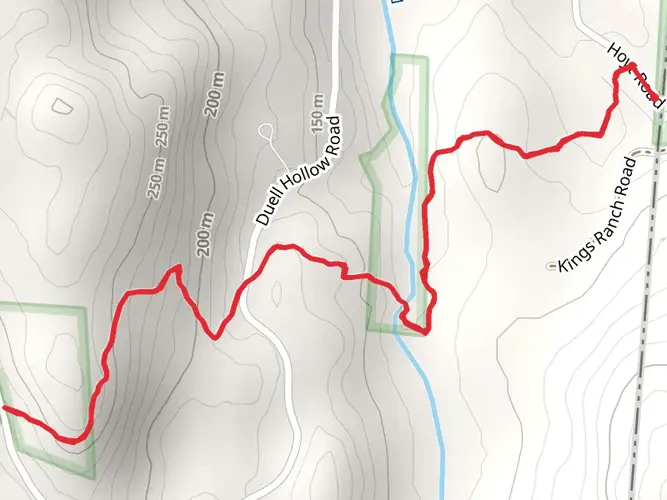
One of the first major landmarks you'll encounter is the Ten Mile River, which offers a picturesque setting for a rest or a photo opportunity. As you continue, you'll ascend to the summit of Caleb's Peak and St. John's Ledge, which provide stunning views of the Housatonic River Valley.
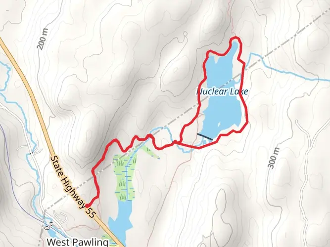
The trail also takes you through the Housatonic Meadows State Park, a perfect spot for observing local flora and fauna. Keep an eye out for wildlife such as white-tailed deer, black bears, and a variety of bird species.
Historical Significance
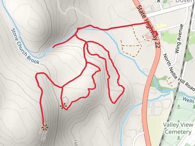
The Connecticut section of the Appalachian Trail is steeped in history. The trail passes near the historic iron-making town of Salisbury and the site of the former Sedgwick Gun Factory. Hikers can reflect on the region's industrial past while enjoying the natural beauty that has reclaimed these areas.
Elevation and Difficulty
The Connecticut portion of the trail is considered difficult due to its elevation gain and the technical nature of some sections. The Bear Mountain peak, the highest point in Connecticut at 2,316 feet (706 meters), is a challenging climb but rewards hikers with panoramic views.
Preparation and Planning
Before setting out, ensure you have adequate supplies, as there are limited resupply points along the trail. Water sources are available, but it's advisable to treat or filter water before drinking. Weather can be unpredictable, so pack appropriate clothing and gear for varying conditions.
Conclusion
The Appalachian Trail in Connecticut offers a rich blend of natural beauty, wildlife, and history. With proper preparation and the use of navigation tools like HiiKER, hikers can enjoy a memorable experience traversing this iconic American trail.

Frequently asked questions
How long does it take to hike the Appalachian Trail - Connecticut section?
The Appalachian Trail - Connecticut section is about 80.08 km, or roughly 50 miles, so most backpackers take 3 to 5 days depending on pace, weather, and overnight stops. It is a point-to-point route with about 3,597 m of climbing overall, so the elevation gain makes it more demanding than the mileage alone suggests.
How hard is the Appalachian Trail - Connecticut section compared with other AT state sections?
The Appalachian Trail - Connecticut section is generally a medium-difficulty multi-day hike, but it still includes long climbs, rocky footing, and sustained elevation gain. Over 80.08 km it gains about 3,597 m, with notable hillier stretches around places such as St. John’s Ledges, Caleb’s Peak, and Bear Mountain, the highest point on the Connecticut A.T. at 2,316 feet.
What are the main highlights on the Appalachian Trail - Connecticut section?
Major highlights on the Appalachian Trail - Connecticut section include the Housatonic River corridor, St. John’s Ledges, Caleb’s Peak, and Bear Mountain near Salisbury. The Connecticut A.T. is about 52.2 miles long and includes broad valley walking, hardwood forest, ridgeline viewpoints above Kent, and a well-known accessible stretch along the Housatonic near Falls Village.
Where do hikers usually start the Appalachian Trail - Connecticut section?
The southern end of the Appalachian Trail - Connecticut section begins at the New York-Connecticut border near Sherman, and the route runs north to Sage’s Ravine at the Massachusetts line near Salisbury. Common access points for shorter entries and exits are near Kent, Falls Village, Cornwall, and Salisbury, depending on whether the hike is being done as a full section or in stages.
Can dogs go on the Appalachian Trail - Connecticut section?
Dogs can generally accompany hikers on the Appalachian Trail - Connecticut section, but the route is managed as a hiking trail and includes rocky ledges, steep climbs, and wildlife-sensitive areas that may not suit every dog. Black bear activity has been noted in parts of the Connecticut A.T., including around St. John’s Ledges and Mt. Riga Shelter, so strong leash control and careful food storage are important.
Is camping allowed on the Appalachian Trail - Connecticut section?
Camping is a normal part of hiking the Appalachian Trail - Connecticut section, and the Connecticut A.T. includes seven shelters along its 52.2-mile route. Overnight use is typically centered on established shelters and campsites rather than informal roadside camping, and food storage matters because bear activity is documented on parts of the route.
What is the best time of year to hike the Appalachian Trail - Connecticut section?
Late spring through fall is usually the best window for the Appalachian Trail - Connecticut section. Connecticut’s hardwood forests are especially well known for late-spring mountain laurel and strong fall color, while summer brings longer daylight for covering the 80.08 km route; after heavy rain, river-adjacent sections and rocky ledges can be slower and more slippery.
Comments and Reviews
User comments, reviews and discussions about the Appalachian Trail - Connecticut, New York.
4.5
average rating out of 5
8 rating(s)