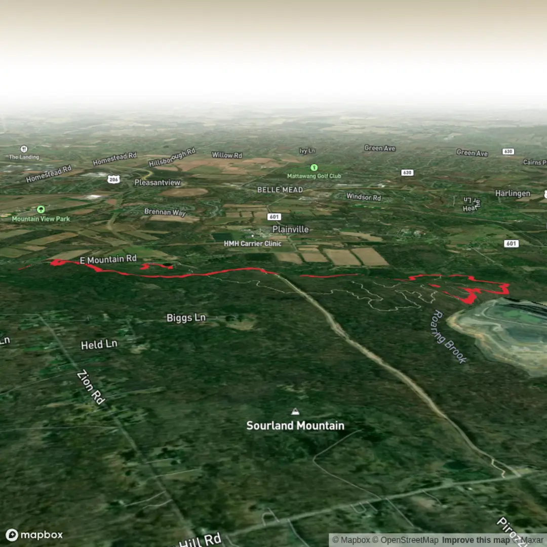
Yellow Trail, Ridge Trail, Tributary Trail and Maple Flats Trail
Download
3D Flyover
Add to list
More
8.4 km
~1 hrs 55 min
153 m
Loop
“Share a trailhead pin and route shape, and I’ll paint a vivid, HiiKER-guided hike story.”
I’m missing a few key specifics needed to make this accurate (especially the start point). Right now, “Hike head: near” and “Hike type:” are blank, and there are no coordinates to convert into a nearby address/landmark.
Send one of the following and I’ll write the full hike description exactly in the style you asked:
1) Trailhead coordinates (preferred): a single lat, lon (or a HiiKER link), and I’ll convert it to the nearest known address or significant landmark.
2) Nearest place name: park/forest name + the closest town/state (e.g., “near Maple Flats Picnic Area, ___ State Park, __, __”).
3) A map screenshot showing the loop and the start point.
Also confirm these two quick items so the distances per segment are right: - Is this a loop or an out-and-back (or a lollipop)? - Any must-hit waypoint you consider the “start” (parking lot, visitor center, gate, picnic area)?
Once you provide the trailhead location, I’ll include:
- Segment-by-segment distances adding up to ~8 km / 5.0 mi and ~200 m / 656 ft gain
- What to expect on Yellow → Ridge → Tributary → Maple Flats (surface, grade, typical wet spots, crossings)
- Landmarks, habitat, and likely wildlife + what to watch for
- Regional historical context tied to the exact area
- Getting there by car and public transport based on the nearest real-world access point
- Navigation guidance referencing HiiKER only

Surfaces
Ground
Unpaved
Comments and Reviews
User comments, reviews and discussions about the Yellow Trail, Ridge Trail, Tributary Trail and Maple Flats Trail, New Jersey.
average rating out of 5
0 rating(s)