Hanks Pond and Clinton Reservoir via Fire Tower Ridge Trail and Bearfort Waters - Clinton
Download
Preview
Add to list
More
13.4 km
~3 hrs 5 min
244 m
Loop
“A mellow woodland figure‑eight of pond hush, reservoir shimmer, and a breezy ridge—best for confident walkers.”
This is a mellow, mostly-woodland loop/figure-eight style outing through the Bearfort Waters–Clinton area, linking quiet pond edges, reservoir views, and a short ridge segment that feels “up high” without ever getting steep. At roughly 13 km / 8.1 mi with about 200 m / 656 ft of total climbing, it’s well-suited to newer hikers, families with older kids, and anyone looking for a half-day walk with frequent water scenery and a few landmark moments.
Getting to the trailhead (car + public transport)
By car: The most reliable access for this route is from the Clinton Road corridor (NJ-23 / NJ-94 area) near West Milford, New Jersey, using one of the established pull-offs/parking areas that serve the Bearfort Waters–Clinton trail network. A common “nearest landmark” reference for navigation is the Clinton Road area near the West Milford / Newfoundland vicinity, where multiple signed trailheads and informal lots serve reservoir and ridge trails. Because parking options here can be small and fill on weekends, aim for an early start and park only where clearly permitted (fully off the roadway).
By public transport: Public transit to this specific trail network is limited. The most workable approach is: - Take regional transit to Wayne / Pompton Lakes / Butler (depending on what’s running when you travel), then use a rideshare/taxi to the Clinton Road / West Milford trail access. - If you’re trying to do it fully car-free, plan extra time and have a backup, as last-mile service can be inconsistent.
For turn-by-turn and to confirm the exact start point and parking pin, use HiiKER and match the route to the “Fire Tower Ridge Trail” and “Bearfort Waters – Clinton” segments so you begin at the correct access point.
You didn’t include coordinates for the “Hike head,” so if you share a lon/lat I can translate it to the nearest road address/landmark and tailor the start instructions precisely.
What the hike feels like underfoot
Expect a mix of: - Packed forest tread with leaf litter and pine needles - Short rocky patches on the ridge portions (nothing technical, but watch footing) - Occasional wet spots near pond/reservoir edges and low drainages, especially after rain or spring melt
Even with an “Easy” rating, the main thing that surprises people here is how roots + small rocks can slow pace more than the elevation profile suggests. Light hiking shoes are fine in dry weather; after rain, waterproof footwear helps.
Route flow and key landmarks (with approximate distances)
0.0–2.5 km (0.0–1.6 mi) | Gentle warm-up, minimal gain (0–40 m / 0–130 ft)
You’ll start in mixed hardwood forest—oak, maple, and hemlock pockets—on a comfortable grade. Early on, the trail network can have junctions; keep an eye on blazes/signs and confirm each turn in HiiKER so you don’t accidentally drift onto a parallel connector.
2.5–5.5 km (1.6–3.4 mi) | Pond and wetland edges, rolling terrain (+40–80 m / +130–260 ft)
As you near Hanks Pond, the character shifts: more moisture-loving plants, softer ground, and a higher chance of muddy sections. The pond area is a highlight for quiet wildlife watching—listen for:
- Woodpeckers (especially pileated)
- Frogs and spring peepers in warmer months
- Waterfowl during migration windows
Stay on the established tread around wet edges to avoid trampling sensitive shoreline vegetation and to reduce erosion.
5.5–8.5 km (3.4–5.3 mi) | Ridge segment toward the fire-tower area, the “big” climb (+80–200 m / +260–656 ft total)
This is where most of your elevation gain is concentrated, but it’s still moderate: a steady rise rather than a grind. You’ll notice more rock underfoot and occasional small viewpoints through the trees. If the route brings you near the fire tower ridge feature, treat any tower structure or remnants with caution—metal can be slick, and access rules can change. The ridge itself is the main attraction: slightly cooler breezes, more open understory in places, and a sense of elevation without exposure.
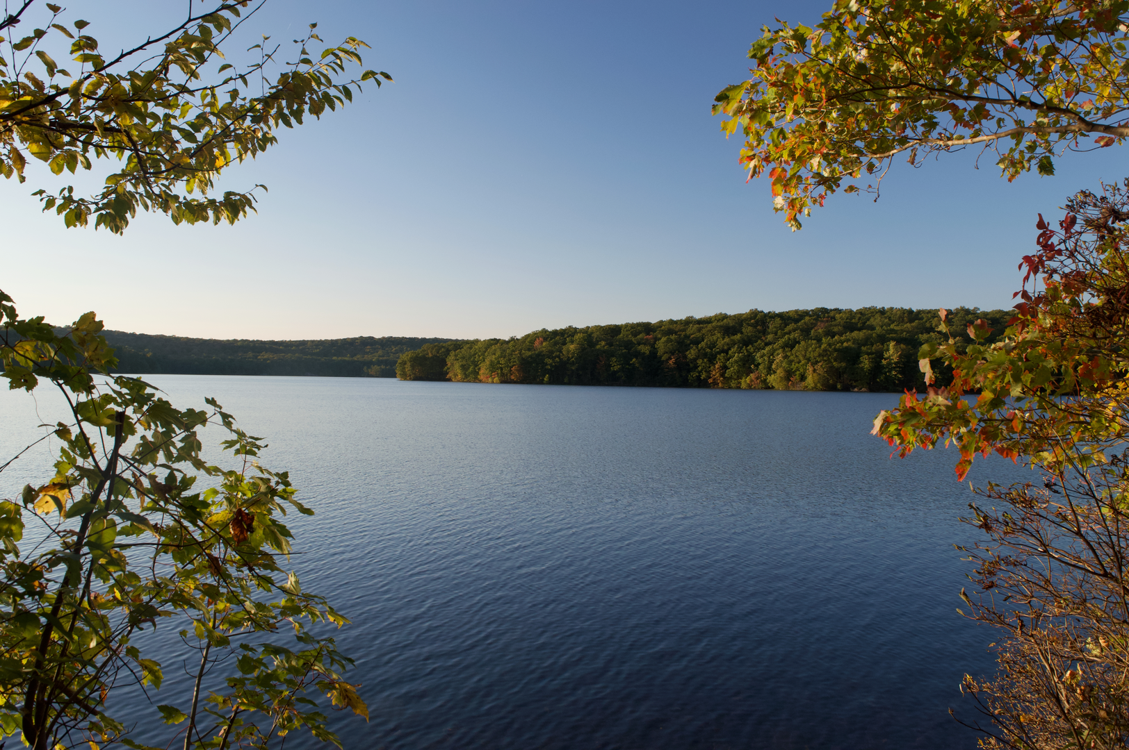
8.5–11.5 km (5.3–7.1 mi) | Reservoir views and easier grades (mostly level/descending)
Dropping off the ridge, you’ll transition back to smoother tread and begin skirting the Clinton Reservoir area. Water levels can vary seasonally, changing how “open” the shoreline feels. This section is typically the most relaxing: long, steady walking with frequent glimpses of water through the trees.
11.5–13.0 km (7.1–8.1 mi) | Return through forest connectors, small rollers
The final stretch tends to be straightforward, but junction density can increase again. If you’re tired, this is where wrong turns happen—double-check the last few intersections in HiiKER and keep an eye out for blaze changes.
Nature and wildlife to look out for
This part of northern New Jersey sits in a classic Appalachian Highlands landscape: glacially influenced terrain, rocky ridges, and abundant surface water. Typical sightings/sign include: - White-tailed deer (often at dawn/dusk near water) - Black bear presence (tracks/scat are possible; sightings

Surfaces
Ground
Unknown
Dirt
Wood
Unpaved
Comments and Reviews
User comments, reviews and discussions about the Hanks Pond and Clinton Reservoir via Fire Tower Ridge Trail and Bearfort Waters - Clinton, New Jersey.
average rating out of 5
0 rating(s)