Download
3D Flyover
Add to list
More
6.1 km
~1 hrs 12 min
0 m
Loop
“Wander a peninsula where shady maritime woods give way to salt-marsh vistas between two bays.”
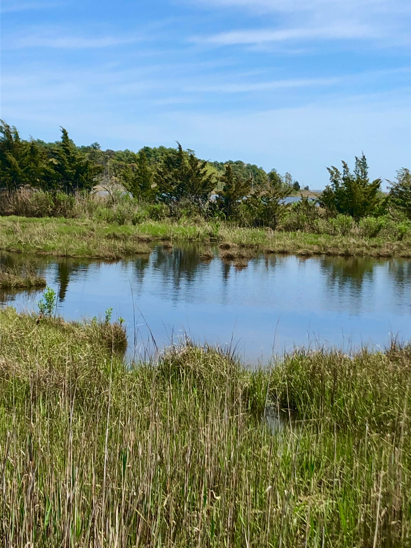
You’ll be walking a flat, coastal-woods loop on a peninsula that splits Silver Bay from Barnegat Bay—a mix of shady maritime forest, open salt marsh, and a few bay-edge viewpoints that feel surprisingly wild for how close they are to neighborhoods. The “Long Loop” here typically strings together several color-blazed paths into roughly 6 km (3.7 mi) with essentially 0 m (0 ft) of climbing—easy on the lungs, but expect a few short sandy or rooty stretches that can slow the pace.
Nearest known start point / landmark (trailhead) Most hikers start from the main park parking area by the Cooper Environmental Center at Cattus Island County Park, 1170 Cattus Island Blvd, Toms River, NJ 08753. (oceancountyparks.org)
Getting to the start (car + public transport)
By car: From NJ Route 37 in Toms River, head north on Fischer Blvd, then follow signs/turns toward Cattus Island Blvd to the county park entrance and the main lot by the environmental center. Parking is typically straightforward outside peak weekend midday. (pinelandsalliance.org)
By public transport: Toms River’s local bus service is Ocean Ride (Ocean County). Routes and schedules change, so the practical approach is to use Ocean Ride to reach the Fischer Blvd / Route 37 area or central Toms River, then plan a short rideshare/taxi to the park (there usually isn’t a stop right at the trailhead). Check the current Ocean Ride route map/timetables before you go. (co.ocean.nj.us)
What the loop is like underfoot (and how to navigate it)
The park’s trail network is well-established and mostly level, with frequent junctions where multiple blazed routes intersect. Use HiiKER to confirm you’re staying on the longer circuit rather than accidentally taking one of the shorter loops (many individual loops here are closer to ~2.5–4 km / 1.5–2.5 mi). (hiiker.app)
Surface is typically: - Packed sand/soil through maritime woods - Rooty, slightly uneven singletrack in places - Boardwalk or firm edges near wetter marsh margins (where present), plus occasional muddy patches after rain or high tides
Because the elevation gain is negligible, the main “effort” variables are wind exposure along the bay/marsh edges and trail dampness in low spots.
Landmarks, scenery, and the best “pay attention” moments
Early on, you’ll be in maritime forest—a coastal woodland shaped by salt air and storms. As the loop swings outward, the scenery opens into salt marsh and bay-edge views. Cattus Island is known for having multiple ecosystems close together, including maritime forest and extensive marsh, with pockets of boggy/wetland habitat on the upland edges. (en.wikipedia.org)
Key moments to look for: - Marsh overlooks and tidal creeks: These are the most photogenic spots and also where footing can be slick if the trail edge is damp. - Bay-side openings: Wind can be stronger here than in the woods; in cooler months it can feel noticeably colder than the parking lot. - Junction clusters: Several intersections come close together; confirm your next turn on HiiKER before you stride through.
Nature and wildlife to expect (and what to look out for)
This is a strong birding walk—salt marsh and bay edges attract waders and raptors, and the wooded sections hold songbirds. The park is widely regarded as a good spring/early-summer birding location with marsh and bay habitat. (birdforum.net)
Common, practical cautions: - Ticks: Coastal NJ woods and brushy edges can have ticks much of the year—use repellent, stay centered on trail, and do a post-hike check. - Mosquitoes/biting flies: Marsh-adjacent sections can be buggy, especially on warm, still days. - Poison ivy: Often lines sunny trail edges and junction clearings. - Seasonal wet spots: After heavy rain or during very high tides, low areas near marsh margins can

Surfaces
Unpaved
Unknown
Sand
Dirt
Asphalt
Comments and Reviews
User comments, reviews and discussions about the Cattus Island Long Loop, New Jersey.
average rating out of 5
0 rating(s)