Download
3D Flyover
Add to list
More
6.1 km
~1 hrs 13 min
0 m
Out and Back
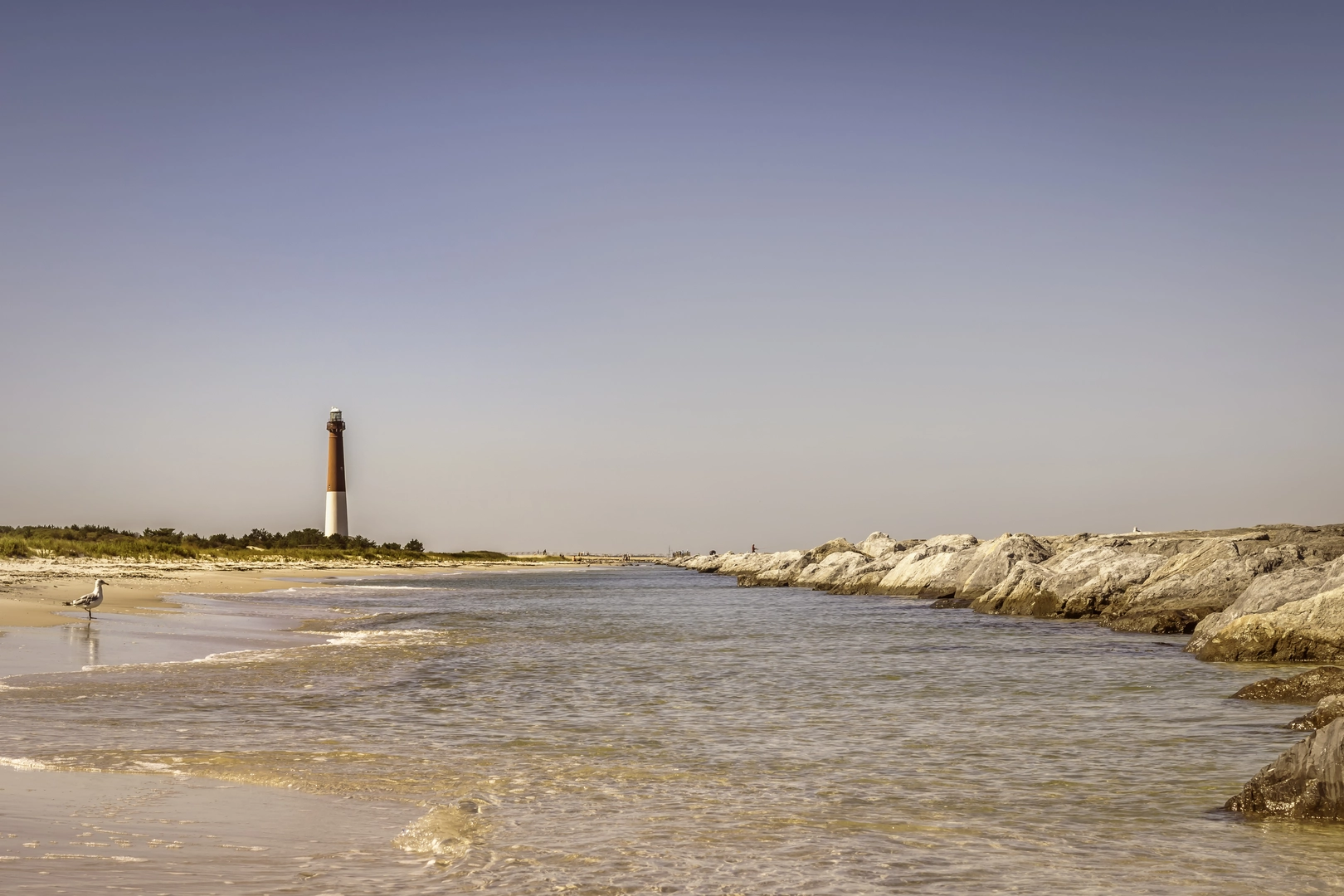
“Stroll from Old Barney into wind-swept dunes and surf, where seabirds and shifting sands set the pace.”
This is a short, flat coastal walk of about 6 km (3.7 mi) with essentially 0 m (0 ft) of climbing—ideal for a relaxed out-and-back or a point-to-point if you arrange a pickup. Expect sand, boardwalk/paved path, and exposed shoreline with constant wind off the Atlantic, plus a few short sections where soft sand can slow your pace.
Getting to the start (car + public transport)
Because the start point wasn’t fully provided (“Hike head: near …”), the most practical, well-known access for an “Ocean View” approach to Barnegat Inlet is from the Barnegat Lighthouse State Park area in Barnegat Light, NJ, near Barnegat Lighthouse (Old Barney) at the north end of Long Beach Island. A reliable “nearest landmark” to aim for is:
- Barnegat Lighthouse State Park / Barnegat Lighthouse, 208 Broadway, Barnegat Light, NJ 08006 (significant landmark and common trailhead area)
By car:
Drive onto Long Beach Island via NJ-72 (Manahawkin Bay Bridge), then continue north on Long Beach Blvd to Barnegat Light. Parking is typically available around the state park lots and nearby streets (seasonal restrictions are common—check posted signs when you arrive).
By public transport:
Public transit to the far north end of Long Beach Island can be limited and seasonal. The usual approach is:
- Bus service toward Manahawkin / Stafford Township (mainland) and then a taxi/rideshare to Barnegat Light. If you’re planning a weekend/summer trip, verify the current bus routes and schedules before committing, since service patterns can change.
What the route feels like underfoot
Most of this hike is flat and exposed. Even with “no elevation gain,” you’ll feel effort from: - Soft sand (especially if you choose to walk closer to the waterline or cross dune access points) - Headwinds (common here; they can make the return leg feel longer) - Sun exposure (very little shade)
Plan on 1.5–2.5 hours depending on stops, wind, and how much sand you take on.
Key landmarks and how the 6 km (3.7 mi) typically breaks down
Distances below are approximate and meant to help you pace the walk.
0.0–1.0 km (0.0–0.6 mi): Lighthouse and jetty approach
Starting near Barnegat Lighthouse, you’ll quickly pick up coastal views and the “working waterfront” feel of the inlet area. The lighthouse itself is one of the most prominent landmarks on the New Jersey shore—built to guide vessels around the hazardous shoals and shifting sands at the inlet. The terrain here is usually firm (paved/packed surfaces), with frequent side views to dunes and beach vegetation.
1.0–3.0 km (0.6–1.9 mi): Inlet edge, dunes, and open ocean views
This is the most scenic stretch: wide Atlantic views, constant seabird activity, and the sound of surf. You’ll likely pass dune fencing and protected vegetation zones—stay on established paths to avoid trampling fragile dune plants that stabilize the shoreline.
3.0 km (1.9 mi): Turnaround / inlet viewpoint
At roughly the halfway point (if you’re doing an out-and-back), you’ll reach a strong “destination” feel: the inlet’s meeting of ocean and bay currents, often with visible turbulence, shifting sandbars, and fishing activity. This is a good spot for a break, photos, and a quick gear check before heading back into the wind.
3.0–6.0 km (1.9–3.7 mi): Return the way you came
The return is straightforward navigation-wise, but it’s where wind and sun exposure add up. If the wind is at your back on the way out, expect it in your face coming back.
Navigation (keep it simple)
Cell service is usually decent on Long Beach Island, but don’t rely on it. Download the route in HiiKER ahead of time so you can follow the correct access points and avoid wandering into closed dune-protection areas or dead-end beach cuts.
Nature and wildlife to look for
This area sits within a classic Mid-Atlantic barrier-island ecosystem:
- Dune plants: American beachgrass and other salt-tolerant vegetation that anchors dunes. These areas are easily damaged—stick to marked walkovers and paths.
- Birdlife: Expect gulls, terns, and shorebirds; during migration you may see larger mixed flocks moving along the coast. Protected nesting areas may be roped off in warmer months.
- Marine life: Depending on season and surf conditions, you may spot dolphins offshore. At the inlet, fish activity can attract birds and anglers.
- Insects: On calmer days, especially near dune vegetation, biting flies and mosquitoes can appear—more likely around dawn/dusk.
Conditions and hazards to plan around
- Wind exposure: Bring a light wind layer even on warm days; the inlet can feel significantly cooler than inland.
- Sun reflection: Sand and water amplify UV. Sunglasses and sunscreen matter here more than on wooded trails.
- Soft sand + ankle stability: If you spend time on uneven sand, consider supportive footwear. Even “easy” flat walks can cause ankle fatigue on sloped beach edges.
- Tides and wave run-up: If you choose to walk close to the waterline, be aware that higher tide and wave sets can narrow the firm-sand corridor

Surfaces
Sand
Unknown
Comments and Reviews
User comments, reviews and discussions about the Barnegat Inlet via Ocean View Trail, New Jersey.
average rating out of 5
0 rating(s)