
Download
3D Flyover
Add to list
More
7.7 km
~1 hrs 43 min
108 m
Loop
“Follow purple-to-white blazes through glowing hardwoods to a modest high point, mud permitting.”
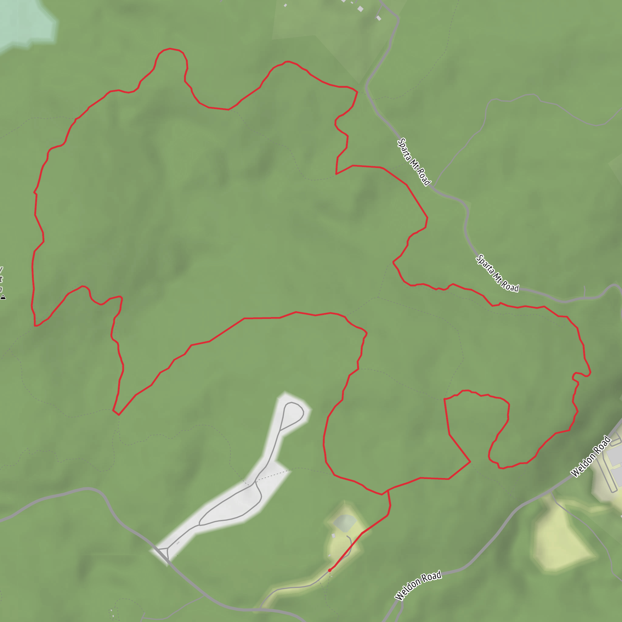
This easy out-and-back/loop-style walk (depending on how you connect the colored blazes) climbs gently—about 8 km / 5.0 mi total with roughly 100 m / 330 ft of gain—through classic Morris County hardwood forest to one of the area’s local “high points.” Expect mostly well-packed dirt with short rocky patches, a few rooty sections, and a couple of potentially muddy low spots after rain.
Getting to the start (car + public transport)
Because the start is listed only as “near,” the most reliable way to pinpoint the exact trailhead is to open the route in HiiKER and use the “navigate to start” function; once you share the start coordinates (or a map pin), I can convert them to the nearest street address or named landmark.
By car (typical approach in Morris County, NJ): - Aim for the nearest signed trailhead parking area associated with the preserve/park that contains the Purple and White blazed trails. In this part of New Jersey, parking is often a small gravel lot or roadside pull-off with a kiosk. - Arrive early on weekends—Morris County trailheads can fill quickly, especially in fall foliage season.
By public transport (typical approach): - Many Morris County hikes are reachable by NJ Transit rail into Morristown, Madison, Dover, Boonton, or Mount Arlington, then a short rideshare/taxi to the trailhead. - If you tell me which town you’re coming from (or share the start point), I can suggest the most practical station and last-mile plan.
What the route feels like underfoot
From the trailhead, the Purple Trail usually serves as the “approach” segment: a comfortable warm-up on rolling terrain where the grade stays friendly and the elevation gain is spread out rather than concentrated. Over the first 1–2 km (0.6–1.2 mi) you’ll likely notice: - Hardwood canopy (oak, maple, hickory) with seasonal changes: spring wildflowers, dense summer green, and strong autumn color. - Short, rocky steps where the trail crosses glacially scattered stones—common across the New Jersey Highlands and adjacent ridges. - Drainage dips that can hold water; after storms, expect mud and consider waterproof footwear.
As you transition toward the White Trail, the walking often becomes a touch more “ridge-like”—still easy, but with slightly more rock underfoot and a clearer sense of climbing toward the high point. The steepest bits on hikes like this are usually brief: think 30–90 seconds of a firmer push rather than a sustained ascent.
Landmarks, nature, and wildlife to watch for
Even on a modest “high point” hike, the payoff is often in the small features along the way:
Forest and plants - Spring: ephemeral wildflowers (trout lily, spring beauty, violets) appear before the canopy fully leafs out. - Summer: ferns and understory shrubs thicken; ticks are more active—long pants and repellent help. - Fall: leaf litter can hide rocks and roots; step carefully on descents.
Wildlife - White-tailed deer are common; you may also see signs of fox or coyote (tracks/scat). - Songbirds and woodpeckers are frequent in mixed hardwood stands. - In warmer months, watch for black bears in parts of Morris County—rarely an issue if you keep food secured and give wildlife space. - Snakes (often non-venomous) may sun on warm rocks; step onto rocks rather than over them when visibility is limited.
Navigation and staying on route
Blazed-trail networks can have frequent junctions. Use HiiKER to: - Confirm each turn where Purple meets White (and any connector paths). - Check that your heading matches the intended direction after intersections—especially if there are unblazed side paths or old woods roads.
A good rule here: if you go more than 200–300 m (0.1–0.2 mi) without seeing the expected blaze color, pause and verify in HiiKER before continuing.
Terrain, pacing, and effort (easy doesn’t mean “no prep”)
With ~100 m / 330 ft of gain over 8 km / 5.0 mi, most hikers finish in 2–3 hours at a relaxed pace including short stops. Plan for: - Footing variability: easy grades, but occasional rocks/roots. - Seasonal mud/ice: in late fall through early spring, shaded sections can hold ice even when trailheads are clear. Light traction can be useful after freeze–thaw cycles. - Hydration: bring at least 0.5–1 L per person for mild weather; more in summer humidity.
Regional context and historical significance
Morris County sits within a landscape shaped by glaciation—the “rocky, bouldery” feel of many local trails comes from glacial deposits and scoured bedrock. Historically, the county is closely tied to the American Revolutionary War era, with Morristown serving as a major Continental Army winter encampment area and the broader region supporting ironworks, farming, and later suburban growth. Even when a specific trail doesn’t pass a marked historic site, you’re walking in a corridor where old property lines, stone piles/walls, and legacy woods roads often reflect centuries of land use.
What to bring and what to look out for
- Footwear: trail runners are fine in dry conditions; choose hiking
Surfaces
Dirt
Ground
Unpaved
Unknown
Comments and Reviews
User comments, reviews and discussions about the Morris County High Point via Purple Trail and White Trail, New Jersey.
average rating out of 5
0 rating(s)
