Download
3D Flyover
Add to list
More
10.7 km
~2 hrs 27 min
190 m
Point-to-Point
“Drift beside the Lamington’s murmuring bends through leafy woods, with easy escapes and occasional slick mud.”
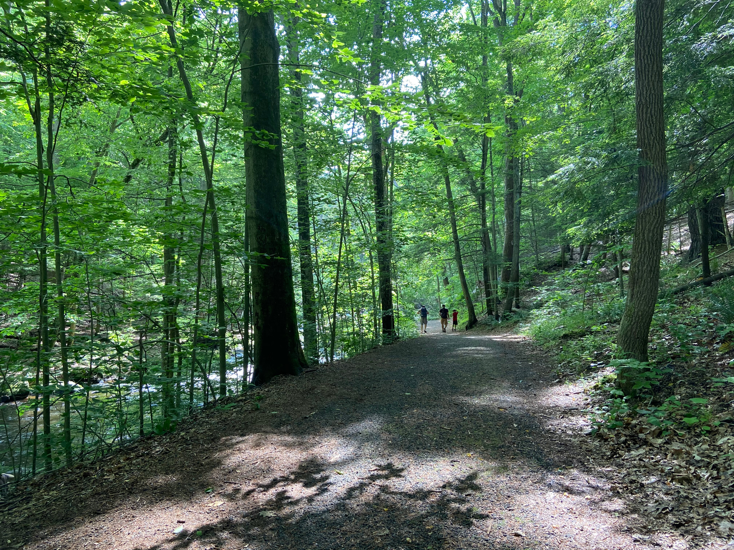
This is a relaxed riverside-and-woods walk with frequent access to the Lamington River, gentle grades, and lots of “bail-out” points where you can shorten the day. At roughly 11 km (6.8 mi) with about 200 m (656 ft) of total climbing, it suits newer hikers, families, and anyone looking for a low-stress outing—just plan for a few potentially muddy or slick spots near the water.
Getting to the start (car + public transport)
Because the hike head location is incomplete (“near …”) and no coordinates were provided, the most reliable way to plan is to anchor your start to the Patriot’s Path / Lamington River corridor in Morris County, New Jersey, where Patriot’s Path commonly parallels the river through parkland and preserves.
- By car: A typical, convenient access point for this corridor is near Morristown National Historical Park / Jockey Hollow area (a major, well-signed landmark with multiple nearby trail access points and parking areas). Use HiiKER to select the exact Patriot’s Path trailhead/parking pin that matches your intended segment and confirm parking rules (some lots are day-use only, and some close at dusk).
- By public transport: The most common transit hub for this area is Morristown Station (NJ Transit Morris & Essex Line). From there, you can use local rideshare/taxi to reach the nearest Patriot’s Path access point, or (depending on the exact segment you choose in HiiKER) walk to a trail connection if it’s within a couple miles.
If you share the lon/lat for your intended start, I can convert it to the nearest known address or landmark and tailor the directions precisely.
What to expect on the route You’ll generally be moving through a mix of riparian woodland (right along the river), mixed hardwood forest, and occasional open park edges. The tread is usually straightforward—packed dirt, leaf litter, and short gravelly stretches—making it a good “cruise” hike, but the river-adjacent sections can change character after rain.
- 0–2 km (0–1.2 mi): A gentle warm-up on easy grades, often under tree cover. Expect a few small rises (short, low-effort climbs) as the path weaves around low spots and drainage.
- 2–6 km (1.2–3.7 mi): The most “Lamington River” feeling portion—more frequent views and sounds of moving water, with side paths and informal openings where people sometimes step closer to the bank. This is where you’ll most notice mud after wet weather.
- 6–9 km (3.7–5.6 mi): A slightly more rolling section where the cumulative elevation gain adds up—still easy, but you’ll feel a few longer gentle inclines. Watch for intersections with other local trails; keep an eye on HiiKER here so you stay on the intended Patriot’s Path line.
- 9–11 km (5.6–6.8 mi): A mellow finish, typically easing back toward more developed park edges or a clearer trailhead approach, depending on your chosen start/end points.
Landmarks, scenery, and natural highlights
- Lamington River corridor: The river is the star—expect shaded banks, small bends, and occasional wider, calmer pools. In warmer months, the river corridor can feel noticeably cooler than nearby open areas.
- Forest character: Look for classic northeastern hardwoods—oak, maple, beech—plus denser understory near wetter ground. In spring and early summer, the edges can be lush with ferns and low shrubs.
- Seasonal color: Fall can be especially scenic here, with strong leaf color and clearer sightlines through the woods once leaves drop.
Wildlife and what to look out for
You’re in a corridor that commonly supports a lot of everyday New Jersey wildlife activity:
- Birdlife: Songbirds in the canopy and along the river; you may also spot larger birds cruising above the water corridor.
- Mammals: White-tailed deer are common; smaller mammals are often heard more than seen.
- Ticks: This is a key practical concern in wooded, brushy, and river-edge environments. Wear long socks/pants if you can, use repellent, and do a thorough tick check after the hike—especially in late spring through fall.
- Poison ivy: Often present along sunny edges and at trail margins; stay centered on the tread where possible.
Trail conditions and difficulty notes Even with an “Easy” rating, a few conditions can change the feel of the hike:
- Mud and slick roots: After rain, the river-adjacent tread can hold water. Roots and flat rocks near the bank can be slick—take shorter steps and slow down in shaded damp sections.
- Minor erosion and puddling: Expect occasional uneven footing where water drains across the trail.
- Navigation at junctions: Patriot’s Path segments can intersect with local connectors. Keep HiiKER open and confirm you’re following the correct branch at each multi-trail junction.
Historical significance of the region This part of northern New Jersey is closely tied to Revolutionary War-era history, especially around Morristown and the surrounding parklands. The broader area includes sites associated with Continental Army winter encampments and the logistical landscape of the war. Even if your exact Patriot’s Path segment stays closer to the river corridor, you’re hiking in a region where trails and roads often trace long-used travel routes through the Highlands and valleys.
Planning and gear for an easy 11 km (6.8 mi) day - Time: Many hikers will take **2.

Surfaces
Unknown
Dirt
Comments and Reviews
User comments, reviews and discussions about the Lamington River via Patriot's Path, New Jersey.
average rating out of 5
0 rating(s)