
Download
3D Flyover
Add to list
More
5.8 km
~1 hrs 14 min
58 m
Loop
“Wander Cheesequake’s mosaic—pine, hardwood, and salt-kissed wetlands—over gentle rollers and rooty, puddled edges.”
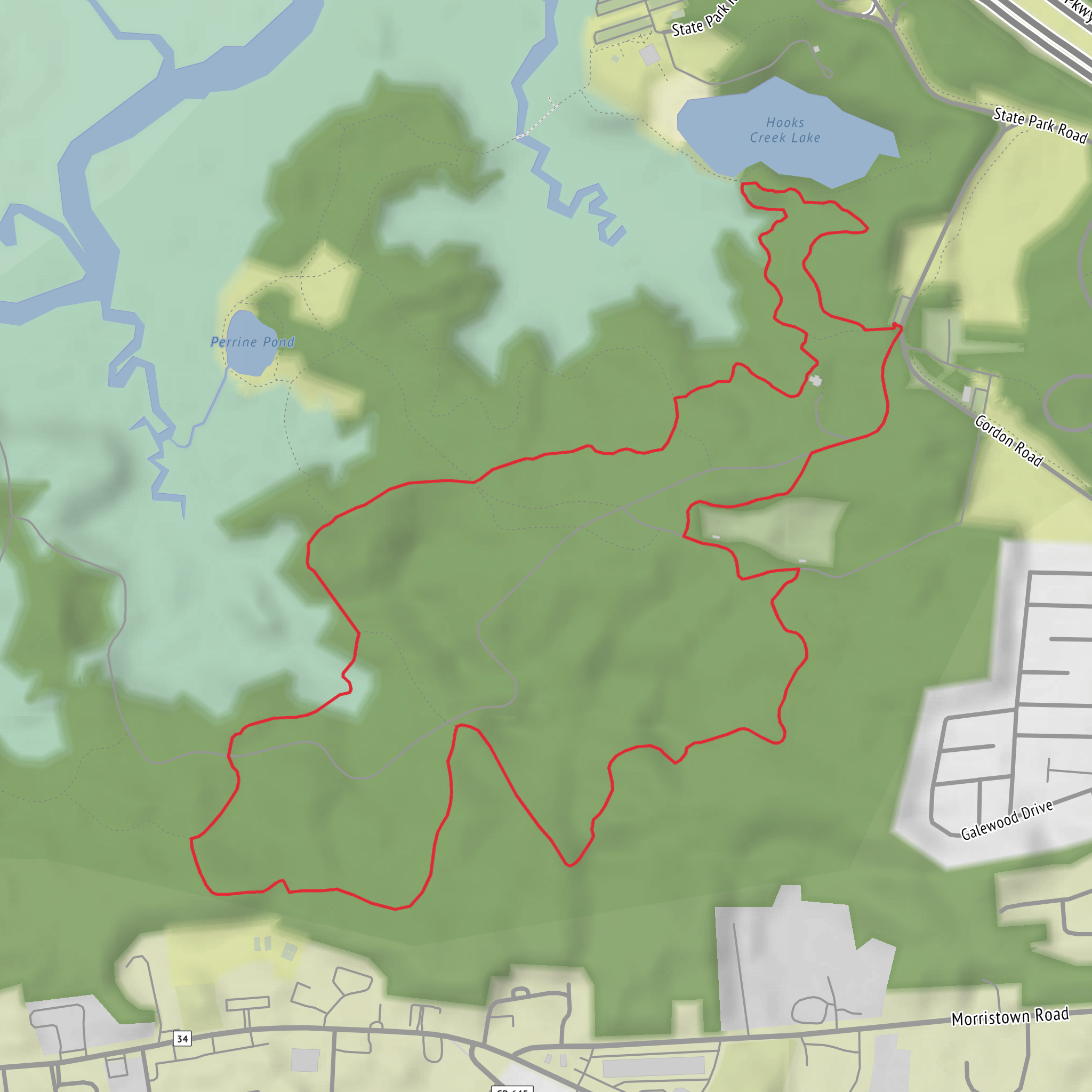
This easy loop is a great sampler of Cheesequake’s “edge-of-ecosystems” landscape—where coastal plain forest, swampy lowlands, and salt-influenced habitats sit unusually close together. Expect a mostly well-defined, blazed path with gentle ups and downs, totaling about 6 km (3.7 mi) and roughly 100 m (330 ft) of climbing spread out in short rises rather than one sustained hill.
Getting to the start (and where “near” usually means here) - By car: Most hikers begin from the main day-use area at Cheesequake State Park, commonly using parking near the trailhead kiosks by the park’s main facilities/picnic area (the same general area that serves multiple marked trails). If you’re navigating, pull up the Green Loop on HiiKER and match the loop’s start point to the nearest official parking/trailhead shown there; the park has several access points and it’s easy to start on the “right trail” from the “wrong lot” if you don’t confirm the exact junctions. - By public transport: Transit options exist in the broader Old Bridge/Matawan area, but service patterns and the last-mile walk can vary a lot. The most reliable approach is to take rail/bus to the Matawan–Aberdeen area and then use a rideshare/taxi for the final leg to Cheesequake State Park’s main entrance/day-use area. Use HiiKER to identify the closest trailhead parking to the loop you plan to follow so you’re not adding extra road-walking.
What the tread feels like You’ll be on a mix of packed dirt, pine needles, and occasional sandy patches typical of New Jersey coastal plain trails. After rain, low sections can hold water—expect muddy spots and shallow puddling in the flatter, darker-soil areas. Roots are the most common “trip hazard,” especially where the trail threads through older hardwoods. The elevation gain is modest, but there are a few short rises that can feel steeper if the footing is loose or damp.
Key waypoints and landmarks along the loop
Distances below are approximate and assume a typical start from the main day-use/trailhead area:
0.0–1.0 km (0.0–0.6 mi): Settling into the forest Early on, the trail usually feels wide and friendly, with clear blazing at junctions. You’ll likely pass through mixed woods—oak and other hardwoods—before the character shifts toward more pine and scrubby coastal-plain vegetation. This is a good stretch to confirm you’re on the correct color blazes and that your loop direction matches what you planned on HiiKER.
1.0–2.5 km (0.6–1.6 mi): Lowland edges and wetter ground This is where you’re most likely to encounter soft ground, especially after wet weather. Watch for:
- Mosquitoes and ticks in warm months (long socks and repellent help).
- Short, slick rooty sections where the trail skirts damp hollows.
- Frogs and turtles near wetter pockets; give them space and watch your step.
2.5–4.5 km (1.6–2.8 mi): The “Cheesequake transition zone” feel Cheesequake is known for sitting near a natural transition between ecological regions, and on this loop you can often notice subtle changes—different understory plants, shifts from hardwood shade to brighter piney stretches, and occasional openings where wind and salt influence can be felt in the vegetation. Keep an eye out for:
- Songbirds and woodpeckers in the canopy.
- Deer moving quietly through the understory (most active early/late).
- Raptors circling above clearer patches.
4.5–6.0 km (2.8–3.7 mi): Gentle return with small rises The final portion typically rolls back toward the busier day-use area. You may cross or parallel other marked trails—junction density increases closer to facilities—so this is where it’s easiest to accidentally “shortcut” onto a different color. If you want to keep the loop true to plan, check the next junction on HiiKER before you commit.
Navigation and staying on the Green Loop
Cheesequake has multiple intersecting trails, and the Green Loop can share corridors or meet other routes at several points. The simplest strategy: - At every junction, pause and confirm blaze color and direction. - Use HiiKER to verify the next landmark/junction distance so you can catch a wrong turn quickly (wrong turns here often feel “reasonable” for a while).
Wildlife and what to look out for - Ticks: Common in New Jersey woods from spring through fall. Do a full tick check after the hike. - Mosquitoes/biting flies: Especially near wetter sections in warm months. - Snakes: You may see non-venomous species basking on warm days; give them room and step carefully over logs. - Poison ivy: Very common along trail edges—avoid brushing against shiny three-leaf clusters.
Seasonal expectations - Spring: Wettest footing; best wildflower and bird activity; more insects as temperatures rise. - Summer: Hotter and more humid; bring more water than you think you’ll need for a “short easy loop.” - Fall: Often the best conditions—cooler air, fewer bugs, and strong color in hardwood sections. - Winter: Can be icy in shaded low spots;
Surfaces
Unpaved
Unknown
Asphalt
Comments and Reviews
User comments, reviews and discussions about the Green Loop Trail in Cheesequake State Park, New Jersey.
average rating out of 5
0 rating(s)

