Download
3D Flyover
Add to list
More
53.5 km
~2 days
687 m
Multi-Day
“Embark on the Lenape Trail for a 33-mile historical and natural odyssey through New Jersey's urban and forested landscapes.”
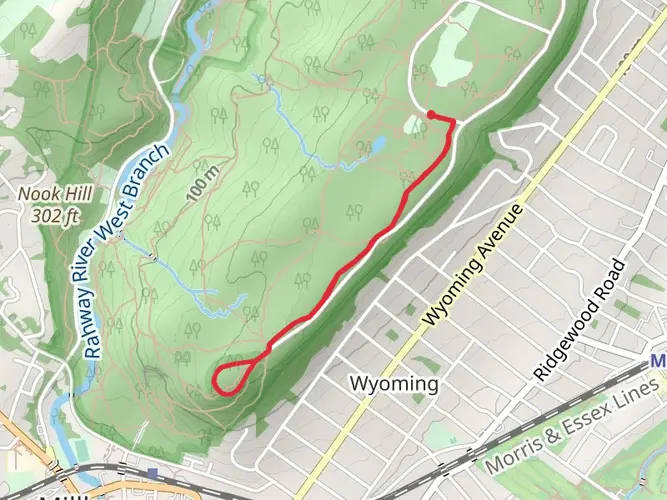
The Lenape Trail is a moderately challenging, point-to-point trek that spans approximately 53 kilometers (about 33 miles) with an elevation gain of around 600 meters (roughly 1,968 feet). This trail offers a diverse experience as it winds through the suburban and urban landscapes of Essex County, New Jersey, while also providing pockets of natural beauty and solitude.
Getting to the Trailhead
The starting point of the Lenape Trail is located near the intersection of Bloomfield Avenue and Lakeside Avenue in Verona, New Jersey, close to the Essex County Environmental Center. For those opting for public transportation, NJ Transit buses serve the area, and the nearest bus stop is a short walk from the trailhead. If driving, parking is available at the Environmental Center or in nearby public parking areas.
Navigating the Trail
As you embark on the Lenape Trail, you can rely on the HiiKER app for detailed navigation and mapping. The trail is marked with yellow blazes that guide you through various parks and preserves. Early on, you'll traverse the forested paths of the Eagle Rock Reservation, which offers a stunning overlook of the New York City skyline, a sight especially breathtaking during sunrise or sunset.
Historical Significance and Landmarks
The Lenape Trail is named after the Lenape Native Americans, who originally inhabited the area. As you hike, you'll encounter landmarks that reflect the region's history, such as the Mayapple Hill, which provides a serene setting and a glimpse into the past with its old stone walls and foundations.
Natural Features and Wildlife
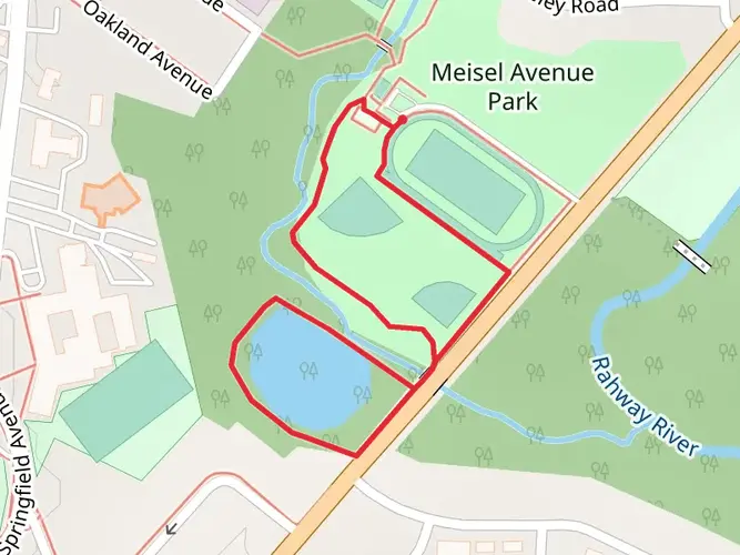
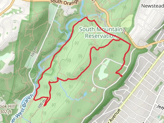
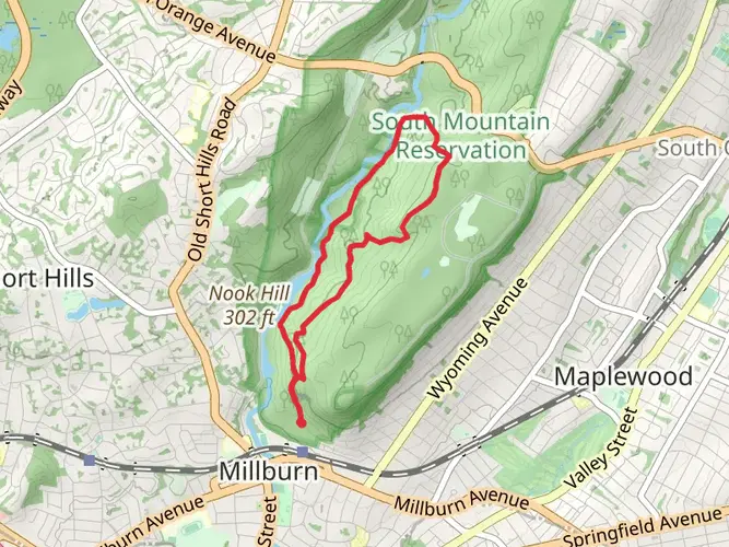
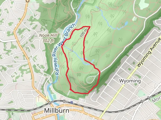
The trail meanders through a mix of terrains, including dense woodlands, wetlands, and open meadows. Wildlife sightings are common, with deer, foxes, and a variety of bird species inhabiting the area. The South Mountain Reservation section of the trail is particularly rich in natural beauty, featuring hemlock groves, streams, and the dramatic Hemlock Falls.
Challenges and Considerations
While the Lenape Trail is rated medium in difficulty, it's important to be prepared for some challenging sections, particularly where the trail crosses urban areas and requires careful navigation across streets and through neighborhoods. The elevation gain is gradual but can be taxing over the distance, so ensure you have adequate water and snacks.
Seasonal Variations
The trail offers a different experience with each season. Spring brings wildflowers and lush greenery, while autumn boasts a spectacular display of fall foliage. Winter hiking can be serene, though snow and ice may require additional gear such as microspikes. Summer offers full canopies of leaves, but be prepared for heat and humidity.
End of the Trail
The Lenape Trail concludes at the southern end of Branch Brook Park, near the famous cherry blossom trees of Newark. This park is accessible by public transportation, making it convenient for hikers to return to their starting point or continue their journey into the city.

What to expect?
Activity types
Frequently asked questions
How long is the Lenape Trail in Essex County, New Jersey?
The Lenape Trail is 53.47 kilometers long, which is about 33.2 miles. It is a point-to-point route across Essex County with roughly 687 meters of elevation gain, so it is long enough for a full-day effort or a multi-day walk depending on pace.
How difficult is the Lenape Trail and is the Lenape Trail good for beginners?
The Lenape Trail is generally rated easy, but its total length makes it more demanding than the grade alone suggests. The route gains about 687 meters over 53.47 kilometers and passes through a mix of park paths, wooded sections, and urban-suburban connectors, so it suits beginners best when broken into shorter sections.
What parks and landmarks does the Lenape Trail pass through in Essex County?
The Lenape Trail links 18 parks across 11 Essex County municipalities and includes well-known sections in Eagle Rock Reservation, Brookdale Park, Branch Brook Park, Mills Reservation, and South Mountain Reservation. Notable sights along the route include the Eagle Rock overlook and 9/11 Memorial, plus broad wooded terrain in South Mountain Reservation.
Are the Lenape Trail blazes easy to follow on the Lenape Trail?
The Lenape Trail is marked with yellow blazes, and Essex County park pages identify it as a countywide urban-suburban route through multiple reservations and parks. Because it crosses both natural and developed areas, paying attention at road crossings and park junctions is important even though the trail has an established blaze color.
Where can you start the Lenape Trail and park for the Lenape Trail?
A common western starting area for the Lenape Trail is near Bloomfield Avenue and Lakeside Avenue in Verona, close to the Essex County Environmental Center. Parking is available in nearby county park areas, and several Lenape Trail segments also pass parks with their own access points, including Eagle Rock Reservation and Mills Reservation.
Can you use public transit to reach the Lenape Trail in Verona?
Yes. NJ Transit serves the Verona area, and Route 105 stops at Bloomfield Avenue and Lakeside Avenue in Verona, which is near a common Lenape Trail access point. Other parts of the trail are also reachable near developed park areas and Bloomfield Avenue corridor transit stops.
What is the best section of the Lenape Trail for views and scenery?
One of the standout scenic sections of the Lenape Trail is Eagle Rock Reservation, where the route passes the eastern edge of the park. That area is known for its overlook and Essex County 9/11 Memorial, with wide views toward the New York City skyline from the crest of the First Watchung Mountain.
Comments and Reviews
User comments, reviews and discussions about the Lenape Trail, New Jersey.
4.78
average rating out of 5
9 rating(s)