Download
3D Flyover
Add to list
More
13.1 km
~2 hrs 38 min
14 m
Loop
“Drift through pitch pine and oak beside tea-dark cedar pools, where soft sand slows calm miles.”
A flat, sandy Pine Barrens loop like this is all about steady forward progress through pitch pine and oak, tea-colored cedar water, and long stretches where the only “climbs” are gentle rises over old dunes and trail berms. At ~13 km / ~8.1 mi with roughly ~0 m / ~0 ft of gain, it’s a good fit for an easy day—just plan for soft footing that can feel slower than the distance suggests.
Getting to the start (car + public transport)
Because your start point is listed only as “near” (and no coordinates were provided), the most reliable way to pin down the exact trailhead/parking area is to open the route in HiiKER and use the trailhead it shows for the Batona / Mount Misery / Cranberry connection. If you share the lon/lat (or a HiiKER link), I can convert it to the nearest known address or landmark precisely.
By car (typical approach for this area): - Most hikers access this network via the Mount Misery area in Brendan T. Byrne State Forest (formerly Lebanon State Forest), using signed forest parking pull-offs near the Mount Misery trail system. Expect a sand/forest-road feel even when you’re close to paved roads—drive slowly and watch for deep sand at road edges.
By public transport (realistic expectations):
- Public transit is limited in the Pine Barrens. A workable strategy is usually:
1) take rail/bus to a nearby town with service (often along the NJ Transit Atlantic City Line corridor), then
2) use a rideshare/taxi the last miles to the forest trailhead.
- Cell coverage can be patchy once you’re in the trees, so arrange pickup times conservatively and screenshot key details from HiiKER before you lose signal.
What the hike feels like underfoot
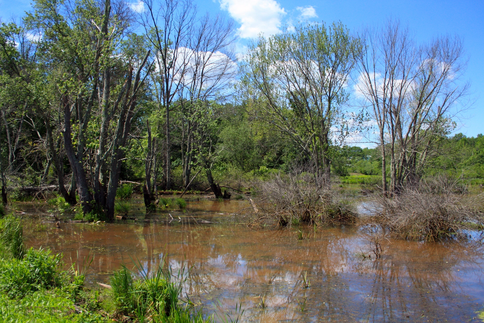
You’ll spend much of the day on sandy singletrack and pine-needle tread, with occasional wider, straighter segments that hint at old woods roads. Even with “no elevation,” the surface can be the main challenge: - Soft sand can sap energy; a relaxed pace helps. - After rain, low spots can hold water and turn into muddy, tea-stained puddles—the water often looks dark from tannins, not pollution. - Roots are generally less aggressive than in rocky regions, but you’ll still get ankle-catching pine roots in places where the trail narrows.
Route flow and key junctions (approximate)
Exact sequencing depends on where you start, but a common pattern for linking these three is: a Batona segment → a connector into Mount Misery trails → a return via Cranberry Trail (or the reverse). For planning purposes, expect something like:
- First 3–5 km / 1.9–3.1 mi: Settling into the Batona corridor—long, straight-ish stretches through pitch pine and scrub oak, with a quiet, “tunnel of green” feel in warmer months.
- Middle 4–6 km / 2.5–3.7 mi: The Mount Misery portion tends to feel more “trail-like” and winding, with subtle changes in vegetation where the soil moisture shifts.
- Final 3–5 km / 1.9–3.1 mi: Cranberry Trail often brings you back through classic Pine Barrens scenery—low, open understory, sandy tread, and occasional wetland edges.
Bring HiiKER for junction confidence: these forests can have multiple intersecting footpaths and old sand roads that look tempting but aren’t your route. The terrain is forgiving, but it’s easy to drift onto a parallel track if you’re chatting or moving fast.
Landmarks, ecology, and what to look for
This is prime New Jersey Pine Barrens country—nutrient-poor, sandy soils that support a distinctive community of plants and wildlife.
Plants and habitats - Pitch pine and oak dominate, with blueberry and huckleberry in the understory. - Near wetter pockets you may see Atlantic white cedar and sphagnumy ground—these transitions are subtle but noticeable in the plant mix and the cooler, damper air. - In late spring and summer, keep an eye out for carnivorous plants in appropriate wet, open areas (where present and protected). Stay on trail—these habitats are fragile.
Wildlife - Common sightings include white-tailed deer, wild turkey, and a lot of birdlife (woodpeckers are especially at home in pine stands). - You may encounter ticks in brushy edges and leaf litter—use repellent, do a full check afterward, and consider light-colored clothing to spot them. - Snakes are part of the ecosystem; most encounters are brief and non-problematic if you give space and watch where you place hands/feet near logs and sunny trail edges.
Historical significance of the region
The Pine Barrens landscape is shaped as much by people as by ecology: - The broader area is known for its historic “bog iron” and charcoal-era industry, where forests fed furnaces and small settlements rose and fell with resource booms. - Trails and straight sand roads often trace old access routes used for forestry, hunting, and moving goods through otherwise difficult terrain. - The Batona Trail itself is a well-known long-distance route through the Pinelands, connecting multiple forests and highlighting how this sandy, flat region can still feel remote.
Practical planning: timing, water, and gear
- Time: Easy effort for most hikers, but sandy tread can slow you. Many groups take 3–4.5 hours moving time for ~13 km

Surfaces
Unknown
Unpaved
Asphalt
Comments and Reviews
User comments, reviews and discussions about the Batona Trail, Mount Misery Trail and Cranberry Trail, New Jersey.
average rating out of 5
0 rating(s)