Download
3D Flyover
Add to list
More
46.0 km
~3 days
2444 m
Multi-Day
“Embark on the Pemi Loop's breathtaking odyssey through the White Mountains' peaks and historical wilderness.”
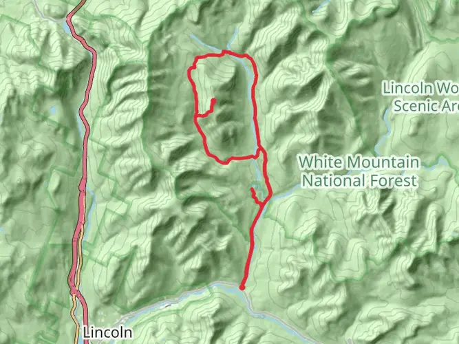
The Pemigewasset Loop, affectionately known as the Pemi Loop, is a challenging and rewarding trek nestled in the heart of the White Mountains of New Hampshire. This approximately 46 km (28.5 miles) loop trail, with an elevation gain of roughly 2400 meters (7,874 feet), is a favorite among experienced hikers for its stunning vistas and rigorous terrain.
Getting to the Trailhead
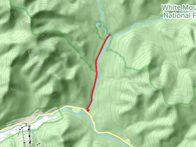
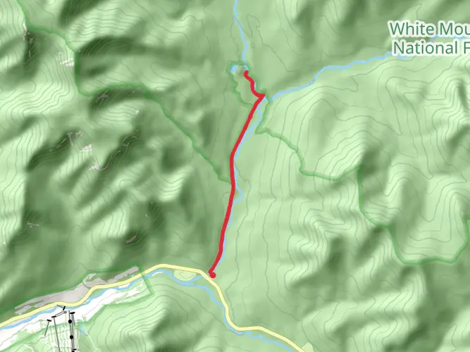
To begin your adventure on the Pemi Loop, you'll want to make your way to the Lincoln Woods Trailhead, which is accessible by car. The trailhead is located just off the Kancamagus Highway (NH-112), near Lincoln, New Hampshire. For those relying on public transportation, options are limited, but during the summer and fall, a shuttle service operates along the Kancamagus Highway, which can drop you near the trailhead. Parking is available at the Lincoln Woods Visitor Center, but be aware that it can fill up quickly during peak season, so an early start is advisable.
Navigating the Loop
As you embark on the loop, it's essential to have a reliable navigation tool like HiiKER to help you stay on track. The trail is well-marked with white blazes, but the complex network of intersecting paths in the White Mountains can be confusing, so a digital map can be invaluable.
Landmarks and Scenery
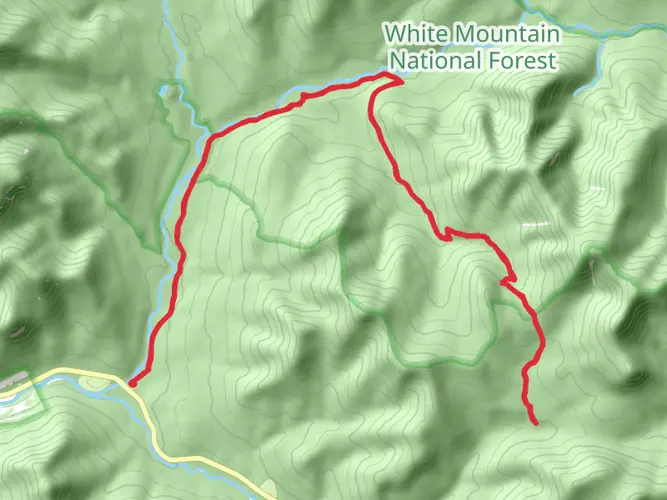
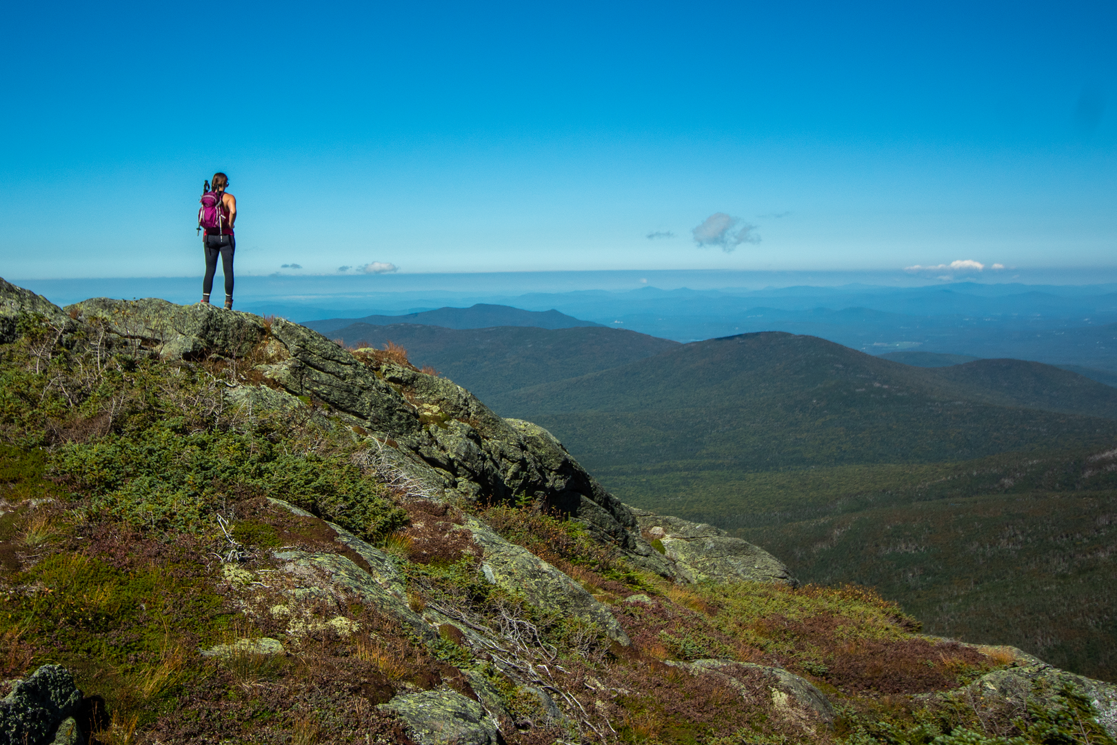
The Pemi Loop traverses some of the most rugged and beautiful parts of the White Mountains, including a series of prominent peaks known as the Franconia Ridge and the Bonds. The Franconia Ridge section offers breathtaking panoramic views and includes the summits of Mount Flume, Mount Liberty, Little Haystack, Mount Lincoln, and Mount Lafayette. This ridge walk is one of the most celebrated sections of the loop, with an elevation gain that will test your endurance.
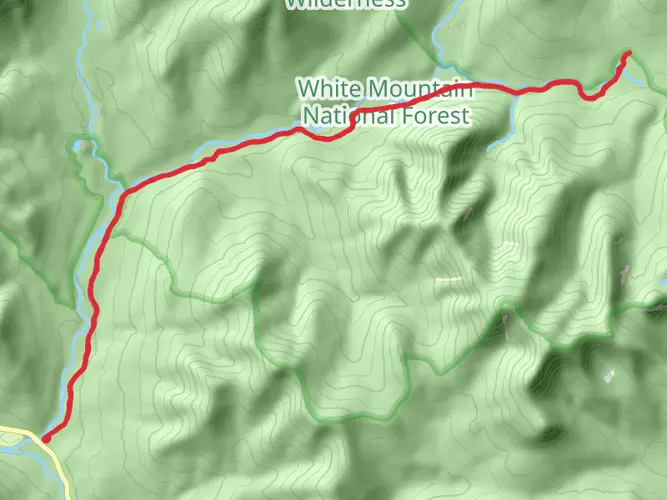
As you continue, you'll encounter the remote and serene wilderness of the Pemigewasset Wilderness, where the trail dips into deep forests and crosses pristine mountain streams. The ascent of Mount Garfield provides another highlight, with its unique summit offering expansive views of the surrounding peaks.
Further along, the trail brings you to the Bondcliff, an impressive cliff face that provides a dramatic backdrop for photos and a moment to take in the vastness of the wilderness. The final major peaks on the loop are Mount Bond and West Bond, which offer solitude and one last challenging climb before the descent.
Wildlife and Nature
The White Mountains are home to a diverse array of wildlife, including moose, black bears, and a variety of bird species. Hikers should be aware of their surroundings and know how to safely encounter wildlife. The region's flora is equally impressive, with dense forests of spruce and fir, and in the fall, a spectacular display of autumn foliage.
Historical Significance
The White Mountains have a rich history, with the Pemigewasset Wilderness being named after the Pemigewasset tribe of Native Americans. The area was also a hub for logging in the 19th and early 20th centuries, and remnants of old logging railroads can still be seen along some parts of the trail.
Preparation and Planning
Given the difficulty of the Pemi Loop, hikers should be well-prepared with proper gear, including sturdy hiking boots, weather-appropriate clothing, and enough food and water for the duration of the hike. It's also wise to check the weather forecast and trail conditions before setting out, as the weather in the White Mountains can be unpredictable.
The Pemigewasset Loop is a true gem in the Northeast, offering an unforgettable experience for those who take on its challenge. With its stunning peaks, lush forests, and rich history, it's a hike that epitomizes the rugged beauty of New Hampshire's wilderness.

What to expect?
Activity types
Frequently asked questions
How long is The Pemigewasset Loop and how much climbing does it involve?
The Pemigewasset Loop is 45.99 km, or about 28.5 miles, with 2,444 meters of elevation gain, roughly 8,018 feet. That combination makes it a serious White Mountains objective rather than a casual overnight, with long stretches of steep climbing and descending on exposed ridgeline terrain.
Where do most hikers start The Pemigewasset Loop in New Hampshire?
Most hikers begin The Pemigewasset Loop at Lincoln Woods Visitor Center on the Kancamagus Highway east of Lincoln. The trailhead has a parking area, a 180-foot suspension bridge, and flush toilets, and it is the standard access point for the classic loop into the Pemigewasset Wilderness.
Is parking available for The Pemigewasset Loop at Lincoln Woods?
Yes. Lincoln Woods Visitor Center has a dedicated parking area at the trailhead, about 5 miles east of Lincoln on NH-112. It is one of the main access points into the Pemigewasset Wilderness, so spaces can fill early on summer and fall weekends when hikers are heading for the Bonds, Franconia Ridge, and other major routes.
Can The Pemigewasset Loop be done as a day hike, or is it usually backpacked?
The Pemigewasset Loop can be done in a single very long day by exceptionally strong hikers, but its 45.99 km distance and 2,444 meters of ascent make it far more commonly tackled as a multi-day backpack. The route is rated Extra Difficult, and the sustained elevation change across the White Mountains is what pushes it beyond a typical day hike for most parties.
What are the main peaks and landmarks on The Pemigewasset Loop?
The classic Pemi Loop links some of the best-known high terrain in the White Mountains, including the Franconia Ridge section and the Bonds. Lincoln Woods is the usual southern access, and the route travels through the Pemigewasset Wilderness, a roughly 45,000-acre backcountry area in the center of White Mountain National Forest.
Are there places to stay overnight on The Pemigewasset Loop?
Yes. Common overnight options around The Pemigewasset Loop include AMC backcountry sites such as Liberty Springs, Garfield, and Guyot, and some itineraries also use Greenleaf Hut on the Franconia side. Those locations break up the loop into more manageable stages, which is useful on a route with nearly 46 km of travel and over 2,400 meters of climbing.
What is the best time of year to hike The Pemigewasset Loop?
The usual hiking season for The Pemigewasset Loop is late summer through early fall, when the high ridges are generally snow-free and daylight is longer. Conditions on Franconia Ridge and the Bonds are much more serious outside that window because the route is high, exposed, and subject to fast-changing White Mountains weather.
Comments and Reviews
User comments, reviews and discussions about the The Pemigewasset Loop, New Hampshire.
4.91
average rating out of 5
11 rating(s)