Download
3D Flyover
Add to list
More
12.7 km
~4 hrs 21 min
1096 m
Loop
“Conquer the thrilling Caps Ridge Trail loop, ascend Mount Jefferson, and revel in the White Mountains' rugged beauty and rich history.”
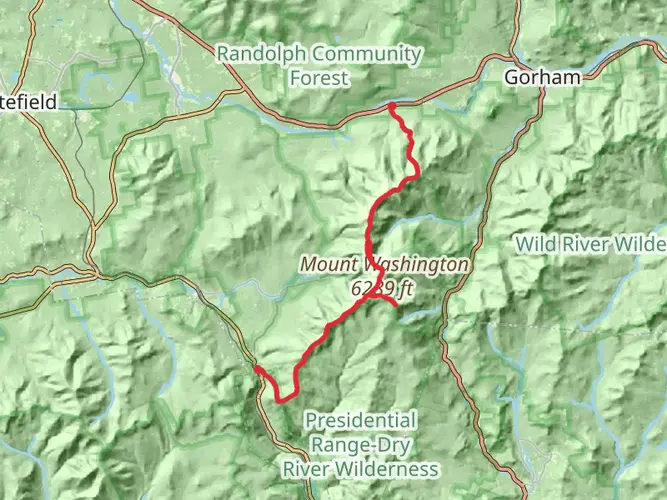
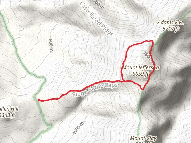
Embarking on the Mount Jefferson and Mount Clay Loop via Caps Ridge Trail presents an exhilarating journey through the rugged terrain of the White Mountains in New Hampshire. This approximately 13 km (8 miles) loop trail, with an elevation gain of around 1000 meters (3280 feet), offers hikers a challenging yet rewarding experience.
Getting to the Trailhead
The trailhead is accessible near Coos County, New Hampshire, and can be reached by car. From Jefferson, NH, take the Jefferson Notch Road, which is generally open from Memorial Day to the first significant snowfall. Parking is available at the Caps Ridge Trail parking area, which is the starting point for your hike. Public transportation options are limited in this region, so driving is the most feasible way to reach the trailhead.
The Caps Ridge Trail
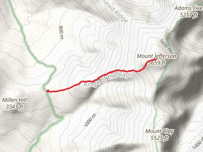
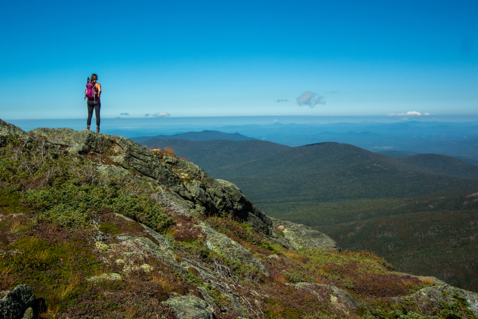
The adventure begins on the Caps Ridge Trail, known for its steep and rocky ascent. The trail quickly gains elevation, offering early views that become increasingly spectacular as you climb. The terrain here is rugged, with large boulders and rock scrambles that require careful navigation. Hikers should be prepared for exposed sections where the trail can be quite narrow and steep.
Mount Jefferson Ascent
As you approach Mount Jefferson, the third highest peak in New Hampshire, the trail becomes even more challenging. The final push to the summit involves some scrambling, where hikers should use caution, especially in wet or icy conditions. Upon reaching the summit of Mount Jefferson, at approximately 1.9 km (1.2 miles), you are rewarded with panoramic views of the Presidential Range and the Great Gulf Wilderness.
Traverse to Mount Clay
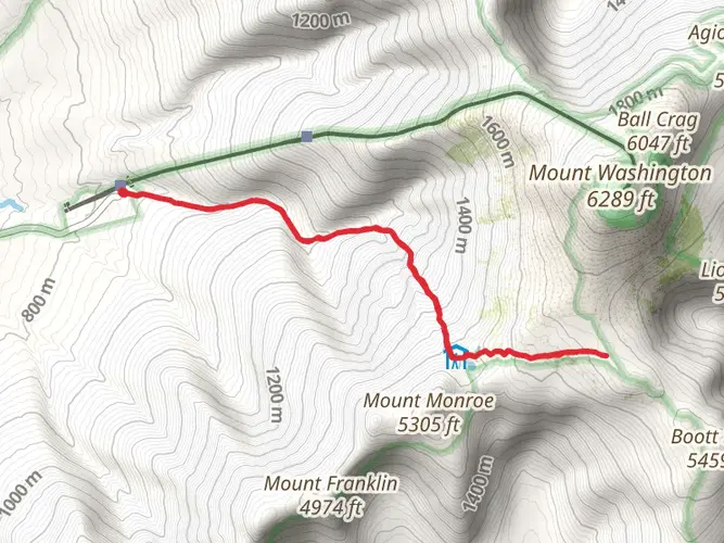
Continuing from Mount Jefferson, the trail descends slightly before traversing towards Mount Clay. This section is less strenuous and allows for a bit of recovery after the initial climb. Mount Clay, while not an official 4000-footer due to its prominence, offers unique perspectives of the surrounding peaks and is a worthwhile addition to the loop.
Historical Significance
The White Mountains are steeped in history, with the Presidential Range named in honor of U.S. presidents and other prominent American figures. The area has been a popular destination for hikers and nature enthusiasts for over a century, and the trails here are part of the Appalachian Trail system, which has historical significance as one of the longest continuously marked footpaths in the world.
Flora and Fauna
Throughout the hike, you'll encounter a variety of plant and animal life native to the White Mountains. Alpine vegetation is delicate, so it's important to stay on the trail to protect these ecosystems. Birdwatchers may spot species such as the Bicknell's thrush, while mammals like moose and black bears inhabit the region, though they are seldom seen on the higher ridges.
Descent and Loop Completion
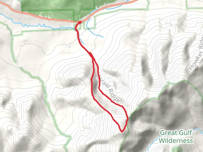
After enjoying the views from Mount Clay, the loop continues by connecting with the Gulfside Trail and then the Jewell Trail for the descent. The Jewell Trail offers a more gradual descent compared to the Caps Ridge Trail, with fewer rock scrambles and a chance to enjoy the forested environment. The loop concludes upon returning to the Caps Ridge Trail parking area, completing the circuit.
Preparation and Safety
Hikers should be well-prepared with appropriate gear, including sturdy hiking boots, weather-appropriate clothing, and sufficient water and food. The weather in the White Mountains can change rapidly, so be ready for varying conditions. It's also wise to carry a map and compass or use a navigation tool like HiiKER to stay on track.
Given the trail's difficulty rating of medium, it's suitable for hikers with some experience. The total loop can take between 6 to 8 hours to complete, depending on pace and conditions. Always check the weather forecast before heading out and be mindful of your abilities and the time of year, as snow can linger on the peaks well into the summer months.

Comments and Reviews
User comments, reviews and discussions about the Mount Jefferson and Mount Clay Loop via Caps Ridge Trail, New Hampshire.
4.57
average rating out of 5
7 rating(s)