Download
3D Flyover
Add to list
More
2.6 km
~54 min
231 m
Out and Back
“Embark on the Butterworth Trail for a scenic ascent to East Rattlesnake's summit, unveiling Squam Lake's splendor and rich heritage.”
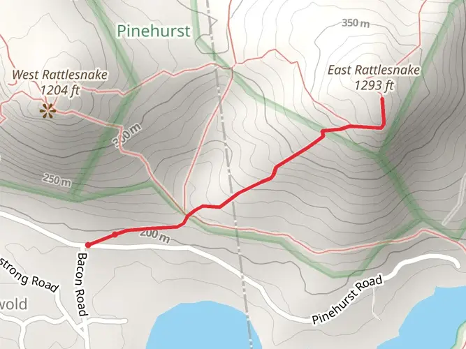
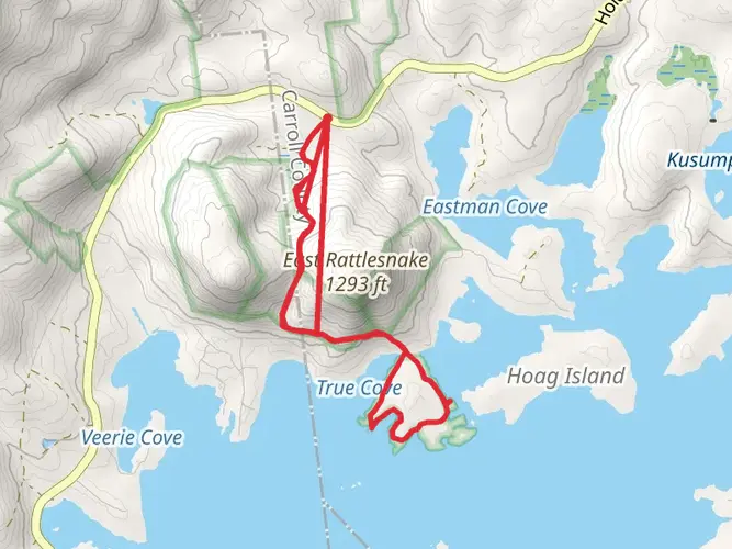
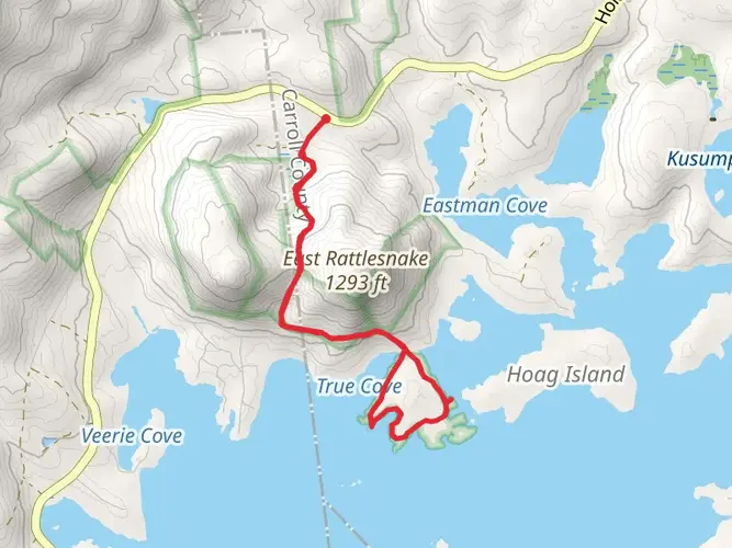
The East Rattlesnake via Butterworth Trail is a moderately challenging hike located near Carroll County, New Hampshire, offering hikers a chance to experience the beauty of the Squam Lake region. The trail stretches approximately 3 kilometers (about 1.9 miles) and features an elevation gain of around 200 meters (656 feet), providing a good workout with rewarding views.
Getting to the Trailhead To reach the trailhead, you can drive to the designated parking area off Route 113 near Holderness, New Hampshire. The closest significant landmark is the Squam Lakes Natural Science Center, which is a short drive from the trailhead. For those relying on public transportation, options are limited, but the nearest towns with bus services are Plymouth and Meredith. From there, a taxi or ride-sharing service can be used to reach the trailhead.
The Hike As you begin your ascent on the Butterworth Trail, you'll be enveloped by a mixed hardwood forest, with the path occasionally dotted by large boulders and rock outcroppings. The trail is well-marked, but it's always wise to have a navigation tool like HiiKER on hand to ensure you stay on the correct path.
Flora and Fauna Throughout the hike, keep an eye out for the diverse wildlife that inhabits the area, including white-tailed deer, red squirrels, and a variety of bird species. The forest canopy is home to oak, maple, and birch trees, and during the fall, the foliage transforms into a vibrant palette of reds, oranges, and yellows.
Historical Significance The region around Squam Lake, including the East Rattlesnake area, is rich in history. The Abenaki people originally inhabited the land, and European settlers later used the surrounding forests for logging. Today, the area is a testament to conservation efforts, with much of the land protected to preserve its natural beauty.
Summit Views Upon reaching the summit of East Rattlesnake, you'll be rewarded with panoramic views of Squam Lake and its many islands. The lake is a highlight of the region, known for its clear waters and undeveloped shoreline. The summit area provides a perfect spot to rest and enjoy a snack while taking in the scenery.
Descent The return journey follows the same path back to the trailhead. The descent can be a bit quicker, but it's important to watch your footing on the downhill sections, especially if the trail is damp or covered in fallen leaves.
Preparation Before setting out, ensure you have adequate water, snacks, and layers of clothing to adapt to changing weather conditions. It's also a good idea to check the weather forecast and trail conditions, as the trail can be slippery after rain or snow. Remember to leave no trace and pack out all your trash to help preserve the trail's natural beauty for future hikers.
Conclusion The East Rattlesnake via Butterworth Trail offers a delightful hiking experience with a mix of natural beauty, wildlife sightings, and historical context. Whether you're a seasoned hiker or someone looking to enjoy a few hours in nature, this trail is a must-visit for anyone in the New Hampshire Lakes Region.

What to expect?
Activity types
Comments and Reviews
User comments, reviews and discussions about the East Rattlesnake via Butterworth Trail, New Hampshire.
4.42
average rating out of 5
26 rating(s)