Download
3D Flyover
Add to list
More
35.9 km
~2 days
1752 m
Multi-Day
“Embark on an epic hike through Nevada's rugged terrain, unveiling history and majestic desert beauty.”
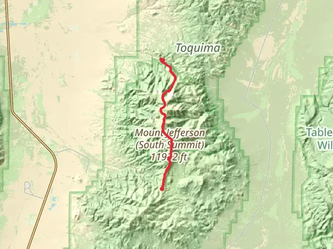
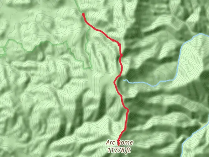
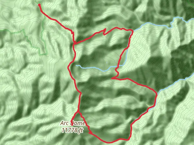
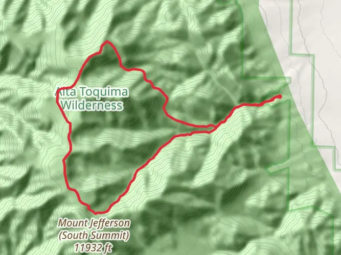
Embarking on the North - South Twin Rivers trail, hikers will traverse approximately 36 kilometers (about 22 miles) of diverse terrain, with an elevation gain of roughly 1700 meters (approximately 5577 feet). This point-to-point trail is nestled near Nye County, Nevada, and is considered difficult due to its challenging elevation changes and length.
Getting to the Trailhead
To reach the starting point of the North - South Twin Rivers trail, hikers can drive to the vicinity of Nye County, where the trailhead is located. There is no direct public transportation to the trailhead, so a personal vehicle or a rented car is necessary. The nearest significant landmark is the town of Tonopah, Nevada, which is a good reference point for navigation. From Tonopah, hikers can follow local roads towards the trailhead, which is situated in a more remote area of the county.
Trail Experience
As you set out on the trail, the initial segment will introduce you to the arid landscape typical of the Nevada backcountry. The path meanders through a series of canyons and valleys, offering a stark yet beautiful vista of the surrounding desert. The trail is not heavily trafficked, providing a sense of solitude and a chance to connect with nature.
Flora and Fauna
Throughout the hike, you'll encounter a variety of desert-adapted plants such as sagebrush, Joshua trees, and cacti. Wildlife sightings may include jackrabbits, coyotes, and a range of bird species, including the occasional golden eagle. Remember to keep a respectful distance from any wildlife you encounter.
Historical Significance
The region around the North - South Twin Rivers trail is steeped in history, with the land having been inhabited by indigenous peoples long before European settlers arrived. The area also experienced a mining boom in the late 19th and early 20th centuries, and hikers may come across abandoned mines or relics from this era. It's important to exercise caution around such structures and to leave historical artifacts undisturbed.
Navigation and Preparation
Due to the trail's remote nature and challenging terrain, it is essential to be well-prepared. Hikers should carry plenty of water, sun protection, and appropriate layers for temperature changes. Navigation can be tricky, so it's recommended to use a reliable GPS tool like HiiKER to track your progress and stay on the correct path.
Elevation and Terrain Challenges
The trail's elevation gain is significant, with steep ascents and descents throughout. The highest points offer panoramic views of the surrounding landscape, making the effort worthwhile. Hikers should be prepared for potentially strenuous climbs and ensure they are in good physical condition before attempting this trail.
Conclusion
The North - South Twin Rivers trail is a rewarding challenge for experienced hikers seeking adventure in the Nevada wilderness. With its historical significance, diverse wildlife, and stunning desert landscapes, it promises an unforgettable experience for those who are well-prepared and respectful of the natural environment.

What to expect?
Activity types
Frequently asked questions
How long is the North - South Twin Rivers hike in Nye County, Nevada?
The North - South Twin Rivers hike is 35.94 kilometers long, which is about 22.3 miles. That length puts it firmly in long-day-hike or multi-day territory, especially in remote Nye County where progress can be slower on rough desert and mountain terrain.
How hard is the North - South Twin Rivers trail and how much climbing does it have?
North - South Twin Rivers is rated difficult and includes 1,752 meters of elevation gain, or about 5,748 feet. That combination of distance and climbing makes it a demanding route better suited to experienced hikers with solid fitness, route planning, and enough time for a multi-day effort.
Is the North - South Twin Rivers route a loop or an out-and-back hike?
North - South Twin Rivers is a point-to-point route rather than a loop. That means transportation logistics matter, because the start and finish are in different places and a vehicle shuttle or pickup plan is usually needed before setting out.
Can the North - South Twin Rivers trail be done in one day or is it better as a multi-day hike?
North - South Twin Rivers is classified as a multi-day hike, and that fits the numbers: 35.94 kilometers with 1,752 meters of ascent is a big undertaking. Very strong hikers may cover that distance in a single push, but most parties will find it more realistic to split it over more than one day.
Where is the North - South Twin Rivers trail located?
The North - South Twin Rivers trail is in Nye County, Nevada. It sits in a remote part of central Nevada, with Tonopah serving as the nearest widely recognized town for trip planning, fuel, and final supplies before heading toward the trail area.
What kind of terrain should hikers expect on the North - South Twin Rivers trail?
North - South Twin Rivers crosses rugged backcountry terrain with major elevation change over nearly 36 kilometers. Hikers should expect a strenuous route through remote Nevada landscapes where steep climbs, long exposed stretches, and uneven footing can make the trail feel harder than the mileage alone suggests.
Comments and Reviews
User comments, reviews and discussions about the North - South Twin Rivers, Nevada.
4.45
average rating out of 5
11 rating(s)