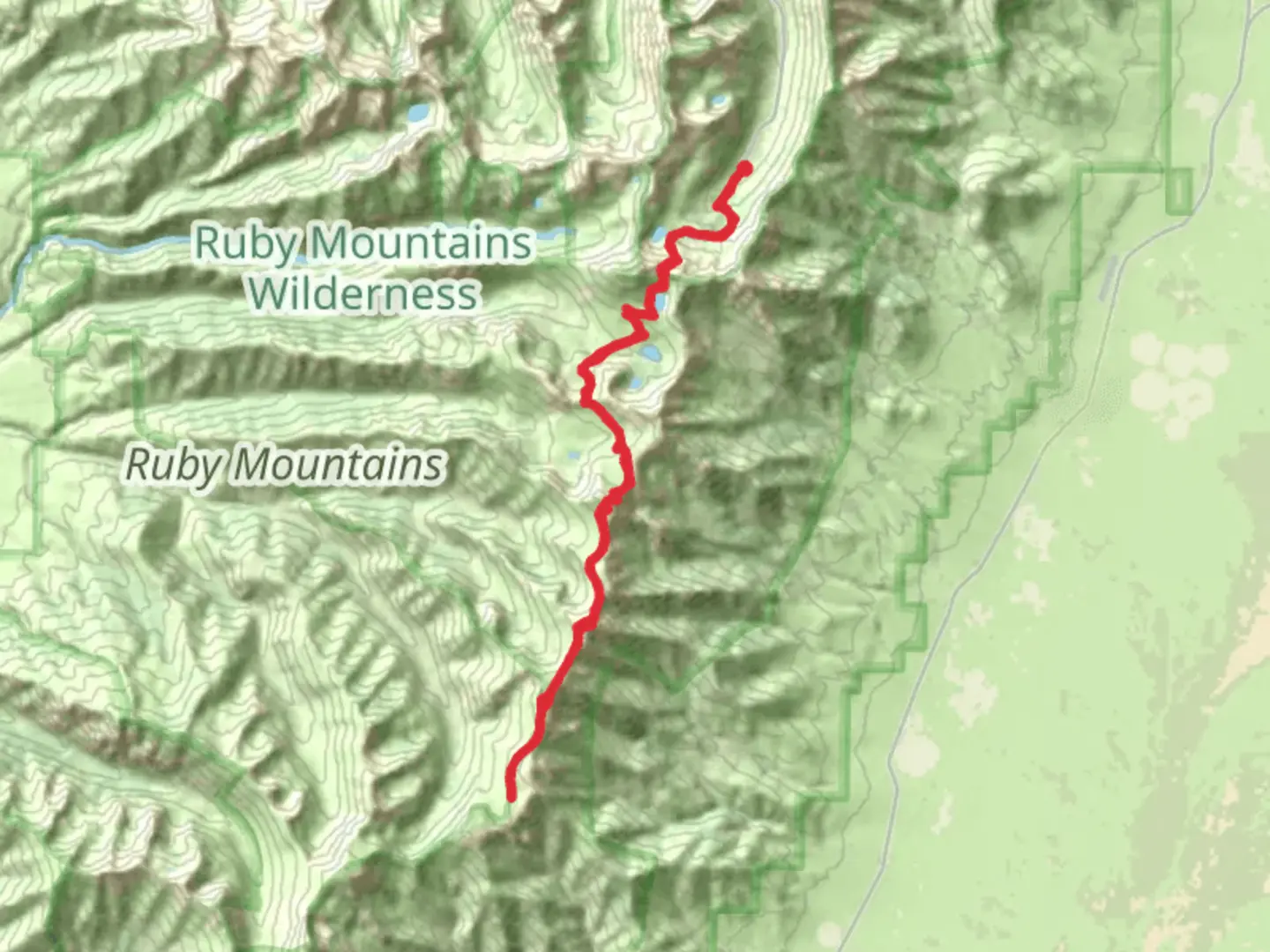
Ruby Crest National Recreation Trail, Wines Peak, Liberty Lake, Dollar Lakes Trail
Download
3D Flyover
Add to list
More
44.2 km
~2 days
1918 m
Out and Back
“The Ruby Crest Trail, a breathtaking alpine adventure, offers diverse landscapes and rich history in Nevada's own "Alps."”
The Ruby Crest National Recreation Trail is a stunning high-elevation path that traverses the scenic Ruby Mountains of Elko County, Nevada. This approximately 44-kilometer (27-mile) trail is an out-and-back route with an elevation gain of roughly 1900 meters (6,234 feet), offering hikers a medium difficulty challenge with rewarding vistas and diverse ecosystems.
Getting to the Trailhead To reach the trailhead, you can drive to the end of Lamoille Canyon Road, which is the main access point for the Ruby Crest Trail. This road is located near the town of Lamoille, about a 30-minute drive from Elko, Nevada. There is no direct public transportation to the trailhead, so a personal vehicle or a taxi service from Elko is necessary. Parking is available at the road's end, where the trail begins.
The Journey Begins Setting out from the trailhead, hikers will immediately be greeted by the lush greenery of Lamoille Canyon, with towering peaks on either side. The trail ascends steadily, offering views of the canyon's dramatic glacial features. Within the first few miles, you'll reach the Dollar Lakes area, a series of alpine lakes that are a perfect spot for a rest or a scenic lunch.
Wildlife and Flora As you continue, keep an eye out for the diverse wildlife that inhabits the Ruby Mountains, including mule deer, mountain goats, and a variety of bird species. The trail also winds through different plant zones, from montane shrubs to subalpine fir forests, showcasing the area's rich biodiversity.
Historical Significance The Ruby Mountains, often referred to as the "Alps of Nevada," have a rich history. The Shoshone people historically inhabited the region, and in the 19th century, it became an area of interest during the mining boom. Although the Ruby Crest Trail itself is a more recent development, it traverses a landscape that has been significant for indigenous peoples and settlers alike.
Wines Peak and Liberty Lake One of the highlights of the trail is the ascent to Wines Peak, which offers panoramic views of the Ruby Range. This section of the trail is more challenging, with steeper grades and rocky terrain. Further along, you'll encounter Liberty Lake, another alpine gem that's nestled below the towering peaks. It's a serene spot that's well worth the hike.
Navigation and Preparation For navigation, hikers should use the HiiKER app to access detailed maps and waypoints, ensuring they stay on the correct path. It's essential to be prepared for sudden weather changes at high elevations, so pack layers, rain gear, and plenty of water. Also, due to the trail's length and elevation gain, it's advisable to be in good physical condition and to consider breaking the hike into a multi-day adventure if needed.
End of the Trail The Ruby Crest National Recreation Trail culminates at the northern end of the Ruby Mountains. Hikers can choose to turn back at any point, but completing the entire trail provides a sense of accomplishment and an intimate experience with one of Nevada's most beautiful mountain ranges. Remember to practice Leave No Trace principles, preserving the pristine nature of this incredible trail for future adventurers.

What to expect?
Activity types
Comments and Reviews
User comments, reviews and discussions about the Ruby Crest National Recreation Trail, Wines Peak, Liberty Lake, Dollar Lakes Trail, Nevada.
average rating out of 5
0 rating(s)