Download
3D Flyover
Add to list
More
13.3 km
~2 hrs 39 min
0 m
Loop
“Wander through a living tapestry of mossy bogs, wild birds, and echoes of peatland history.”
Begin your journey in the tranquil peatlands of Drenthe, starting near the village of Weiteveen, a small settlement close to the Dutch-German border. The Oosterveen and Bargerveen Loop covers approximately 13 km (about 8 miles) with virtually no elevation gain, making it an accessible route for hikers of all experience levels. The trailhead is easily reached by car, with parking available in Weiteveen, or by public transport via bus connections from Emmen, the nearest city with a train station.
Getting Oriented and Navigation
The loop is well-marked, but for added confidence, use HiiKER to follow the route and track your progress. The flat terrain means navigation is straightforward, but the open landscape can be disorienting in foggy or wet weather, so a digital map is recommended.
Peatlands and Wetlands
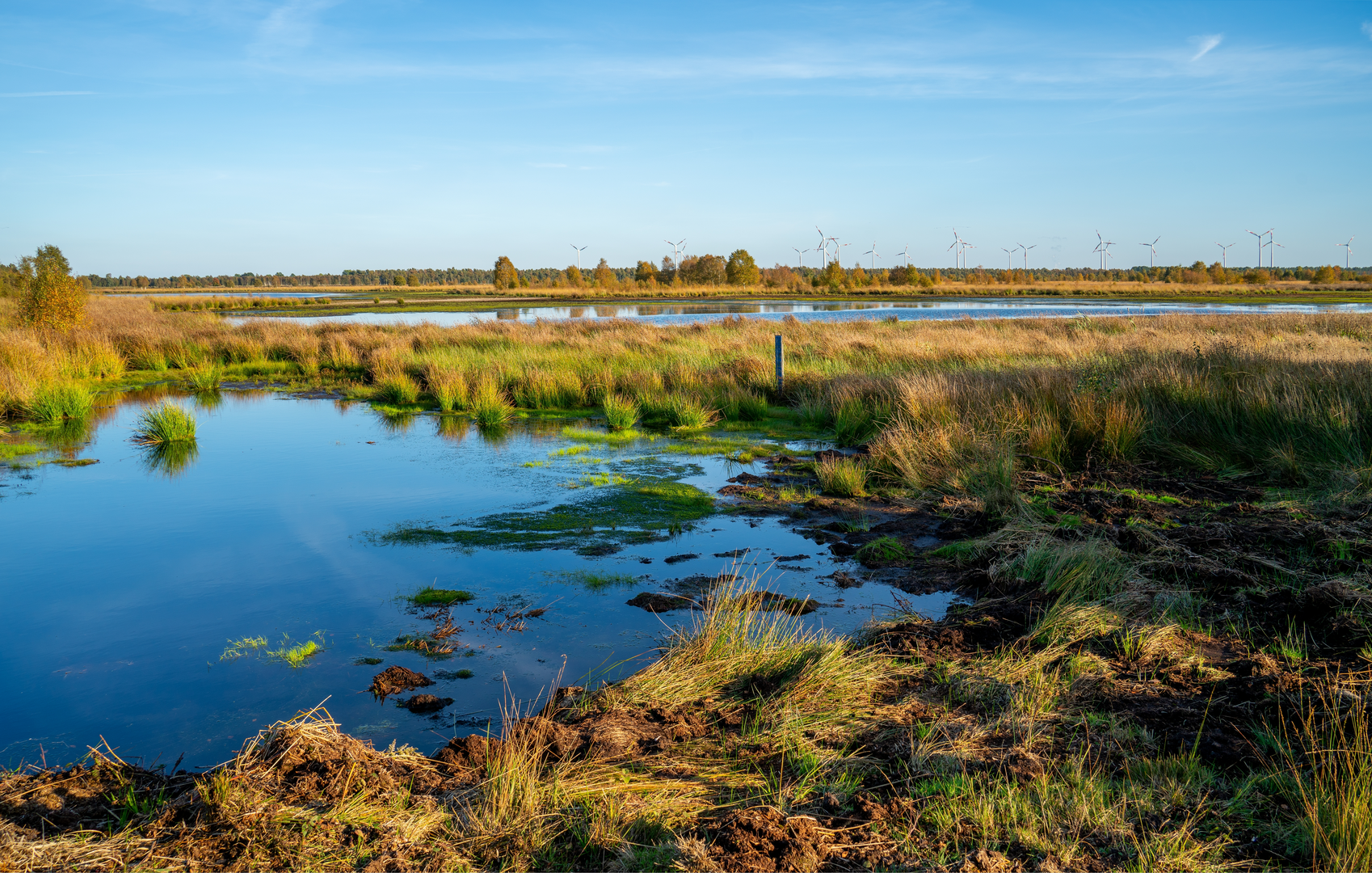
The first section leads you into the heart of Bargerveen Nature Reserve, one of the last remaining raised bogs in Western Europe. This unique ecosystem is a haven for rare flora and fauna. Expect to see expanses of sphagnum moss, cotton grass, and heather, especially vibrant in late summer. The area is home to over 300 bird species, including cranes, hen harriers, and the rare bluethroat. Watch for Highland cattle and sheep grazing in the distance, part of ongoing conservation efforts to maintain the landscape.
Historical Significance
Bargerveen’s landscape tells the story of centuries of peat extraction, which shaped both the land and the local communities. Along the route, you’ll encounter remnants of old peat-cutting trenches and drainage channels. Informational signs detail the history of peat workers and the transformation of the bog from an industrial resource to a protected nature reserve. The nearby village of Weiteveen itself was founded by peat workers in the late 19th century, and its small museum offers further insight into this heritage.
Landmarks and Points of Interest
At around the halfway mark, you’ll pass the Veenloopcentrum, a visitor center with exhibitions on the area’s ecology and history. This is a good spot for a rest and to refill water bottles. Wooden boardwalks cross the wetter sections of the bog, providing safe passage and excellent vantage points for photography and birdwatching. In spring and autumn, migratory birds fill the skies, making this a highlight for nature enthusiasts.
Trail Conditions and Preparation
The loop is mostly on well-maintained gravel paths and boardwalks, with some sections that can become muddy after rain. Waterproof footwear is recommended, especially outside the summer months. There are few shaded areas, so bring sun protection and plenty of water. Facilities are limited along the route, but the start and end points in Weiteveen offer basic amenities, including a café and restrooms.
Access and Transport
To reach the trailhead, drive to Weiteveen, where parking is available near the Veenloopcentrum (Zusterweg 17, 7765 AL Weiteveen, Netherlands). For public transport, take a train to Emmen and transfer to bus line 44 or 73, which stops in Weiteveen. From the bus stop, it’s a short walk to the start of the loop.
This easy, flat loop offers a rare opportunity to experience the wild beauty and cultural history of the Dutch peatlands, with abundant wildlife and peaceful scenery throughout the journey.

Surfaces
Unknown
Sand
Gravel
Unpaved
Grass
Dirt
Concrete
Comments and Reviews
User comments, reviews and discussions about the Oosterveen and Bargerveen Loop, Netherlands.
average rating out of 5
0 rating(s)