Download
3D Flyover
Add to list
More
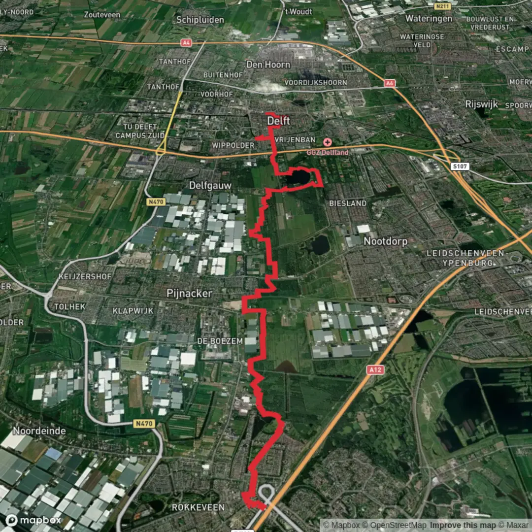
16.2 km
~3 hrs 14 min
0 m
Point-to-Point
“Drift from Zoetermeer’s new streets to Delft’s old soul, along breezy canals and reedbeds.”
This is a flat, lowland walk linking modern Zoetermeer with historic Delft through classic Zuid-Holland “polder” scenery: canals, pasture, reedbeds, and a couple of well-loved recreation/nature areas. At around 16 km / 10 miles with roughly 0 m / 0 ft of climbing, it suits a relaxed half-day pace, but wind and exposed paths can make it feel longer than the numbers suggest.
Getting to the start (public transport + car)
Because your start point is listed only as “near” (no coordinates provided), the most practical, reliable place to begin for this route is Zoetermeer Centrum-West station (Zoetermeer)—a major transit hub that sits naturally on the Zoetermeer–De Balij–Delft line of travel.
- By public transport:
- Take NS rail or RandstadRail/metro-style services to Zoetermeer Centrum-West. From the platforms you can step straight into the city’s path network and head toward the green corridor leading to De Balij.
- By car:
- Aim for parking near Zoetermeer Centrum-West / Stadshart Zoetermeer (shopping district). Paid parking is common around the Stadshart; check signage for time limits. Starting here also makes it easy to finish in Delft and return by train.
If you share a lon/lat for the exact trailhead you meant, I can pin it to the nearest address/landmark and adjust the first kilometer precisely.
What to expect underfoot and with navigation - Surface: mostly paved cycle paths, compacted gravel, and well-maintained park tracks. After rain, expect damp edges and occasional muddy pinch points where paths narrow beside canals. - Wayfinding: the area is dense with intersecting cycle routes and local footpaths; it’s easy to drift onto a parallel track that still “feels right.” Load the route in HiiKER and keep an eye on junctions around recreation areas where paths braid together. - Exposure: there’s very little elevation, but plenty of open sky. Wind off the polders can be persistent; in cooler months it’s the main comfort factor.
From Zoetermeer into the polder (approx. 0–5 km / 0–3.1 mi) Leaving the urban edge, you’ll quickly trade streets for green corridors and water. This part is quintessential “new town meets polder”: straight lines, drainage canals, and long views. Expect: - Canals and ditches running arrow-straight, often with steep grassy banks—watch footing if you step aside to pass others. - Birdlife that thrives in these wet margins: you’ll commonly see coots, moorhens, mallards, grey herons, and depending on season, geese moving between fields. In spring and early summer, listen for reedbed songbirds where vegetation thickens. - Grazing areas with cattle or sheep in some sections; keep dogs leashed where required and give animals space at gates.
Because the terrain is flat, pacing is straightforward: most hikers cover this first segment in about an hour at an easy walk, with minimal stops.
De Balij and the green transition (approx. 5–9 km / 3.1–5.6 mi)
De Balij is a popular green/recreation zone that acts like a “soft buffer” between towns. Paths here can be busier, especially on weekends, with cyclists, runners, and families.
Look out for: - Path etiquette pinch points: bridges, narrow causeways, and shared-use paths. Stay predictable, keep right, and expect fast bikes. - Water edges and reedbeds: these are good spots for herons and sometimes cormorants. In warmer months, insects can be noticeable near still water—pack repellent if you’re sensitive. - Seasonal ground conditions: shaded sections can hold moisture; in winter, slick algae can form on paving near water.
This is also a good place to plan a short break: benches and open grassy areas are common, but services (cafés/shops) may require a small detour depending on your exact line.
De Grote Plas and the “big water” feel (approx. 9–12.5 km / 5.6–7.8 mi) As you approach De Grote Plas, the landscape opens up around a larger body of water. Even without hills, the change in scale is dramatic: wider horizons, more wind, and a stronger sense of being “out of town.”
What hikers should watch for here: - Windchill and sun exposure: the open water amplifies wind; in summer there’s often little shade. A light windproof layer and sunscreen are worth carrying even on an “easy” flat walk. - Waterfowl concentrations: larger water attracts more birds—expect ducks, geese, swans, and in migration periods, mixed flocks resting on the water. Keep a respectful distance, especially during nesting season. - Shared recreation space: anglers, picnickers, and cyclists are common. Be alert at junctions where cycle routes curve quickly around the shoreline.
If you’re timing your day, this is a natural “halfway-ish” landmark: you’ll be around 10–12 km / 6–7.5 mi in, depending on the exact shoreline line you take.
Into Delft: from polder to historic city (approx. 12.5–16 km / 7.8–10 mi) The final stretch gradually trades open fields for the approach corridors into Delft. You’ll likely follow canals and green strips that historically mattered for this region’s identity: Zuid-Holland’s towns grew wealthy

Surfaces
Unknown
Asphalt
Gravel
Concrete
Unpaved
Wood
Cobblestone
Comments and Reviews
User comments, reviews and discussions about the Zoetermeer to Delft via De Balij and De Grote Plas, Netherlands.
average rating out of 5
0 rating(s)