Download
3D Flyover
Add to list
More
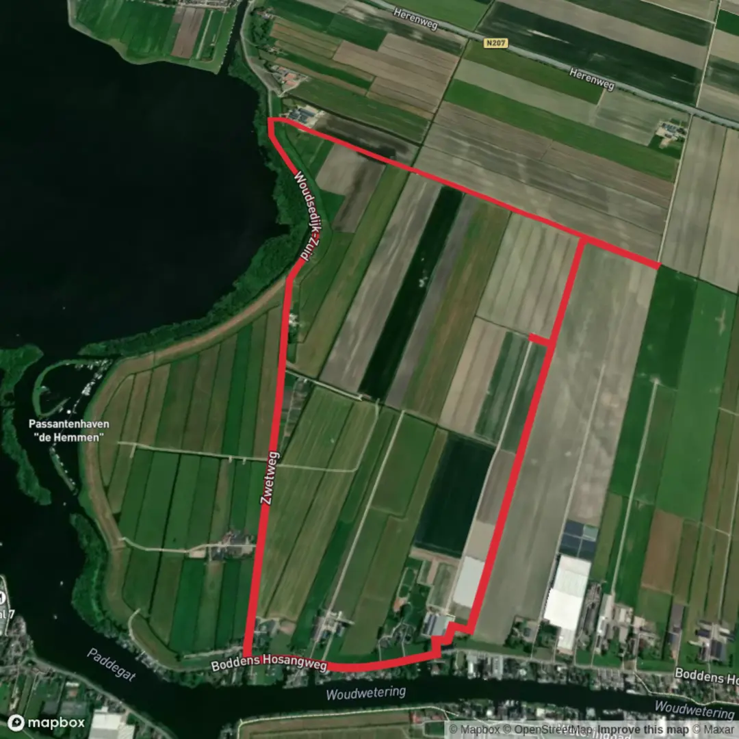
5.9 km
~1 hrs 10 min
0 m
Loop
“Stroll the Braassemermeer dikes for big skies, reed-birds, sailboats, and living Dutch watercraft history.”
This easy, almost perfectly flat loop (about 6 km / 3.7 mi with roughly 0 m / 0 ft of climbing) is a classic Dutch waterside walk: big skies, reed-fringed shorelines, working farmland, and constant views across the Braassemermeer—a broad lake that’s closely tied to the region’s long history of water management and land reclamation.
For planning purposes, a practical “hike head” area is Roelofarendsveen (municipality of Kaag en Braassem, South Holland)—aim for the Noordeinde / Kerkweg side of town where you can easily step onto the dike-top paths and lanes that connect toward the Zwetweg area and the lake. (Roelofarendsveen is the nearest well-known village hub to use for navigation and parking.)
Getting to the start (car + public transport)
- By car: Roelofarendsveen is well connected via the A4 corridor (between Amsterdam and Leiden/The Hague). Park near the village center (around Noordeinde / Kerkweg) or at signed public parking areas close to the waterfront/dike roads, then walk a few minutes to pick up the route.
- By public transport: The most straightforward approach is typically train to Leiden Centraal or Schiphol/Hoofddorp, then a regional bus onward to Roelofarendsveen. From the bus stop area in town, it’s a short walk to the dike paths and lakeside lanes. Check current bus routing and stop locations in HiiKER when you build your track, since local lines and stop names can change.
You’ll want HiiKER loaded before you start—not because the terrain is difficult, but because the area has many similar-looking dike roads, farm lanes, and water crossings where it’s easy to take the “right-looking” turn and add extra distance.
From the village edge you’ll quickly settle into the defining rhythm of this hike: straight, level walking with water on one side and open polder landscape on the other. Underfoot is usually a mix of paved lane, hard-packed dike path, and occasional gravelly or brick sections—all very manageable in normal walking shoes, though after rain the edges can be slick with mud or algae where the path meets the water.
As you angle toward the Braassemermeer, the views open up: expect sailboats, small marinas, and long sightlines across the lake. The wind is the real “elevation” here—on an exposed dike, a headwind can make an easy 6 km feel longer than it is, so bring a light shell even on mild days.
What you’ll see: water, birds, and working landscape
This is prime lowland habitat. Along the reeds and shore margins, look for common Dutch waterbirds such as coots, moorhens, mallards, grebes, and geese, plus herons stalking the shallows. In spring and summer, the reedbeds can be loud with smaller songbirds; in cooler months, the lake often hosts larger groups of wintering birds. You may also spot rabbits on grassy dike slopes and the occasional raptor (like a kestrel) hovering over fields.
Because the route stays near water, keep an eye out for: - Narrow path edges with a steep drop into the canal/lake - Slippery algae on bricks/wood near small landings and bridges - Cyclists—many dike routes double as popular cycle corridors, so walk predictably and keep right
Historical context you can feel under your feet
This whole region is shaped by centuries of Dutch engineering—dikes, canals, and managed water levels. Nearby, the Ringvaart (Ring Canal) of the Haarlemmermeer polder is a major example of that tradition: a man-made circular canal built in the 1800s as part of the effort to drain the former Haarlemmermeer lake and control water in the surrounding landscape. The Ringvaart is about 61 km / 38 mi long and remains a key waterway for drainage and boat traffic. (en.wikipedia.org)
Even if your 6 km loop doesn’t follow the Ringvaart the entire time, the same “polder logic” is everywhere: straight alignments, raised dikes, and water moving through a network designed to keep land usable. The broader Haarlemmermeer story includes large-scale 19th-century pumping works (including famous steam pumping stations) that made permanent dry land out of open water—an important chapter in

Surfaces
Unknown
Grass
Concrete
Wood
Comments and Reviews
User comments, reviews and discussions about the Braassemermeer via Zwetweg, Netherlands.
average rating out of 5
0 rating(s)