Download
3D Flyover
Add to list
More
23.1 km
~4 hrs 37 min
0 m
Loop
“Follow Frisian lake-edges on dikes and quiet lanes, where wind and wide horizons linger.”
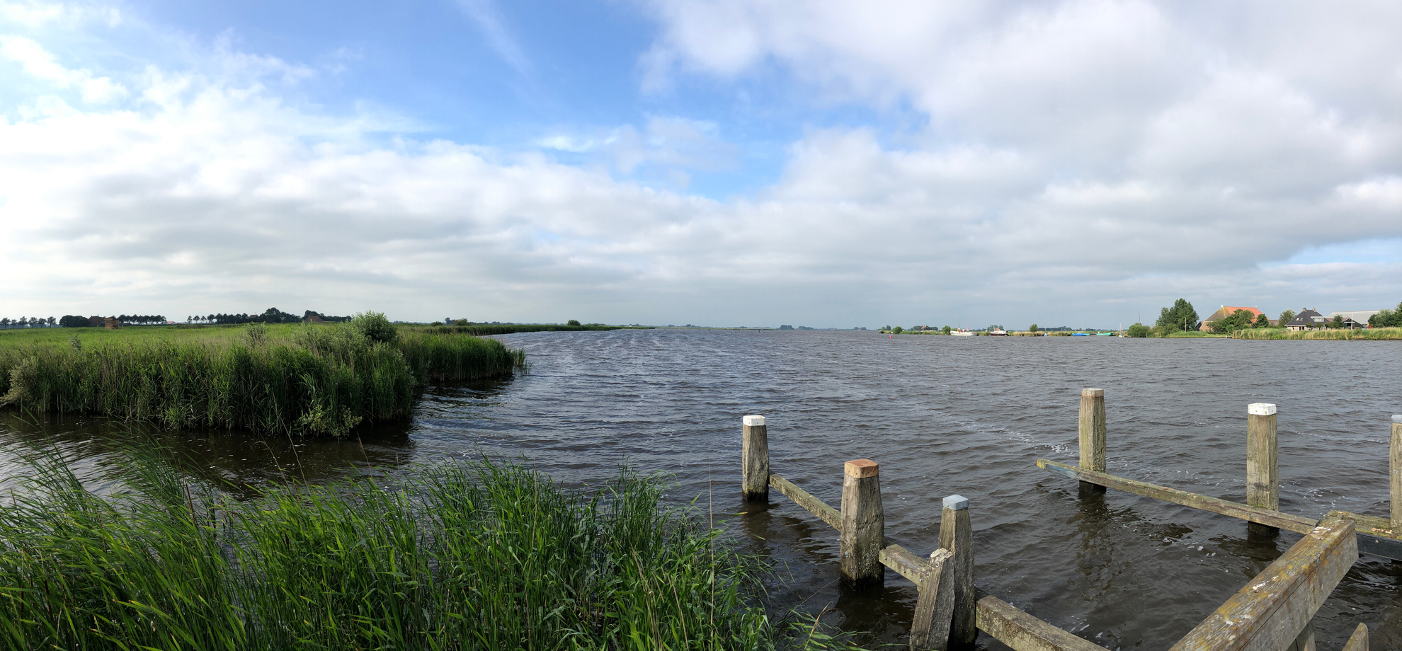
This is a classic “Frisian lake-edge” loop: long, level, and big on sky-and-water views rather than hills. Over roughly 23 km (14.3 mi) you’ll trace the margins of the Flakke Brekken (Vlakke Brekken) and Âldegeaster Brekken (Oudegaaster Brekken)—two of the named waters within the Frisian Lakes system—using the Brekkenpaad/Brekkenpad and quiet dike-top lanes. Expect ~0 m / ~0 ft of elevation gain, but don’t underestimate how wind exposure and open terrain can make the day feel longer than the profile suggests. (en.wikipedia.org)
Getting to the start (car + public transport)
Most practical start area: the village of Oudega (Súdwest-Fryslân), where the church and village center are easy to locate and commonly used as a meeting point. Oudega is also a logical place to find services (small shops) before you head out. (frieslandwonderland.nl)
- By car: Aim for Oudega (Súdwest-Fryslân) village center and park in/near the central area (close to the church is typical in small Frisian villages). From there you can link onto the Brekkenpaad corridor toward the lakes. (gps-route.org)
- By public transport: Oudega is reachable by bus from Sneek (local sources commonly reference a Sneek–Oudega connection and a stop in the village center). Service patterns can be limited at certain times, so check the day’s timetable before committing. (frieslandwonderland.nl)
If you’re navigating the loop, load the route in HiiKER and keep an eye on where the path transitions between cycle path, farm access lanes, and dike roads—the terrain is simple, but junctions can be easy to miss in a landscape with few vertical landmarks.
What the trail feels like underfoot
Most of this loop is on paved or hard-packed surfaces: dedicated cycle path sections (the Brekkenpaad is widely praised as a standout path along the Brekken waters), plus narrow rural roads and dike-top tracks. (nl.wikiloc.com)
Because it’s so flat, the main “difficulty” variables are:
- Wind off the lakes (headwinds can slow pace dramatically).
- Sun exposure (very little shade).
- Wet edges: after rain, grassy verges and field margins can be slick; stick to the firm line and avoid crumbling banks near drainage ditches.
Plan on 4.5–6.5 hours depending on stops, wind, and how much time you spend at viewpoints and heritage sites.
Route flow with approximate distances (23 km / 14.3 mi total)
Distances below are approximate and meant for planning; your exact numbers will vary with start point in Oudega and any short detours.
0.0–5.5 km (0.0–3.4 mi): Oudega out to the Brekkenpaad and first big water views
Leaving the village, the landscape opens quickly into classic Southwest Friesland: rectangular pastures, straight drainage ditches, and long sightlines to the lake margins. You’ll start getting broad views across the Âldegeaster Brekken, with reedbeds and wet grassland at the edges.
5.5–11.5 km (3.4–7.1 mi): Along the Brekken waters—wind, birds, and wide horizons
This is the heart of the loop: sustained lakeside travel where the scenery changes subtly—open water, then reed fringes, then pasture again. In spring and autumn especially, this area is strong for waterfowl and meadow birds: look for geese and ducks on the water, and scan fence lines and posts for raptors using the open fields for hunting.
11.5–15.5 km (7.1–9.6 mi): Windmill country and polder engineering landmarks
A standout landmark in this region is Doris Mooltsje, a historic drainage windmill near the Oudegaaster Brekken. It’s an **

Surfaces
Concrete
Unknown
Asphalt
Wood
Paved
Comments and Reviews
User comments, reviews and discussions about the Flakke Brekken and Aldegeaster Brekken via Brekkenpad Loop, Netherlands.
average rating out of 5
0 rating(s)